- Barwon Heads, Victoria
Infobox Australian Place | type = town
name = Barwon Heads
city = Geelong
state = vic
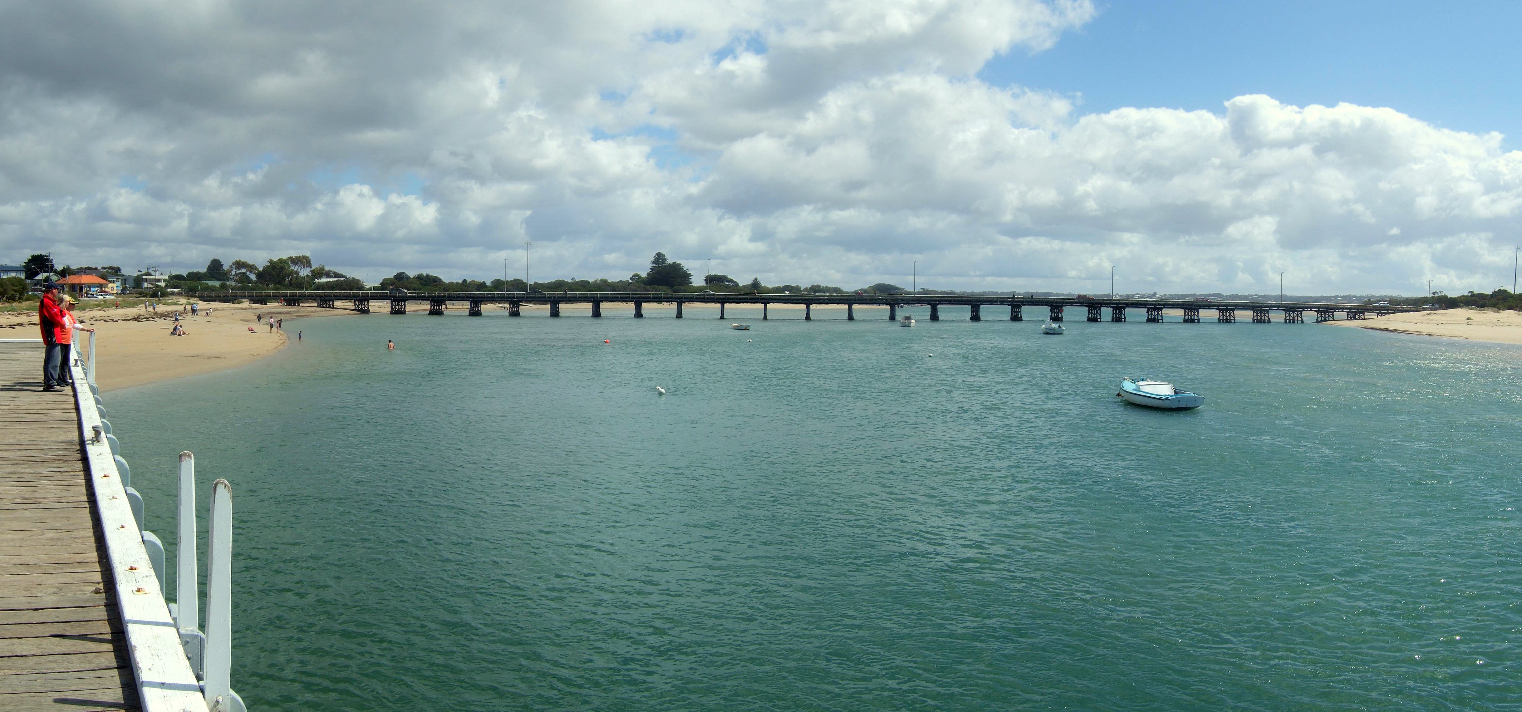
caption = The iconic Barwon Heads Bridge.
lga = City of Greater Geelong
postcode = 3227
coordinates = coord|38|16|45|S|144|29|30|E|type:city_region:AU|display=inline,title
pop = 2994 (2006)Census 2006 AUS | id = SSC25095 | name = Barwon Heads (State Suburb) | accessdate = 2007-10-01 | quick = on]
area =
propval = [http://www.domain.com.au/public/suburbprofile.aspx?suburb=Barwon%20Heads&postcode=3227 $381,250] (2007)
stategov = South Barwon
fedgov = Corangamite
near-nw = Marshall
near-n =
near-ne = Wallington
near-w =
near-e = Ocean Grove
near-sw =
near-s =
near-se =
dist1 =
location1=Barwon Heads is a coastal township on the
Bellarine Peninsula , near Geelong, Victoria,Australia . It is situated at the mouth of the Barwon River belowLake Connewarre .History
The township of Barwon Heads was surveyed in 1870 but remained sparsely populated for years, a Post Office finally opening in the area on 15 December 1889 (renamed Connewarre East in 1890 when a new Barwon Heads PO opened in the township). Citation
last = Premier Postal History | title = Post Office List | url = https://www.premierpostal.com/cgi-bin/wsProd.sh/Viewpocdwrapper.p?SortBy=VIC&country= | accessdate = 2008-04-11 ]
Fishing was the mainstay of the town in its early years. In the 1920s and 1930s the town became a popular holiday resort and a number of the richer families of Melbourne built houses here. The summer period today still sees a large influx of holidaymakers to the town.
In 1959 the closing scenes of the film "On the Beach" based on a
Neville Shute novel about the end of the world was filmed in the town.Barwon Heads Bridge
The Barwon Heads Bridge was opened in 1927, crossing the Barwon River between
Barwon Heads and Ocean Grove. Prior to this there was a rowboat service across the river. The bridge was used in filming the ABC television seriesSeaChange .In July 2006, the
Government of Victoria shelved plans to replace theheritage-listed [ [http://www.heritage.gov.au/cgi-bin/ahpi/record.pl?RNE102760 Australian Heritage Places Inventory: Barwon Heads Road bridge] ] bridge with a new one. [cite web|url=http://www.abc.net.au/news/items/200607/1699171.htm?victoria| title='Sea Change' bridge wins reprieve| date=28 July 2006| | publisher=Australian Broadcasting Corporation| accessdate=2006-08-01]A proposal was made to align a new bridge with Geelong Road, permitting traffic flows to bypass the main shopping precinct and primary school, but with the consequence of taking out one home. An independent panel was appointed by the then Minister for Planning,
Rob Hulls to decide on a location. Evidence was presented, for and against Geelong Road, and the existing site, and concluded that Geelong Road was unsuitable for environmental, social, economic reasons. On 16 March 2007 it was announced that the current bridge would be improved [ [http://www.geelongaustralia.com.au/Media_Releases/March_2007/Councillors_welcome_Barwon_Heads_bridge_announcement/ City of Greater Geelong: Councillors welcome Barwon Heads bridge announcement] ] and there were no plans at present to build a second bridge upstream.SeaChange & Tourism
During the late 1990s, Barwon Heads was the primary location of filming for the popular Australian television series, "
SeaChange ". In the past decade Barwon Heads has become subject to what is colloquially known in some parts of Australia as the 'seachange effect'.Since the "SeaChange" television series first aired in 1998 there has been a significant increase in
tourism andreal estate sales and development (both commercial and residential) in the area. This has resulted in a very substantial increase in property and land values, making the town an ideal location forproperty developer s.Nearby
Thirteenth Beach is a popular surfing location, the beach is named for its proximity to the 13th hole of the golf course. The town was subject to flooding, including a flood that lasted some weeks in 1952, until the construction oflevee banks in the 1950s.port
The town has an
Australian Rules football team competing in theBellarine Football League . Citation | last = Full Points Footy | title = Barwon Heads | url = http://www.fullpointsfooty.net/Barwon_Heads.htm | accessdate = 2008-07-25 ]References
External links
* [http://web.archive.org/web/20040511084841/www.arts.monash.edu.au/ncas/multimedia/gazetteer/list/barwonheads.html Australian Places - Barwon Heads]
* [http://www.barwonheads.net/ Barwon Heads town website]
* [http://www.barwonheads.net/WHISTLER/wh42.htm Barwon Heads bridge history]
Wikimedia Foundation. 2010.