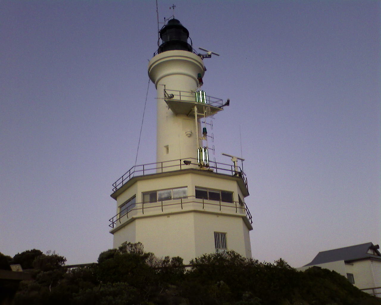
- Point Lonsdale, Victoria
Infobox Australian Place | type = town
name = Point Lonsdale
state = vic

caption = The lighthouse at Point Lonsdale, at dusk, as seen from the beach below.
lga = MainlyBorough of Queenscliffe , with some streets in theCity of Greater Geelong
postcode = 3225
pop = 2,477
est =
stategov = Bellarine
fedgov = Corangamite
dist1 = 103
dir1 = SW
location1=Melbourne
dist2 = 28
dir2 = SE
location2= Geelong
dist3 = 4
dir3 = W
location3=Queenscliff, Victoria Point Lonsdale is a coastal township on the
Bellarine Peninsula , near Queenscliff, Victoria,Australia , and included in theBorough of Queenscliffe . Point Lonsdale is also one of the headlands which, with Point Nepean, frameThe Rip , the entrance toPort Phillip Bay. At the 2006 census, Point Lonsdale had a population of 2,477.Census 2006 AUS
id=SSC26453
name=Point Lonsdale (State Suburb)
accessdate=2007-08-05
quick=on]History
The traditional owners of this area are the
Wautharong people of theKulin nation. The escaped convict William Buckley is the first known European to have resided in the area, having lived with the local people between 1803 and 1835. A signal station was built in1854 . Permanent European settlement began at Point Lonsdale in the latter half of the 19th century with the construction of alighthouse in 1863 and the extension of the railway line fromGeelong toQueenscliff in 1879. Since settlement numerous ships have been wrecked here on the rocky reefs at the entrance toPort Phillip Bay .The town is named after police officer William Lonsdale and is the birthplace of former Premier of Victoria
Thomas Hollway .Environment
Next to the town is Lake Victoria a shallow saline lake that is part of the Lonsdale Lakes Nature Reserve and an important site for the
waterbird s and migratorywader s that form part of the population using the Ramsar-listed Swan Baywetland system. [Hewish, Marilyn. (2003). The waterbirds of Lake Victoria, a sub-coastal wetland on the Bellarine Peninsula. "Geelong Bird Report" 2002: 73-110.]The coastal rock platforms and adjacent waters are included in the
Port Phillip Heads Marine National Park . The intertidal platforms have the highest invertebrate diversity of anycalcarenite reef in Victoria, while subtidal areas are characterised by diverse and abundant algal communities as well as by encrusting organisms such asascidian s,sponge s andbryozoan s.Parks Victoria. (2006). "Port Phillip Heads Marine National Park Management Plan". Parks Victoria: Melbourne. ISBN 0-7311-8349-5]Along the open coast there are regular sightings of threatened marine mammals such as Humpback and
Southern Right Whale s.References
External links
* [http://www.smh.com.au/news/Victoria/Point-Lonsdale/2005/02/17/1108500207165.html Sydney Morning Herald]
Wikimedia Foundation. 2010.
