- County of Grant
Infobox Australian cadastral
name = Grant
state = Victoria
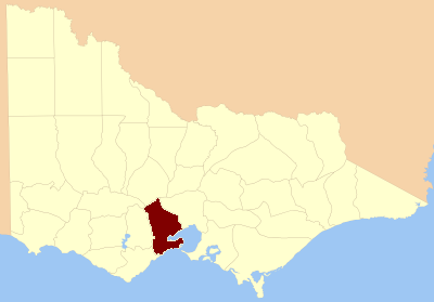
caption = Location in Victoria
near-nw = Ripon
near-n = Talbot
near-ne = Bourke
near-e = Bourke
near-se = "Port Phillip Bay "
near-s = "Southern Ocean "
near-sw = Polwarth
near-w = GrenvilleThe County of Grant is one of the 37counties of Victoria which are part of thecadastral divisions of Australia , used for land titles. It is located to the west ofMelbourne , on the west side ofPort Phillip Bay and includesGeelong .Ballarat is on its north-western edge. It is bounded in the west by theYarrowee River , on the north by theGreat Dividing Range and on the east by theWerribee River .Parishes
Parishes within the county:
*Anakie, Victoria
*Ballark, Victoria
*Ballarat, Victoria (also in the counties of Grant, Grenville, Ripon & Talbot)
*Balliang, Victoria
*Bamganie, Victoria
*Barrarbool, Victoria
*Bellarine, Victoria
*Beremboke, Victoria
*Borhoneyghurk, Victoria
*Bulban, Victoria
*Bungal, Victoria
*Bungaree, Victoria (also in the counties of Grant, Grenville & Talbot)
*Bungeeltap, Victoria
*Buninyong, Victoria
*Burtwarrah, Victoria
*Cargerie, Victoria
*Carrah, Victoria
*Carrung-e-murnong, Victoria
*Clarendon, Victoria
*Cocoroc, Victoria
*Conewarre, Victoria
*Coolebarghurk, Victoria
*Corio, Victoria
*Darriwil, Victoria
*Dean, Victoria (also in the county of Talbot)
*Duneed, Victoria
*Durdidwarrah, Victoria
*Gherang Gherang, Victoria
*Gherineghap, Victoria
*Gnarwarre, Victoria
*Gorong, Victoria
*Gorrockburkghap, Victoria
*Jan Juc, Victoria
*Kerrit Bareet, Victoria
*Korweinguboora, Victoria
*Lake Lake Wollard, Victoria
*Lal Lal, Victoria
*Lara, Victoria
*Mambourin, Victoria
*Meredith, Victoria
*Modewarre, Victoria
*Moolap, Victoria
*Mooradoranook, Victoria
*Moorarbool West, Victoria
*Moorpanyal, Victoria
*Moranghurk, Victoria
*Moreep, Victoria
*Mouyong, Victoria
*Murgheboluc, Victoria
*Murtcaim, Victoria
*Narmbool, Victoria
*Paraparap, Victoria
*Parwan, Victoria
*Paywit, Victoria
*Puebla, Victoria
*Tutegong, Victoria
*Wabdallah, Victoria
*Warrenheip, Victoria
*Werribee, Victoria
*Woornyalook, Victoria
*Wormbete, Victoria
*Wurdi-Youang, Victoria
*Yaloak, Victoria
*Yowang, Victoria References
* [http://services.land.vic.gov.au/vicnames/place.html?method=edit&id=30391 Vicnames, place name details]
* [http://freepages.genealogy.rootsweb.com/~kenmac/victowns/ Research aids, Victoria 1910]
* [http://nla.gov.au/nla.map-raa30-s160 Map of the county of Grant] showing colony and county boundaries, 1886. National Library of Australia
Wikimedia Foundation. 2010.