- Shire of Cardinia
Infobox Australian Place | type = lga
name = Shire of Cardinia
state = vic
caption =
pop = 57,115 (2006)Census 2006 AUS|id=LGA21450|name=Cardinia (S) (Local Government Area)|accessdate=2007-12-24|quick=on]
area = 1280.6
est = 1994
seat = Pakenham
mayor = Bill Ronald
region =

logosize = 143
url = http://www.cardinia.vic.gov.au
stategov =
fedgov =
near-nw = Yarra Ranges
near-n = Yarra Ranges
near-ne = Yarra Ranges
near-w = Casey
near-e = Baw Baw
near-sw = Mornington Peninsula
near-s = Bass Coast
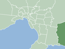
near-se = South GippslandThe Shire of Cardinia is a Local Government Area in Victoria,
Australia , located south-east ofMelbourne between theWestern Port bay and the Yarra Ranges on the outskirts of Melbourne. It has an area of 1,281 square kilometres, and at the2006 census it had a population of 57,115.The council offices of the shire are situated in Pakenham.
History
The areas within the present-day boundaries of Cardinia were originally parts of the Cranbourne and Berwick districts, which were incorporated in 1860 and 1862 respectively. The Shire of Ferntree Gully, later
Shire of Sherbrooke , split away in 1889 and included areas to the east of Melbourne. In 1973, theCity of Berwick , including Berwick and areas closer to Dandenong, split away from the Shire of Berwick, with the remainder being renamedShire of Pakenham .cite book|title=Victorian Municipal Directory|year=1992|publisher=Arnall & Jackson|location=Brunswick|pages=639-40, 805-6, 832-3 Accessed atState Library of Victoria , La Trobe Reading Room.]The shire came into being on
15 December 1994 as the result of statewide local government reform, by merging theShire of Pakenham with rural sections of theShire of Sherbrooke andCity of Cranbourne . [cite web|url=http://www.ausstats.abs.gov.au/ausstats/free.nsf/0/76E601D6DB55E88ACA25722500049195/$File/12570_1994-95.pdf|title=Victorian local government amalgamations 1994-1995: Changes to the Australian Standard Geographical Classification|author=Australian Bureau of Statistics |date=1 August 1995 |publisher=Commonwealth of Australia|page=5|isbn=0-642-23117-6|accessdate=2007-12-16]Mayors
* 2005: Garry Runge
* 2006: Bill Ronald
* 2007: Kate Lempriere
* 2008: Bill RonaldGeography
The shire includes the following towns and localities:
* Avonsleigh
* Bayles
* Beaconsfield
* Beaconsfield Upper.
* Bunyip
* Bunyip North
* Caldermeade
* Cardinia
* Catani
* Clematis
* Cockatoo
* Cora Lynn
* Dalmore
* Dewhurst
* Emerald
* Garfield
* Garfield North
* Gembrook
* Guys Hill
* Iona
* Koo Wee Rup
* Koo Wee Rup North
* Lang Lang
* Lang Lang East
* Longwarry
* Maryknoll
* Menzies Creek
* Modella
* Monomeith
*Mount Burnett
*Nangana
* Nar Nar Goon
* Nar Nar Goon North
* Officer
* Officer South
* Pakenham
* Pakenham South
* Pakenham Upper
* Rythdale
* Tonimbuk
* Tynong
* Tynong North
* Vervale
* YannathanReferences
See also
*
List of Melbourne suburbs External links
* [http://www.cardinia.vic.gov.au/ Shire of Cardinia official website]
* [http://www.cclc.vic.gov.au/ Casey Cardinia Libraries]
Wikimedia Foundation. 2010.