- Nar Nar Goon, Victoria
-
Nar Nar Goon
Victoria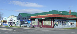
Murals on the intersection of Nar Nar Goon Road and Carney StreetPopulation: 1,010 (2006) [1] Postcode: 3812 Elevation: 95 m (312 ft) Location: LGA: Shire of Cardinia State District: Bass Federal Division: McMillan Localities around Nar Nar Goon: Nar Nar Goon North Maryknoll Tynong North Pakenham Nar Nar Goon Tynong Koo Wee Rup Koo Wee Rup Cora Lynn Nar Nar Goon is a town in Gippsland, Victoria, Australia, 61 km southeast from Melbourne's central business district. Its Local Government Area is the Shire of Cardinia. At the 2006 Census, Nar Nar Goon had a population of 1010.[1]
Contents
History
The name is thought to come from an Aboriginal name for the koala.
The Post Office opened on 15 September 1881, some time after the railway line arrived.[2]
The Town today
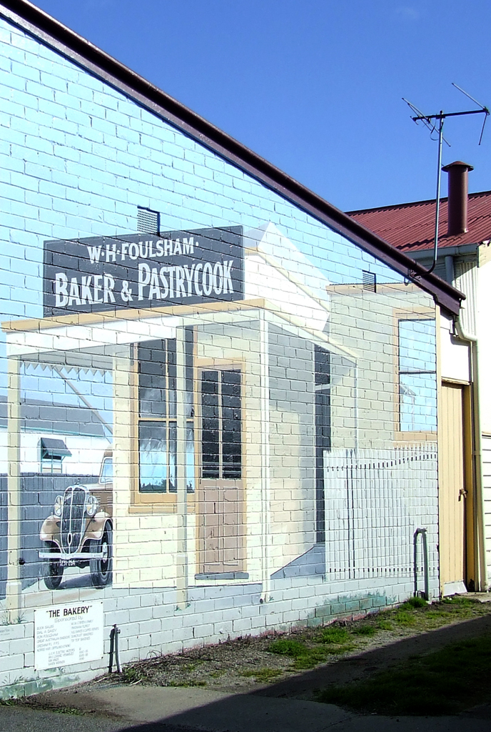
It is known locally as "The Mural Town" or the town with lots of "murals" because of the numerous murals that can be seen around the town.
The town contains a private and public school, each offering primary education, an active progress association, a CFA fire station, scout hall, community centre and hotel.
The town has its own railway station on the Bairnsdale V/Line rail service.
The town has an Australian Rules football team competing in the Ellinbank & District Football League.[3]
The town also has a small number of shops and a pub.
Gallery
-
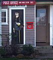
Mural outside the Nar Nar Goon Post Office
-

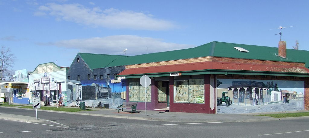
Mural on Nar Nar Goon Road
References
- ^ a b Australian Bureau of Statistics (25 October 2007). "Nar Nar Goon (State Suburb)". 2006 Census QuickStats. http://www.censusdata.abs.gov.au/ABSNavigation/prenav/LocationSearch?collection=Census&period=2006&areacode=SSC26289&producttype=QuickStats&breadcrumb=PL&action=401. Retrieved 2007-09-15.
- ^ Premier Postal History, Post Office List, https://www.premierpostal.com/cgi-bin/wsProd.sh/Viewpocdwrapper.p?SortBy=VIC&country=, retrieved 2008-04-11
- ^ Full Points Footy, Nar Nar Goon, http://www.fullpointsfooty.net/Nar_Nar_Goon.htm, retrieved 2008-07-25[dead link]
Coordinates: 38°04′55″S 145°34′30″E / 38.08194°S 145.575°E
Towns in West Gippsland Athlone · Bona Vista · Brandy Creek · Buln Buln · Bunyip · Cloverlea · Crossover · Darnum · Drouin · Ellinbank · Gainsborough · Garfield · Iona · Jindivick · Labertouche · Lardner · Lillico · Longwarry · Maryknoll · Modella · Nar Nar Goon · Narracan · Neerim · Neerim North · Neerim South · Nilma · Noojee · Pakenham · Rawson · Ripplebrook · Rokeby · Shady Creek · Tarago · Tonimbuk · Trafalgar · Tynong · Warragul · Yarragon
Suburbs of the Shire of Cardinia Avonsleigh · Bayles · Beaconsfield · Beaconsfield Upper · Bunyip · Bunyip North · Caldermeade · Cardinia · Catani · Clematis · Cockatoo · Cora Lynn · Dalmore · Dewhurst · Emerald · Garfield · Garfield North · Gembrook · Guys Hill · Heath Hill · Iona · Koo Wee Rup · Koo Wee Rup North · Lang Lang · Lang Lang East · Maryknoll · Menzies Creek · Modella · Monomeith · Mount Burnett · Nangana · Nar Nar Goon · Nar Nar Goon North · Officer · Officer South · Pakenham · Pakenham South · Pakenham Upper · Rythdale · Tonimbuk · Tynong · Tynong North · Vervale · Yannathan
Categories:- Towns in Victoria (Australia)
- Australian Aboriginal placenames
- Double-named places in Australia
- Gippsland
-

Wikimedia Foundation. 2010.