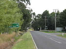
- Modella, Victoria
-
Modella
Victoria
Postcode: 3816 LGA: Shire of Cardinia State District: Bass Federal Division: Flinders Modella is a bounded rural locality in Victoria, Australia. Its Local Government Area is the Shire of Cardinia.
History
Modella Post Office opened on 2 December 1904 and closed in 1962. [1]
References
- ^ Premier Postal History, Post Office List, https://www.premierpostal.com/cgi-bin/wsProd.sh/Viewpocdwrapper.p?SortBy=VIC&country=, retrieved 2008-04-11
- Modella, Victoria is at coordinates 38°11′17″S 145°42′36″E / 38.188°S 145.710°ECoordinates: 38°11′17″S 145°42′36″E / 38.188°S 145.710°E
Suburbs of the Shire of Cardinia Avonsleigh · Bayles · Beaconsfield · Beaconsfield Upper · Bunyip · Bunyip North · Caldermeade · Cardinia · Catani · Clematis · Cockatoo · Cora Lynn · Dalmore · Dewhurst · Emerald · Garfield · Garfield North · Gembrook · Guys Hill · Heath Hill · Iona · Koo Wee Rup · Koo Wee Rup North · Lang Lang · Lang Lang East · Maryknoll · Menzies Creek · Modella · Monomeith · Mount Burnett · Nangana · Nar Nar Goon · Nar Nar Goon North · Officer · Officer South · Pakenham · Pakenham South · Pakenham Upper · Rythdale · Tonimbuk · Tynong · Tynong North · Vervale · Yannathan
Categories:- Towns in Victoria (Australia)
- Melbourne geography stubs
Wikimedia Foundation. 2010.

