- Koo Wee Rup, Victoria
Infobox Australian Place | type = town
name = Koo Wee Rup
state = vic
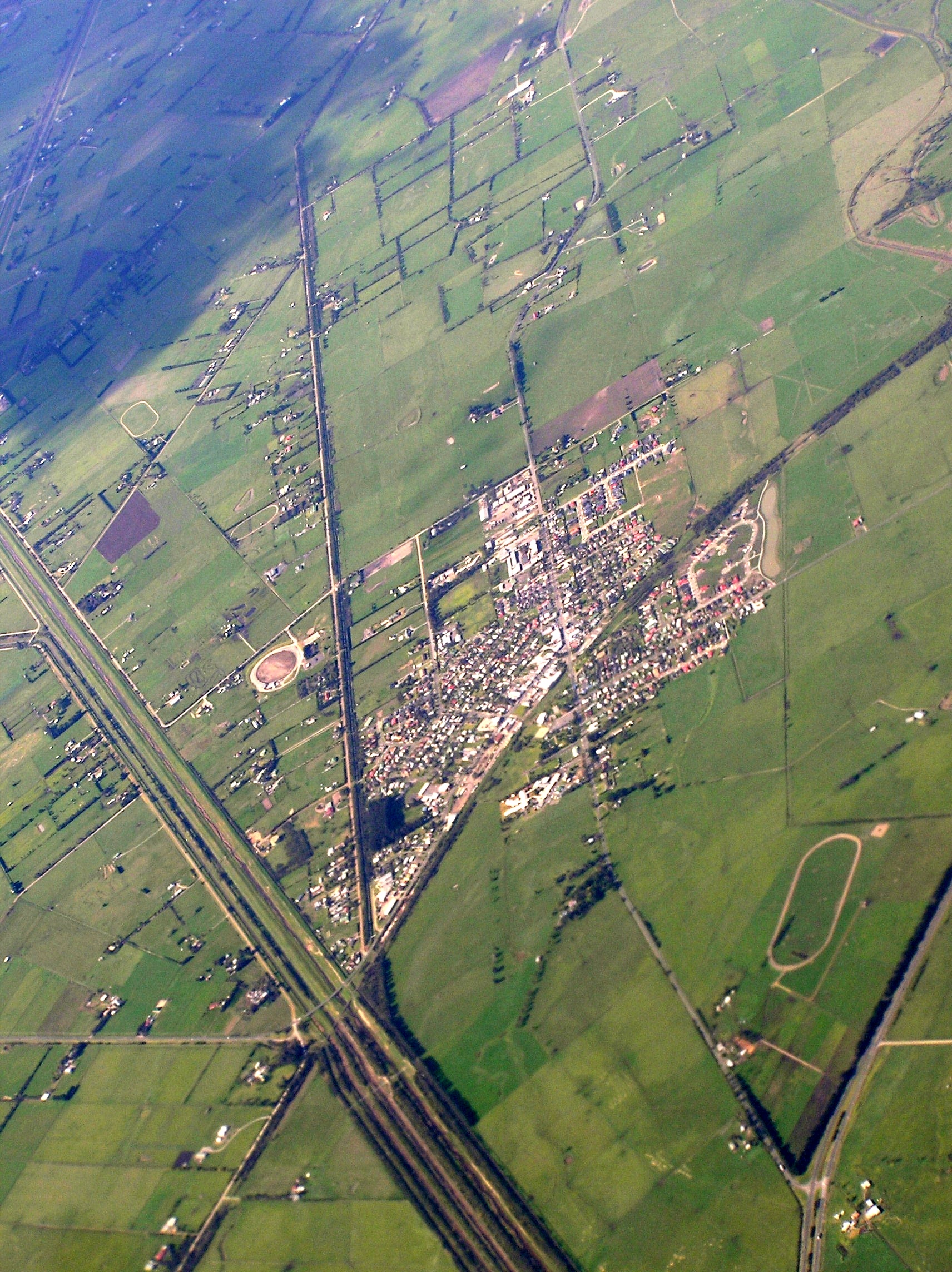
caption = Aerial photo from south west
lga = Shire of Cardinia
postcode = 3981
pop = 2,803 (2006) Census 2006 AUS
id=SSC25901
name = Koo Wee Rup (State Suburb)
accessdate=2007-09-15
quick=on]
est =
elevation= 36
maxtemp =
mintemp =
rainfall =
stategov = Bass
fedgov = Flinders
dist1 = 71
location1=Melbourne
dist2 = 25
location2= Cranbourne
near-nw = Officer
near-n = Pakenham
near-ne = Nar Nar Goon
near-w = Clyde
near-e = Cora Lynn
near-sw = Tooradin
near-s =
near-se = CaldermeadKoo Wee Rup is a town in Victoria,
Australia , 70 km south-east of Melbourne nearWestern Port bay. Its local government area is theShire of Cardinia . Prior to December 1994 the town was part of theShire of Cranbourne .It has an approximate population of 2,800. In the early 1950's many Dutch and Italian families settled in the area.
Built on former marshland now converted to market gardens.
Prior to European settlement the area was occupied by the
Bunurong Aboriginal people. It is from their language that the town's name derives - 'ku-wirup' allegedly meaning 'plenty of blackfish' or 'blackfish swimming'.Koo Wee Rup is Australia's largest
asparagus growing district. It also is a beef farming and potato growing area. The town was previously well-known for its Potato Festival, which was held each March to raise funds for the Westernport Memorial Hospital (now Kooweerup Regional Health Service).Schools include Koo Wee Rup Primary School, St John the Baptist Primary School and Koo Wee Rup Secondary College.
Wikimedia Foundation. 2010.