- Clyde, Victoria
-
Clyde
Victoria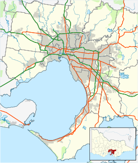
 Clyde
ClydePopulation: 1,224 (2006) [1] Postcode: 3978 Elevation: 8 m (26 ft) Location: - 57 km (35 mi) from Melbourne
- 9 km (6 mi) from Cranbourne
LGA: City of Casey State District: Bass, Cranbourne, Hastings Federal Division: La Trobe Localities around Clyde: Cranbourne East Clyde North Officer South Cranbourne East Clyde Cardinia Devon Meadows Tooradin Dalmore Clyde is a suburb in Melbourne, Victoria, Australia, 48 km south-east from Melbourne's central business district. Its Local Government Area is the City of Casey. At the 2006 Census, Clyde had a population of 1,224.[1]
Contents
History
Clyde Post Office on the Berwick-Cranbourne Road opened on 25 January 1864. In 1915 it was renamed Clyde North, and Clyde Railway Station office (open since 1888) was renamed Clyde.[2]
Description
The town centre is located in a small triangle between Twyford Road, Clyde-Five Ways Road and Ballarto Road and contains a primary school, CFA fire station, general store and community hall. Nearby are the Inghams poultry feed mill, built in 1979, and Lineham Oval, a sports oval which is home to the Clyde club in the West Gippsland Cricket Association.
Transport
Main article: Clyde railway station, VictoriaFrom 1888 until 1993, Clyde had a railway station on the South Gippsland line. [3]
References
- ^ a b Australian Bureau of Statistics (25 October 2007). "Clyde (State Suburb)". 2006 Census QuickStats. http://www.censusdata.abs.gov.au/ABSNavigation/prenav/LocationSearch?collection=Census&period=2006&areacode=SSC25355&producttype=QuickStats&breadcrumb=PL&action=401. Retrieved 2007-09-15.
- ^ Premier Postal History, Post Office List, https://www.premierpostal.com/cgi-bin/wsProd.sh/Viewpocdwrapper.p?SortBy=VIC&country=, retrieved 2008-04-11
- ^ Cranbourne Transit website, accessed 23 November 2006
Coordinates: 38°07′55″S 145°19′37″E / 38.132°S 145.327°E
Suburbs and Rural Townships of the City of Casey | Victoria Berwick · Blind Bight · Cannons Creek · Clyde · Clyde North · Cranbourne · Cranbourne East · Cranbourne North · Cranbourne South · Cranbourne West · Devon Meadows · Doveton · Endeavour Hills · Eumemmerring · Hallam · Hampton Park · Harkaway · Junction Village · Lynbrook · Lysterfield South · Narre Warren · Narre Warren North · Narre Warren South · Pearcedale · Tooradin · Warneet
Categories:- Towns in Victoria (Australia)
- Melbourne geography stubs

Wikimedia Foundation. 2010.