- Narre Warren South, Victoria
-
Narre Warren South
Melbourne, Victoria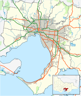
 Narre Warren South
Population: 25,505 (2006) [1] Postcode: 3805 Area: 13.3 km² (5.1 sq mi) Location: LGA: City of Casey State District: Narre Warren South Federal Division: Holt Suburbs around Narre Warren South: Hallam Narre Warren Berwick Hampton Park Narre Warren South Berwick Lynbrook Cranbourne North Clyde North Narre Warren South is a suburb in Melbourne, Victoria, Australia, 41 km south-east from Melbourne's central business district. Its Local Government Area is the City of Casey. At the 2006 Census, Narre Warren South had a population of 25,505.
As of April 2005, the area is one of the fastest growing areas within the state of Victoria.[2]
Contents
History
Since the mid 1990s, Narre Warren South has become a booming suburb, which once was a rural area. In the last 10 years many subdivisions have been developed, including Berwick Springs estate, which was launched in 1999, and Cypress Hill estate/Hillsmeade which was launched around the same time.
There are now other estates in the area, such as Golden Grove estate, Camden Greens Estate, Berwick Springs and Silverleaf.
Education
Narre Warren South is home to Narre Warren South P-12 College, a public school catering for students from Prep to Year 12. The college has one of the largest student enrolments in Victoria, with nearly 2000 students and more than 150 staff members. Narre Warren South is also serviced by Hillsmeade Primary School, a public primary school, and Trinity Catholic Primary School, a co-educational Catholic primary school.
As of November 2010, ICA Casey College, a private school in Narre Warren South that included students up to Year 12, was placed in voluntary administration.[3]
Retail
Narre Warren South has two shopping centres. Casey Central Shopping Centre, located on Narre Warren-Cranbourne Road, is anchored by a Coles Supermarket, and features a large number of specialty stores. Amberley Park Shopping Centre on Ormond Road is a smaller centre containing a Foodworks Supermarket and a few specialty stores, located next door to Narre Warren South P-12 College.
Also close by in adjoining suburbs are the newly built Eden Rise Shopping Centre on the corner of Clyde Road and Greaves Road in Berwick, and Westfield Fountain Gate in Narre Warren.
It has also been revealed that the Casey Central Town Centre, a major activity centre to be completed, will be considered. A number of civic, retail, education, commercial and hospitality outlets will be made available in this integral part of the suburb. The centre will be located adjacent to the current Casey Central Shopping Centre, and will innlude a discount department store, supermarket and various retails. The street and landscaping of the centre has been designed to suit all needs and uses.
See also
References
- ^ Australian Bureau of Statistics (25 October 2007). "Narre Warren South (State Suburb)". 2006 Census QuickStats. http://www.censusdata.abs.gov.au/ABSNavigation/prenav/LocationSearch?collection=Census&period=2006&areacode=SSC21495&producttype=QuickStats&breadcrumb=PL&action=401. Retrieved 2007-09-15.
- ^ About Casey | City of Casey - www.casey.vic.gov.au
- ^ Money problems leave schools in limbo, accessed 20 December 2010
Coordinates: 38°03′18″S 145°18′11″E / 38.055°S 145.303°E
Suburbs and Rural Townships of the City of Casey | Victoria Berwick · Blind Bight · Cannons Creek · Clyde · Clyde North · Cranbourne · Cranbourne East · Cranbourne North · Cranbourne South · Cranbourne West · Devon Meadows · Doveton · Endeavour Hills · Eumemmerring · Hallam · Hampton Park · Harkaway · Junction Village · Lynbrook · Lysterfield South · Narre Warren · Narre Warren North · Narre Warren South · Pearcedale · Tooradin · Warneet
Categories:- Suburbs of Melbourne

Wikimedia Foundation. 2010.