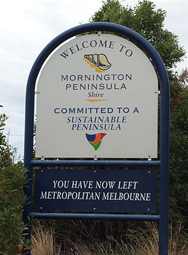
- Shire of Mornington Peninsula
-
Shire of Mornington Peninsula
Victoria
Population: 148,394(2009)[1] Established: 1994 Area: 723.1 km² (279.2 sq mi) Mayor: Cr Graham Pittock, elected December 2011 Council Seat: Rosebud Region: Victoria (Australia) State District: Mornington, Nepean, Hastings Federal Division: Dunkley, Flinders 
LGAs around Shire of Mornington Peninsula: Port Phillip Frankston Casey Shire of Mornington Peninsula Western Port The Shire of Mornington Peninsula is a Local Government Area in Victoria, Australia. It is located to the south of the city of Melbourne on the Mornington Peninsula. It has an area of 723 square kilometres. It has a estimated population of 148,394 people, which increases by up to 30% in summer.[1][2]
The Shire of Mornington Peninsula came into existence on 15 December 1994 when the Kennett Liberal government amalgamated the previous Shires of Flinders, Hastings and Mornington.
Contents
Wards
Each ward has one councillor.
- Mount Eliza
- Mornington
- Balcombe
- Kangerong
- Rosebud
- Truemans
- Rye
- Point Nepean
- Watsons
- Cerberus
- Red Hill
Localities, towns and suburbs
- Arthurs Seat
- Balnarring
- Balnarring Beach
- Baxter
- Bittern
- Blairgowrie
- Boneo
- Cape Schanck
- Crib Point
- Dromana
- Fingal
- Flinders
- Hastings
- HMAS Cerberus the area of the naval base is a bounded locality
- McCrae
- Main Ridge
- Merricks
- Merricks Beach
- Merricks North
- Moorooduc
- Mornington
- Mount Eliza
- Mount Martha
- Point Nepean
- Point Leo
- Portsea
- Red Hill
- Red Hill South
- Rosebud
- Rosebud West
- Rye
- Safety Beach
- Shoreham
- Somers
- Somerville
- Sorrento
- St Andrews Beach
- Tootgarook
- Tuerong
- Tyabb
See also
- List of Melbourne suburbs for other Melbourne suburbs and municipalities.
References
- ^ a b Australian Bureau of Statistics (30 March 2010). "Regional Population Growth, Australia, 2008–09". http://www.abs.gov.au/ausstats/abs@.nsf/Latestproducts/3218.0Main%20Features52008-09?opendocument&tabname=Summary&prodno=3218.0&issue=2008-09&num=&view=. Retrieved 4 June 2010.
- ^ Mornington Peninsula Shire Council
External links
- Mornington Peninsula Shire web site
- Metlink local public transport map
- Link to Land Victoria interactive maps
Suburbs of the Shire of Mornington Peninsula | Victoria Arthurs Seat · Balnarring · Balnarring Beach · Baxter · Bittern · Blairgowrie · Boneo · Cape Schanck · Crib Point · Dromana · Fingal · Flinders · Hastings · HMAS Cerberus · McCrae · Main Ridge · Merricks · Merricks Beach · Merricks North · Moorooduc · Mornington · Mount Eliza · Mount Martha · Point Leo · Portsea · Red Hill · Red Hill South · Rosebud · Rosebud West · Rye · Safety Beach · Shoreham · Somers · Somerville · Sorrento · St Andrews Beach · Tootgarook · Tuerong · Tyabb
Local Government Areas of Victoria Greater Melbourne Inner MelbourneMetropolitanBanyule · Bayside · Boroondara · Darebin · Glen Eira · Hobsons Bay · Kingston · Maribyrnong · Maroondah · Monash · Moonee Valley · Moreland · WhitehorseOuter MetropolitanBrimbank · Cardinia · Casey · Frankston · Greater Dandenong · Hume · Knox · Manningham · Melton · Mornington Peninsula · Nillumbik · Whittlesea · Wyndham · Yarra RangesSouthwest Central Highlands and Goldfields Goulburn Valley Northeast Gippsland Western District Wimmera The Mallee Categories:- Populated places established in 1994
- 1994 establishments in Australia
- Local Government Areas in Melbourne
- Local Government Areas of Victoria (Australia)
- Mornington Peninsula
Wikimedia Foundation. 2010.

