Shire of Gannawarra

Shire of Gannawarra

Infobox Australian Place | type = lga
name = Shire of Gannawarra
state = vic


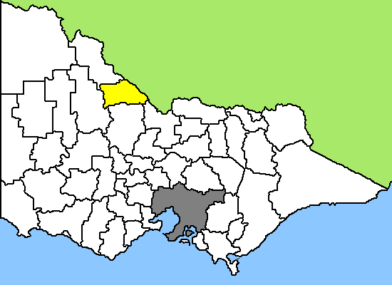
caption = Location in Victoria
pop = 11,296
area = 3732
est =
seat = Kerang
mayor = Keith den Houting
region =

url = http://www.gannawarra.vic.gov.au/
stategov = Rodney, Swan Hill
fedgov = Murray, Mallee
near-nw = Swan Hill
near-n = "Wakool (NSW)"
near-ne = "Wakool (NSW)"
near-w = Buloke
near-e = "Murray (NSW)"
near-sw = Buloke
near-s = Loddon
near-se = Campaspe
The Shire of Gannawarra is a Local Government Area in Victoria, Australia. It is located in the north-western part of the state. The main towns are Cohuna, Kerang and Quambatook. It has an area of 3,728 square kilometres. In 2006 it had a population of 11,296. The Shire was formed in 1995 from the merger of the Borough of Kerang and most parts of the Shire of Kerang and Shire of Cohuna.

The northeastern border of the shire is the Murray River. The Loddon River flows through the shire, feeding into the Murray. The Gunbower State Forest is a significant source of River Red Gum timber, supplying a historic sawmill in Koondrook. Gunbower Island is the largest inland island in the world. [cite web |url=http://www.gannawarra.vic.gov.au/Page/page.asp?Page_Id=176&h=0 |publisher=Gannawarra Shire Council |title=Gannawarra Shire Council - Murray River Region |accessdate=2007-06-10 |date=13 March 2003] It is between the Murray River and the Gunbower Creek, an anabranch of the Murray.

The western part of the shire is predominantly used for cereal grain production. The north and east have significant dairying and milk processing.

Tourists are attracted to the rivers (for fishing) and also the lakes (for bird watching and water sports).

References

External links

* [http://www.gannawarra.vic.gov.au/ Official website]


Wikimedia Foundation. 2010.

Игры ⚽ Поможем написать курсовую

Look at other dictionaries:

  • Shire of Gannawarra — Gannawarra Shire Lage des Gannawarra Shire in Victoria Basisdaten Bundesstaat: Victoria Hauptort: Kerang Fläche: 3.741 …   Deutsch Wikipedia

  • Shire of Kerang — Infobox Australian Place | type = lga name = Shire of Kerang state = vic region = area = 3254.45 est = 1862 seat = Kerang pop = 4380 (1992) [cite book|title=Victorian Year Book|author=Australian Bureau of Statistics, Victoria… …   Wikipedia

  • Shire of Cohuna — Infobox Australian Place | type = lga name = Shire of Cohuna state = vic region = area = 494.69 est = 1922 seat = Cohuna pop = 4630 (1992) [cite book|title=Victorian Year Book|author=Australian Bureau of Statistics, Victoria Office|year=1994|page …   Wikipedia

  • Gannawarra Shire — Lage des Gannawarra Shire in Victoria Gliederung …   Deutsch Wikipedia

  • Shire of Cardinia — Lage von Cardinia Shire in Melbourne Basisdaten Bundesstaat: Victoria Hauptort: Pakenham Fläche: 1.280 …   Deutsch Wikipedia

  • Shire of East Gippsland — Lage des East Gippsland Shire in Victoria Basisdaten Bundesstaat: Victoria Hauptort: Bairnsdale Fläche …   Deutsch Wikipedia

  • Shire of Melton — Lage von Melton Shire in Melbourne Basisdaten Bundesstaat: Victoria Hauptort: Melton Fläche: 528 …   Deutsch Wikipedia

  • Shire of Mornington Peninsula — Lage des Mornington Peninsula Shire in Melbourne Basisdaten Bundesstaat: Victoria Hauptort: Rosebud …   Deutsch Wikipedia

  • Shire of Nillumbik — Lage von Nillumbik Shire in Melbourne Basisdaten Bundesstaat: Victoria Hauptort: Greensborough Fläche …   Deutsch Wikipedia

  • Shire of Towong — Lage des Towong Shire in Victoria Basisdaten Bundesstaat: Victoria Hauptort: Tallangatta Fläche: 6.635 …   Deutsch Wikipedia

Share the article and excerpts

Direct link
Do a right-click on the link above
and select “Copy Link”