- Shire of Kerang
Infobox Australian Place | type = lga
name = Shire of Kerang
state = vic
region =
area = 3254.45
est = 1862
seat = Kerang
pop = 4380 (1992) [cite book|title=Victorian Year Book|author=Australian Bureau of Statistics, Victoria Office|year=1994|page=49-52|id=ISSN 0067-1223]
logosize =
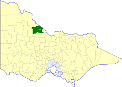
caption = Location in Victoria
county = Gunbower, Tatchera
near-nw = Swan Hill
near-n = Swan Hill
near-ne = "Wakool (NSW)"
near-w = Wycheproof
near-e = Cohuna
near-sw = Charlton
near-s = Gordon
near-se = Gordon
_noautocat = yesThe Shire of Kerang was a Local Government Area located in northwestern Victoria,
Australia , along theMurray River . The shire covered an area of convert|3254.45|km2|sqmi|1, and existed from 1862 until 1995. From 1966 onwards Kerang itself was managed by a separate entity, theBorough of Kerang . After a large-scale statewide amalgamation program by the Victorian Government in 1994–1995, they were reunited under theShire of Gannawarra .History
The Swan Hill District, which initially covered most of northwestern Victoria, was incorporated on 8 July 1862, and became a shire on 14 August 1871. The
Shire of Gordon severed and incorporated on 26 May 1885 from parts of the East and West Loddon Ridings, andShire of Mildura followed suit on 10 January 1890 from the Lower Murray Riding, as did the Shire of Castle Donnington on 30 May 1893 from the remainder of those three ridings. The remainder of the Shire was renamed Shire of Kerang on 31 December 1898.cite book|title=Victorian Municipal Directory|year=1992|publisher=Arnall & Jackson|location=Brunswick|pages=718-720 Accessed atState Library of Victoria , La Trobe Reading Room.]On 8 March 1922, parts of the North East and South East Ridings severed and incorporated as the
Shire of Cohuna , while the area around Kerang itself incorporated as theBorough of Kerang on 1 April 1966. On 5 July 1977 the Shire of Gordon annexed some land in Kerang's southwest.On 20 January 1995, the Shire was abolished, and merged with the Borough of Kerang and
Shire of Cohuna into theShire of Gannawarra . The Tresco township was transferred to theRural City of Swan Hill . [cite book|url=http://www.ausstats.abs.gov.au/ausstats/free.nsf/0/76E601D6DB55E88ACA25722500049195/$File/12570_1994-95.pdf|title=Victorian local government amalgamations 1994-1995: Changes to the Australian Standard Geographical Classification|author=Australian Bureau of Statistics |date=1 August 1995|publisher=Commonwealth of Australia|page=6,11|isbn=0-642-23117-6|accessdate=2008-01-05]Wards
Kerang was divided into three ridings on 1 April 1990, each of which elected three councillors:
* Central Riding
* East Riding
* West RidingTowns and Localities
* Appin
* Appin South
* Koondrook
* Lake Charm
* Lake Meran
* Lalbert
* Macorna
* Murrabit
* Quambatook
* Tittybong
* Towaninny
* Tragowel
* TrescoPopulation
* Estimate in the 1958 Victorian Year Book.
References
Wikimedia Foundation. 2010.