- Shire of Swan Hill
Infobox Australian Place | type = lga
name = Shire of Swan Hill
state = vic
region =
area = 6550
est = 1893
seat = Swan Hill
pop = 12070 (1992) [cite book|title=Victorian Year Book|author=Australian Bureau of Statistics, Victoria Office|year=1994|page=49-52|id=ISSN 0067-1223]
logosize =
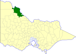
caption = Location in Victoria
county = Tatchera, Karkarooc
near-nw = Mildura
near-n = "Balranald (NSW)"
near-ne = "Balranald (NSW)"
near-w = Walpeup
near-e = "Wakool (NSW)"
near-sw = Wycheproof
near-s = Wycheproof
near-se = Kerang
_noautocat = yesThe Shire of Swan Hill was a Local Government Area located in northwestern Victoria,
Australia , along theMurray River . The shire covered an area of convert|6550|km2|sqmi|1, and existed from 1893 until 1995. From 1939 onwards, Swan Hill itself was managed by a separate entity, ultimately known as theCity of Swan Hill . After a large-scale statewide amalgamation program by the Victorian Government in 1994–1995, they were reunited under theRural City of Swan Hill .History
The Swan Hill District, which initially covered most of northwestern Victoria, was incorporated on 8 July 1862, and became a shire on 14 August 1871. The
Shire of Gordon severed and incorporated on 26 May 1885 from parts of the East and West Loddon Ridings, andShire of Mildura followed suit on 10 January 1890 from the Lower Murray Riding.On 30 May 1893, the Shire of Castle Donnington was severed and proclaimed by the
Governor of Victoria from what remained of the West Loddon, East Loddon and Lower Murray Ridings. The remainder of the Swan Hill shire was renamedShire of Kerang on 31 December 1898, and on 31 May 1904 the Castle Donnington municipality was renamed and gazetted as the Shire of Swan Hill.cite book|title=Victorian Municipal Directory|year=1992|publisher=Arnall & Jackson|location=Brunswick|pages=718-720, 846-847 Accessed atState Library of Victoria , La Trobe Reading Room.] [cite web|url=http://www.access.prov.vic.gov.au/public/component/daPublicBaseContainer?component=daViewAgency&entityId=VA%204385|title=Agency VA 4385|author=Public Record Office Victoria|year=2005|accessdate=2008-01-08]A new shire, Walpeup, was formed in western Victoria on 1 October 1911, taking in some western areas of Swan Hill and sections of five other shires. A small part of the Shire in and near the town of Swan Hill severed on 31 May 1939 and incorporated as a borough, which became the
City of Swan Hill on 2 April 1964.On 20 January 1995, the Shire was abolished, and merged with the
City of Swan Hill and the Tresco district of Kerang into theRural City of Swan Hill . [cite book|url=http://www.ausstats.abs.gov.au/ausstats/free.nsf/0/76E601D6DB55E88ACA25722500049195/$File/12570_1994-95.pdf|title=Victorian local government amalgamations 1994-1995: Changes to the Australian Standard Geographical Classification|author=Australian Bureau of Statistics |date=1 August 1995|publisher=Commonwealth of Australia|page=11|isbn=0-642-23117-6|accessdate=2008-01-05]Wards
Swan Hill was divided into three ridings, each of which elected three councillors:
* North Riding
* South Riding
* Central RidingTowns and Localities
Population
* Estimate in the 1958 Victorian Year Book.
References
Wikimedia Foundation. 2010.