Shire of Strathfieldsaye

Shire of Strathfieldsaye

Infobox Australian Place | type = lga
name = Shire of Strathfieldsaye
state = vic
region =
area = 601.34
est = 1861
seat = Kennington
pop = 19760 (1992) [cite book|title=Victorian Year Book|author=Australian Bureau of Statistics, Victoria Office|year=1994|page=52|id=ISSN 0067-1223]

logosize =


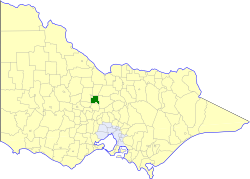
caption = Location in Victoria
county = Bendigo
near-nw = Bendigo (C)
near-n = Huntly
near-ne = Waranga
near-w = Marong
near-e = McIvor
near-sw = Maldon
near-s = Metcalfe
near-se = McIvor
_noautocat = yes

The Shire of Strathfieldsaye was a Local Government Area located immediately to the east and southeast of the regional city of Bendigo, Victoria, Australia, and included the eastern suburbs of Bendigo's metropolitan area. The shire covered an area of convert|601.34|km2|sqmi|1, and existed from 1861 until 1994.

History

Strathfieldsaye was first incorporated as a district on 20 August 1861, and became a shire on 17 September 1866.cite book|title=Victorian Municipal Directory|year=1992|publisher=Arnall & Jackson|location=Brunswick|pages=843-844 Accessed at State Library of Victoria, La Trobe Reading Room.]

On 7 April 1994, the Shire was abolished—one of the first to disappear under the Kennett Liberal government's statewide local government restructuring program—and merged with the City of Bendigo, the Borough of Eaglehawk, the Shire of Huntly and the Rural City of Marong to form the City of Greater Bendigo. [cite web|url=http://www.mav.asn.au/guide.nsf/Council/Greater+Bendigo+City+Council?OpenDocument|title=Greater Bendigo City Council|author=Municipal Association of Victoria|year=2006|accessdate=2008-01-08 Date cross-checked with the Records Division, Greater Bendigo City Council.] [cite news|title=Marong to fall in line on super council|last=Taylor|first=Thomas|page=6|date=6 April 1994|work=The Age Accessed via Factiva online.]

Wards

Strathfieldsaye was divided into three wards, each of which elected three councillors:
* Axedale Ward
* Mandurang Ward
* Strathfieldsaye Ward

Towns and Localities

* Axedale
* Bendigo East
* Diamond Hill
* Emu Creek
* Lake Eppalock
* Junortoun
* Kangaroo Flat
* Kennington
* Longlea
* Mandurang
* Mandurang South
* Mosquito Creek
* Myrtle Creek
* Sedgwick
* Spring Gully
* Strathfieldsaye

Population

* Estimate in the 1958 Victorian Year Book.

References


Wikimedia Foundation. 2010.

Игры ⚽ Нужно сделать НИР?

Look at other dictionaries:

  • Shire of Huntly — Infobox Australian Place | type = lga name = Shire of Huntly state = vic region = area = 878 est = 1861 seat = Huntly pop = 4800 (1992) [cite book|title=Victorian Year Book|author=Australian Bureau of Statistics, Victoria… …   Wikipedia

  • Shire of Waranga — Infobox Australian Place | type = lga name = Shire of Waranga state = vic region = area = 1644.19 est = 1863 seat = Rushworth pop = 4750 (1992) [cite book|title=Victorian Year Book|author=Australian Bureau of Statistics, Victoria… …   Wikipedia

  • Shire of McIvor — Infobox Australian Place | type = lga name = Shire of McIvor state = vic region = area = 1295 est = 1863 seat = Heathcote pop = 3450 (1992) [cite book|title=Victorian Year Book|author=Australian Bureau of Statistics, Victoria… …   Wikipedia

  • Shire of Maldon — Infobox Australian Place | type = lga name = Shire of Maldon state = vic region = area = 549 est = 1858 seat = Maldon pop = 3100 (1992) [cite book|title=Victorian Year Book|author=Australian Bureau of Statistics, Victoria… …   Wikipedia

  • Shire of Metcalfe — Infobox Australian Place | type = lga name = Shire of Metcalfe state = vic region = area = 590.52 est = 1860 seat = Metcalfe pop = 3390 (1992) [cite book|title=Victorian Year Book|author=Australian Bureau of Statistics, Victoria… …   Wikipedia

  • City of Morwell — Shire of Morwell Victoria Location in Victoria Population: 27320 (1992)[1] …   Wikipedia

  • List of localities in Victoria (Australia) — Map of Local Government Areas in Victoria This is a list of locality names and populated place names in the state of Victoria, Australia, outside the Melbourne metropolitan area. It is organised by region from the south west of the state to the… …   Wikipedia

  • City of Bendigo — Victoria Location in Victoria Population: 30890 (1992)[1] …   Wikipedia

  • Rural City of Marong — Infobox Australian Place | type = lga name = Rural City of Marong state = vic region = area = 1488.93 est = 1861 seat = Marong pop = 15880 (1992) [cite book|title=Victorian Year Book|author=Australian Bureau of Statistics, Victoria… …   Wikipedia

  • City of Greater Bendigo — Victoria Location in Victoria …   Wikipedia

Share the article and excerpts

Direct link
Do a right-click on the link above
and select “Copy Link”