- Shire of Waranga
Infobox Australian Place | type = lga
name = Shire of Waranga
state = vic
region =
area = 1644.19
est = 1863
seat = Rushworth
pop = 4750 (1992) [cite book|title=Victorian Year Book|author=Australian Bureau of Statistics, Victoria Office|year=1994|page=52|id=ISSN 0067-1223]
logosize =
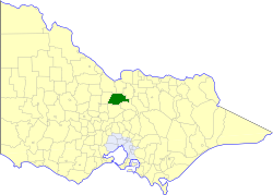
caption = Location in Victoria
county = Rodney
near-nw = Rochester
near-n = Deakin
near-ne = Rodney
near-w = Huntly
near-e = Rodney
near-sw = Strathfieldsaye
near-s = McIvor
near-se = Goulburn
_noautocat = yesThe Shire of Waranga was a Local Government Area located about convert|165|km|mi|0 north of
Melbourne , the state capital of Victoria,Australia . The shire covered an area of convert|1644.19|km2|sqmi|1, and existed from 1863 until 1994.History
Waranga was first incorporated as a district on 1 June 1863, and became a shire on 30 October 1865.cite book|title=Victorian Municipal Directory|year=1992|publisher=Arnall & Jackson|location=Brunswick|pages=881-882 Accessed at
State Library of Victoria , La Trobe Reading Room.]A large area was annexed to the Shire of Echuca on 10 October 1879, which ended up located within the
Shire of Deakin . TheShire of Rodney was severed and incorporated on 19 March 1886. On 16 May 1956 another loss of area occurred whenShire of Goulburn annexed some land in Waranga's southeast.On 18 November 1994, the Shire was abolished, and merged with the
City of Echuca , theTown of Kyabram , the Shires of Deakin and Rochester and some neighbouring districts into theShire of Campaspe . The Murchison district was transferred to theCity of Greater Shepparton . [cite book|url=http://www.ausstats.abs.gov.au/ausstats/free.nsf/0/76E601D6DB55E88ACA25722500049195/$File/12570_1994-95.pdf|title=Victorian local government amalgamations 1994-1995: Changes to the Australian Standard Geographical Classification|author=Australian Bureau of Statistics |date=1 August 1995|publisher=Commonwealth of Australia|page=5,7|isbn=0-642-23117-6|accessdate=2008-01-05]Wards
Waranga was divided into four ridings on 5 May 1971, each of which elected three councillors:
* North Riding
* South Riding
* East Riding
* West RidingTowns and Localities
* Colbinabbin
* Corop
* Mathiesons
* Murchison
* Rushworth
* Toolleen
* WhrooPopulation
* Estimate in the 1958 Victorian Year Book.
References
Wikimedia Foundation. 2010.