- Shire of Rodney
Infobox Australian Place | type = lga
name = Shire of Rodney
state = vic
region =
area = 1009.92
est = 1886
seat = Tatura
pop = 16110 (1992) [cite book|title=Victorian Year Book|author=Australian Bureau of Statistics, Victoria Office|year=1994|page=52|id=ISSN 0067-1223]
logosize =
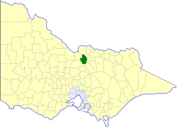
caption = Location in Victoria
county = Rodney
near-nw = Deakin
near-n = Nathalia
near-ne = Shepparton
near-w = Deakin
near-e = Shepparton
near-sw = Waranga
near-s = Goulburn
near-se = Euroa
_noautocat = yesThe Shire of Rodney was a Local Government Area located in the
Goulburn Valley region about convert|170|km|mi|0 north ofMelbourne , the state capital of Victoria,Australia , between Kyabram and Shepparton. The shire covered an area of convert|1009.92|km2|sqmi|1, and existed from 1886 until 1994.History
Rodney was initially part of the Waranga district, which incorporated in 1863 and became a shire two years later. The Shire of Rodney was severed and incorporated on 19 March 1886.cite book|title=Victorian Municipal Directory|year=1992|publisher=Arnall & Jackson|location=Brunswick|pages=817-818 Accessed at
State Library of Victoria , La Trobe Reading Room.] Following the secession of the town of Kyabram on 1 April 1954, the eastern part of the shire adjoining Shepparton, centred on Mooroopna which had became home to the Ardmona fruit cannery in 1922, unsuccessfully attempted to secede from Rodney, a move driven by the town's Chamber of Commerce. [cite web|url=http://web.archive.org/web/20030122124332/www.arts.monash.edu.au/ncas/multimedia/gazetteer/list/mooroopna.html|title=Australian Places - Mooroopna|author=Monash University |year=1999|accessdate=2008-01-06]On 18 November 1994, the Shire was abolished, and merged with the City and
Shire of Shepparton , along with some neighbouring districts into theCity of Greater Shepparton . However the Kyabram hinterland and some land around Lake Waranga transferred into theShire of Campaspe . [cite book|url=http://www.ausstats.abs.gov.au/ausstats/free.nsf/0/76E601D6DB55E88ACA25722500049195/$File/12570_1994-95.pdf|title=Victorian local government amalgamations 1994-1995: Changes to the Australian Standard Geographical Classification|author=Australian Bureau of Statistics |date=1 August 1995|publisher=Commonwealth of Australia|page=5,7|isbn=0-642-23117-6|accessdate=2008-01-05]Wards
Rodney was divided into three ridings on 1 October 1991, each of which elected three councillors:
* North Riding
* Central Riding
* South RidingTowns and Localities
* Tatura
* Mooroopna
* Byrneside
* Coomboona
* Dhurringile
* Gillieston
* Girgarre East
* Harston
* Merrigum
* St Germains
* Toolamba
* UnderaPopulation
* Estimate in the 1958 Victorian Year Book.
References
Wikimedia Foundation. 2010.