- Shire of Walpeup
Infobox Australian Place | type = lga
name = Shire of Walpeup
state = vic
region =
area = 10964
est = 1911
seat = Ouyen
pop = 3310 (1992) [cite book|title=Victorian Year Book|author=Australian Bureau of Statistics, Victoria Office|year=1994|page=49-52|id=ISSN 0067-1223]
logosize =
caption = Location in Victoria
county = Karkarooc, Millewa, Weeah
near-nw = "Loxton (SA)"
near-n = Mildura
near-ne = Swan Hill
near-w = "Pinnaroo (SA)"
near-e = Swan Hill Wycheproof
near-sw = Kaniva Lowan
near-s = Dimboola
near-se = Karkarooc
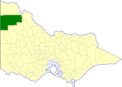
_noautocat = yesThe Shire of Walpeup was a Local Government Area located in northwestern Victoria,
Australia , along theSouth Australia n border. The shire covered an area of convert|10964|km2|sqmi|1, and existed from 1911 until 1994.History
Walpeup was first incorporated as a shire on 1 November 1911, having been created out of parts of the Shires of Mildura, Swan Hill, Lawloit, Lowan, Dimboola and Karkarooc.cite book|title=Victorian Municipal Directory|year=1992|publisher=Arnall & Jackson|location=Brunswick|pages=873-874 Accessed at
State Library of Victoria , La Trobe Reading Room.]On 20 January 1995, the Shire was abolished, and merged with the City and
Shire of Mildura into theRural City of Mildura . [cite book|url=http://www.ausstats.abs.gov.au/ausstats/free.nsf/0/76E601D6DB55E88ACA25722500049195/$File/12570_1994-95.pdf|title=Victorian local government amalgamations 1994-1995: Changes to the Australian Standard Geographical Classification|author=Australian Bureau of Statistics |date=1 August 1995|publisher=Commonwealth of Australia|page=9|isbn=0-642-23117-6|accessdate=2008-01-05]Wards
Walpeup was divided into four ridings in 1986, each of which elected three councillors:
* Ouyen East Riding
* Ouyen West Riding
* Walpeup/Underbool Riding
* Murrayville RidingTowns and Localities
*
Big Desert Wilderness Park
* Cowangie
* Kattyoong
* Kiamal
* Koonda
* Kulwin
* Mittyack
* Murrayville
*Murray-Sunset National Park (split withShire of Mildura )
* Ngallo
* Ouyen
* Panitya
* Tiega
* Underbool
* Walpeup
*Wyperfeld National Park (split withShire of Dimboola )Population
* Estimate in the 1958 Victorian Year Book.
References
Wikimedia Foundation. 2010.