- District Council of Loxton Waikerie
-
District Council of Loxton Waikerie
South Australia
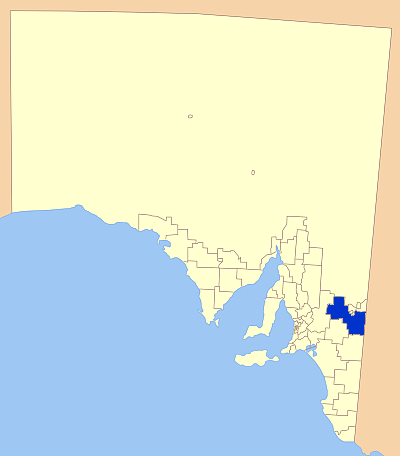
Location of the District Council of Loxton WaikeriePopulation: 12,043(2009)[1] Established: 3 May 1997 Coordinates: 34°26′43″S 140°46′24″E / 34.4454°S 140.7733°ECoordinates: 34°26′43″S 140°46′24″E / 34.4454°S 140.7733°E Area: 7957 km² (3,072.2 sq mi) Mayor: Dean Maywald LGAs around District Council of Loxton Waikerie: Outback Areas Renmark Paringa Mildura (Vic) Mid Murray District Council of Loxton Waikerie Mildura (Vic) Karoonda East Murray Southern Mallee Mildura (Vic) The District Council of Loxton Waikerie is a local government area covering parts of the Riverland and Murray Mallee regions of South Australia.
The council was formed on 3 May 1997 as an amalgamation of the District Councils of Loxton, Waikerie and Browns Well.[2]
Towns and localities covered by the council area are: Alawoona, Bakara, Bayah, Bookpurnong, Boolgun, Browns Well, Bugle Hut, Caliph, Cobera, Devlin Pound, Golden Heights, Hartwig Corner, Holder, Kanni, Kingston-on-Murray, Lock No 2, Lowbank, Loxton, Loxton North, Maggea, Maize Island, Malpas, Markeri, Meribah, Moorook, Mootatunga, Murbko, Myrla, Nadda, Naidia, Nangari, Netherleigh, New Residence, New Well, Noora, Notts Well, Oxford Landing, Paisley, Pata, Peebinga, Poogincok, Pyap, Qualco, Ramco, Ramco Heights, Sunlands, Taldra, Taplan, Taylorville, Tookayerta, Tuscan, Veitch, Waikerie, Wappilka, Woolpunda, Wunkar, Yinkanie
References
- ^ Australian Bureau of Statistics (30 March 2010). "Regional Population Growth, Australia, 2008–09". http://www.abs.gov.au/ausstats/abs@.nsf/Latestproducts/3218.0Main%20Features72008-09?opendocument&tabname=Summary&prodno=3218.0&issue=2008-09&num=&view=. Retrieved 3 June 2010.
- ^ "District Council of Loxton Waikerie - Council Information". District Council of Loxton Waikerie. http://www.loxtonwaikerie.sa.gov.au/site/page.cfm?u=260. Retrieved 2007-12-01.
External links
Local Government Areas of South Australia Metropolitan Adelaide Adelaide · Adelaide Hills · Burnside · Campbelltown · Charles Sturt · Gawler · Holdfast Bay · Marion · Mitcham · Norwood Payneham & St Peters · Onkaparinga · Playford · Port Adelaide Enfield · Prospect · Salisbury · Tea Tree Gully · Unley · Walkerville · West TorrensEyre Peninsula Ceduna · Cleve · Elliston · Franklin Harbour · Kimba · Lower Eyre Peninsula · Port Augusta · Port Lincoln · Streaky Bay · Tumby Bay · Wudinna · WhyallaCentral Barossa · Barunga West · Clare and Gilbert Valleys · Copper Coast · Flinders Ranges · Goyder · Light · Mallala · Mount Remarkable · Northern Areas · Orroroo Carieton · Peterborough · Port Pirie · Wakefield · Yorke PeninsulaSouthern and Hills Murray Mallee Berri Barmera · The Coorong · Gerard · Karoonda East Murray · Loxton Waikerie · Mid Murray · Murray Bridge · Renmark Paringa · Southern MalleeSoutheast Outback
Wikimedia Foundation. 2010.