- District Council of Tumby Bay
-
District Council of Tumby Bay
South Australia
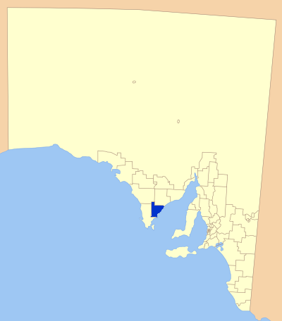
Location of Tumby Bay District Council in bluePopulation: 2,757(2009)[1] Established: 1906 Area: 2615.9 km² (1,010.0 sq mi) Mayor: Laurie WG Collins Council Seat: Tumby Bay Region: NE Eyre Peninsula State District: Flinders Federal Division: Grey LGAs around District Council of Tumby Bay: District Council of Elliston District Council of Cleve District Council of Tumby Bay District Council of Lower Eyre Peninsula The Tumby Bay District Council is a local government area of South Australia covering an area of the North Eastern Eyre Peninsula. Established in 1906, only six years after the town of Tumby Bay was established, the district was annexed from the former District Council of Port Lincoln to form the present council.
Contents
Localities
As well as Tumby Bay, The Tumby Bay District Council covers a number of larger towns including:
A number of smaller areas are also incorporated in the district. These include: Brooker, Butler, Butler Tanks, Carrow, Cockaleechie, Dixson, Hutchison, Koppio, Lipson Cove, Moody, Moreenia, Mount Hill, Nicholls, Redcliff's, Stokes, Thuruna, Trinity Haven, Uranno, Waratta Vale, Yallunda Flat and Yaranyacka.
Economy
The District's economy relies heavily on Agriculture and Fishing, and to a lesser extent, tourism.
The Area has long been a tourist destination, with fishing being a major attraction. A large marina was constructed in Tumby Bay in 2001, which has allowed for easier launching of boats, as well as development of nearby areas.
Elected members
[when?]
Councillor (Mayor) Laurie WG Collins
CEO: Anthony J Irvine
Councillors:- Peter Swaffer
- Pamela Gwen Brougham
- Murray F Mason
- Bob Lawrie
- Robert McFarlane Lawrie
- Donald Baillie
- Max Wilksch
- Samuel Telfer
References
- ^ Australian Bureau of Statistics (30 March 2010). "Regional Population Growth, Australia, 2008–09". http://www.abs.gov.au/ausstats/abs@.nsf/Latestproducts/3218.0Main%20Features72008-09?opendocument&tabname=Summary&prodno=3218.0&issue=2008-09&num=&view=. Retrieved 4 June 2010.
External links
Coordinates: 34°22′30″S 136°06′10″E / 34.375°S 136.102777778°E
Towns and Localities of the District Council of Tumby Bay Brooker · Butler · Butler Tanks · Carrow · Cockaleechie · Dixson · Hutchison · Koppio · Lipson · Lipson Cove · Moody · Moreenia · Mount Hill
Nicholls · Port Neill · Redcliff's · Stokes · Thuruna · Trinity Haven · Tumby Bay · Ungarra · Uranno · Waratta Vale · Yallunda Flat · YaranyackaLocal Government Areas of South Australia Metropolitan Adelaide Adelaide · Adelaide Hills · Burnside · Campbelltown · Charles Sturt · Gawler · Holdfast Bay · Marion · Mitcham · Norwood Payneham & St Peters · Onkaparinga · Playford · Port Adelaide Enfield · Prospect · Salisbury · Tea Tree Gully · Unley · Walkerville · West TorrensEyre Peninsula Ceduna · Cleve · Elliston · Franklin Harbour · Kimba · Lower Eyre Peninsula · Port Augusta · Port Lincoln · Streaky Bay · Tumby Bay · Wudinna · WhyallaCentral Barossa · Barunga West · Clare and Gilbert Valleys · Copper Coast · Flinders Ranges · Goyder · Light · Mallala · Mount Remarkable · Northern Areas · Orroroo Carieton · Peterborough · Port Pirie · Wakefield · Yorke PeninsulaSouthern and Hills Murray Mallee Southeast Outback Categories:- Populated places established in 1906
- 1906 establishments in Australia
- Australia government stubs
- Local Government Areas of South Australia
- Eyre Peninsula
Wikimedia Foundation. 2010.