- Municipal Council of Roxby Downs
-
Municipal Council of Roxby Downs
South Australia
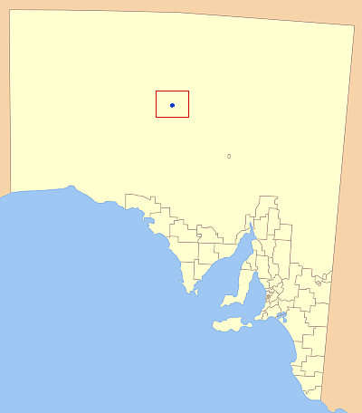
Location of the Municipal Council of Roxby Downs in bluePopulation: 4,484(2009)[1] • Density: 39.0/km² (101.0/sq mi) Established: 1982 Coordinates: 30°30′28″S 136°54′57″E / 30.5079°S 136.9157°ECoordinates: 30°30′28″S 136°54′57″E / 30.5079°S 136.9157°E Area: 110 km² (42.5 sq mi) Mayor: Bill Boehm Council Seat: Roxby Downs Region: The Outback State District: Giles Federal Division: Grey The Municipal Council of Roxby Downs is the local government area covering the town of Roxby Downs and the Olympic Dam mine in South Australia. It has an area of 110 km², and an estimated population of 4,484.[1] The municipality was established in 1982.[2]
References
- ^ a b Australian Bureau of Statistics (30 March 2010). "Regional Population Growth, Australia, 2008–09". http://www.abs.gov.au/ausstats/abs@.nsf/Latestproducts/3218.0Main%20Features72008-09?opendocument&tabname=Summary&prodno=3218.0&issue=2008-09&num=&view=. Retrieved 3 June 2010.
- ^ http://www.roxbydowns.com/servlet/Web?s=1902997&action=downloadResource&resourceID=878083144 Roxby Downs Council 2007/2008
External links
Localities of the Municipal Council of Roxby Downs Local Government Areas of South Australia Metropolitan Adelaide Adelaide · Adelaide Hills · Burnside · Campbelltown · Charles Sturt · Gawler · Holdfast Bay · Marion · Mitcham · Norwood Payneham & St Peters · Onkaparinga · Playford · Port Adelaide Enfield · Prospect · Salisbury · Tea Tree Gully · Unley · Walkerville · West TorrensEyre Peninsula Ceduna · Cleve · Elliston · Franklin Harbour · Kimba · Lower Eyre Peninsula · Port Augusta · Port Lincoln · Streaky Bay · Tumby Bay · Wudinna · WhyallaCentral Barossa · Barunga West · Clare and Gilbert Valleys · Copper Coast · Flinders Ranges · Goyder · Light · Mallala · Mount Remarkable · Northern Areas · Orroroo Carieton · Peterborough · Port Pirie · Wakefield · Yorke PeninsulaSouthern and Hills Murray Mallee Southeast Outback Anangu Pitjantjatjara Yankunytjatjara · Coober Pedy · Maralinga Tjarutja · Nepabunna · Outback Areas Community Development Trust · Roxby Downs · YalataCategories:- Populated places established in 1982
- 1982 establishments in Australia
- Local Government Areas of South Australia
- Australia government stubs
Wikimedia Foundation. 2010.