- Outback Areas Community Development Trust
-
Outback Areas CDT
South Australia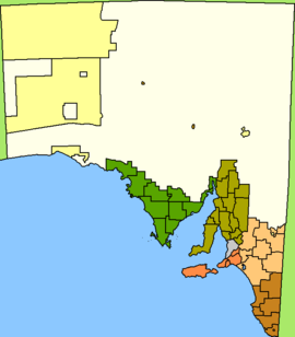
Location in South Australia (white)Population: 3,959(2009)[1] • Density: 0.006/km² (0.0/sq mi) Established: 1978 Area: 624339.0 km² (241,058.6 sq mi) Mayor: Bill McIntosh Council Seat: Port Augusta (outside Outback Areas) Region: Outback SA State District: Giles, Stuart, Flinders Federal Division: Grey 
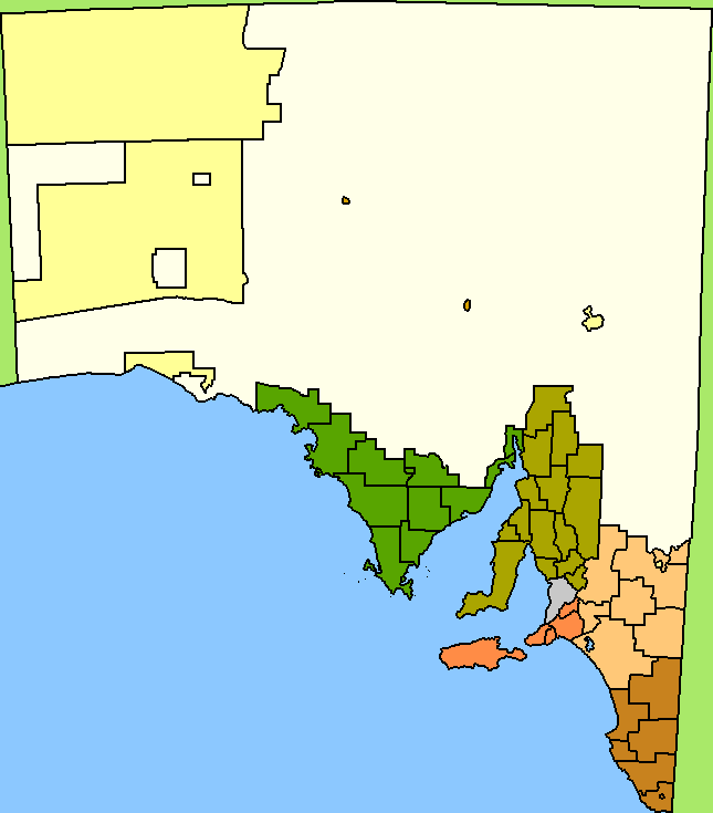
LGAs around Outback Areas CDT: See Surrounding LGAs The Outback Areas Community Development Trust is a trust in South Australia which is operated under the Outback Areas Community Development Trust Act (1978). It has been established to act as a third tier of government for the purposes of receiving and administering funding for 36 remote communities, which are widely dispersed across a region covering almost 60 % of South Australia's land area. The council has its seat at Port Augusta, which is located outside the Outback area. The area has an area of 624339.0 km²[2] and a population of 3,750[3], 639 of whom are Indigenous Australians, and several large pastoral leases and mining operations exist in its area of operation.
The trust's area of responsibility does not include Aboriginal reserves, the largest of which are Anangu Pitjantjatjara Yankunytjatjara in the northwest and Maralinga Tjarutja in the west of the area.
It currently consists of five members and two deputies.
The Outback Communities (Administration and Management) Bill of 2009 will replace the Outback Areas Community Development Trust with the Outback Communities Authority.[4]
The communities are listed by Proposed Unincorporated Area Districts [5] , with their population figures as of census 2006:
- Central North West Region
- East and North East Region
- Far North
- Innamincka (131)
- Marla (72)
- Marree (70)
- Oodnadatta (277)
- Seven Waterholes
- William Creek
- Flinders Ranges
- Beltana (83)
- Blinman (151)
- Copley (104)
- Leigh Creek (548)
- Lyndhurst
- Parachilna
- Gawler Ranges and Far West
- Ash
- Bookabie
- Border Village
- Coorabie
- Fowlers Bay (125)
- Gawler Ranges
- Iron Knob (199)
- Penong (215)
Surrounding LGAs
Because of its size, the OACDT is next to a large number of LGAs. It also completely surrounds the Municipal Council of Roxby Downs and the District Council of Coober Pedy. In South Australia, the OACDT borders from West to East:
- Anangu Pitjantjatjara Yankunytjatjara
- Maralinga Tjarutja
- District Council of Ceduna
- District Council of Streaky Bay
- Wudinna District Council
- District Council of Kimba
- District Council of Franklin Harbour
- City of Whyalla
- City of Port Augusta
- Flinders Ranges Council
- District Council of Orroroo Carrieton
- District Council of Peterborough
- Regional Council of Goyder
- Mid Murray Council
- District Council of Loxton Waikerie
- District Council of Berri and Barmera
- Renmark Paringa Council
In New South Wales it borders:
- Wentworth Shire
- Unincorporated Far West
In Queensland:
- Shire of Bulloo
- Shire of Barcoo
- Shire of Diamantina
In the Northern Territory:
References
- ^ Australian Bureau of Statistics (30 March 2010). "Regional Population Growth, Australia, 2008–09". http://www.abs.gov.au/ausstats/abs@.nsf/Latestproducts/3218.0Main%20Features72008-09?opendocument&tabname=Summary&prodno=3218.0&issue=2008-09&num=&view=. Retrieved 3 June 2010.
- ^ http://www.abs.gov.au/AUSSTATS/abs@.nsf/Latestproducts/LGA19399Environment/Energy12002-2006?opendocument&tabname=Summary&prodno=LGA19399&issue=2002-2006
- ^ http://www.censusdata.abs.gov.au/ABSNavigation/prenav/ProductSelect?newproducttype=QuickStats&btnSelectProduct=View+QuickStats+%3E&collection=Census&period=2006&areacode=LGA49399&geography=&method=&productlabel=&producttype=&topic=&navmapdisplayed=true&javascript=true&breadcrumb=LP&topholder=0&leftholder=0¤taction=201&action=401&textversion=false
- ^ http://www.austlii.edu.au/au/legis/sa/bill/ocamb2009478/
- ^ http://www.oacdt.sa.gov.au/__data/assets/pdf_file/0007/1321/SoO.Report_MR_h.res.pdf State of the Outback Report, Main Report, September 2005, Figure 1 – Draft OACDT Boundary
External links
Local Government Areas of South Australia Metropolitan Adelaide Adelaide · Adelaide Hills · Burnside · Campbelltown · Charles Sturt · Gawler · Holdfast Bay · Marion · Mitcham · Norwood Payneham & St Peters · Onkaparinga · Playford · Port Adelaide Enfield · Prospect · Salisbury · Tea Tree Gully · Unley · Walkerville · West TorrensEyre Peninsula Ceduna · Cleve · Elliston · Franklin Harbour · Kimba · Lower Eyre Peninsula · Port Augusta · Port Lincoln · Streaky Bay · Tumby Bay · Wudinna · WhyallaCentral Barossa · Barunga West · Clare and Gilbert Valleys · Copper Coast · Flinders Ranges · Goyder · Light · Mallala · Mount Remarkable · Northern Areas · Orroroo Carieton · Peterborough · Port Pirie · Wakefield · Yorke PeninsulaSouthern and Hills Murray Mallee Southeast Outback Anangu Pitjantjatjara Yankunytjatjara · Coober Pedy · Maralinga Tjarutja · Nepabunna · Outback Areas Community Development Trust · Roxby Downs · YalataEast and North East Region Far North Flinders Ranges Gawler Ranges and Far West Ash · Bookabie · Border Village · Coorabie · Fowlers Bay · Gawler Ranges · Iron Knob · Penong · MintabieCategories:- Populated places established in 1978
- 1978 establishments in Australia
- Local Government Areas of South Australia
- South Australia geography stubs
Wikimedia Foundation. 2010.