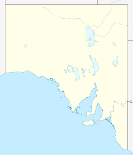
- Marla, South Australia
-
This article is about the town in South Australia. For other uses, see Marla (disambiguation).
Marla
South AustraliaPopulation: 72 (2006 Census)[1] Postcode: 5724 Elevation: 323 m (1,060 ft) Location: - 1100 km (684 mi) North of Adelaide
- 400 km (249 mi) South of Alice Springs
LGA: Outback Areas Community Development Trust Mean max temp Mean min temp Annual rainfall 28.7 °C
84 °F13.6 °C
56 °F208.3 mm
8.2 inMarla (27°18′S 133°37′E / 27.3°S 133.617°E) is a small town on the Stuart highway in north-western South Australia. It is located near the Ghan railway line. At the 2006 census, Marla had a population of 72.[1]
Marla is accessible by train. The Ghan, run by Great Southern Railway between Adelaide and Darwin arrives twice weekly in each direction.
Marla's population is about 70 people and is a service town. The township centres around the Marla Travellers Rest service station which comprises a supermarket, pub, motel, caravan park, pool and workshop. It is situated east of the Anangu Pitjantjatjara Lands and is a main service for these lands. There is a police station located at Marla which is a base for police officers working on these lands.
The Ghan Chandler (to Darwin)
↔ Marla ↔ Manguri
Coober Pedy(to Adelaide)
References
- ^ a b Australian Bureau of Statistics (25 October 2007). "Marla (State Suburb)". 2006 Census QuickStats. http://www.censusdata.abs.gov.au/ABSNavigation/prenav/LocationSearch?collection=Census&period=2006&areacode=SSC44101&producttype=QuickStats&breadcrumb=PL&action=401. Retrieved 26 September 2011.
- Climate statistics for Marla Police Station, Bureau of Meteorology, Accessed 21/4/7
Central North West Region East and North East Region Far North Flinders Ranges Gawler Ranges and Far West Ash · Bookabie · Border Village · Coorabie · Fowlers Bay · Gawler Ranges · Iron Knob · Penong · MintabieCategories:- Towns in South Australia
- Far North (South Australia)
- South Australia geography stubs
Wikimedia Foundation. 2010.

