- Mid Murray Council
-
Mid Murray Council
South Australia
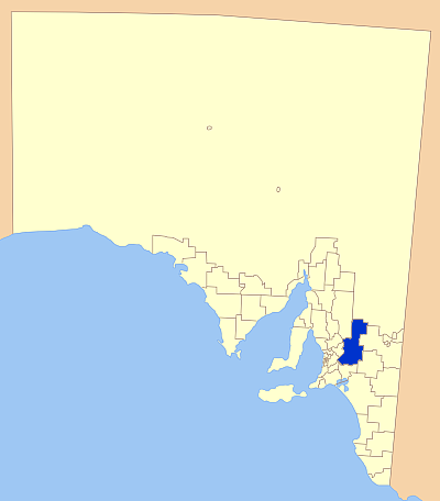
Location of the Mid Murray Council in SAPopulation: 8,511(2009)[1] Coordinates: 34°36′46″S 139°33′09″E / 34.6129°S 139.5525°ECoordinates: 34°36′46″S 139°33′09″E / 34.6129°S 139.5525°E Area: 7957 km² (3,072.2 sq mi) Mayor: Dave Burgess[2] LGAs around Mid Murray Council: Goyder Outback Areas Loxton Waikerie Barossa Mid Murray Council Loxton Waikerie Mount Barker Murray Bridge Karoonda East Murray Mid Murray Council was formed in 1997 from the amalgamation of the former District Councils of Mannum, Morgan, Ridley-Truro and part of the District Council of Mount Pleasant.
The council spans the area from the Riverland through the Murraylands to the eastern slopes of the Mount Lofty Ranges. It includes 220 km of the Murray River.
Towns in the council area include the river towns of Mannum, Swan Reach, Blanchetown and Morgan and the hills towns of Truro, Palmer and Tungkillo.
References
- ^ Australian Bureau of Statistics (30 March 2010). "Regional Population Growth, Australia, 2008–09". http://www.abs.gov.au/ausstats/abs@.nsf/Latestproducts/3218.0Main%20Features72008-09?opendocument&tabname=Summary&prodno=3218.0&issue=2008-09&num=&view=. Retrieved 3 June 2010.
- ^ http://www.mid-murray.sa.gov.au/site/page.cfm?u=530
External links
Local Government Areas of South Australia Metropolitan Adelaide Adelaide · Adelaide Hills · Burnside · Campbelltown · Charles Sturt · Gawler · Holdfast Bay · Marion · Mitcham · Norwood Payneham & St Peters · Onkaparinga · Playford · Port Adelaide Enfield · Prospect · Salisbury · Tea Tree Gully · Unley · Walkerville · West TorrensEyre Peninsula Ceduna · Cleve · Elliston · Franklin Harbour · Kimba · Lower Eyre Peninsula · Port Augusta · Port Lincoln · Streaky Bay · Tumby Bay · Wudinna · WhyallaCentral Barossa · Barunga West · Clare and Gilbert Valleys · Copper Coast · Flinders Ranges · Goyder · Light · Mallala · Mount Remarkable · Northern Areas · Orroroo Carieton · Peterborough · Port Pirie · Wakefield · Yorke PeninsulaSouthern and Hills Murray Mallee Berri Barmera · The Coorong · Gerard · Karoonda East Murray · Loxton Waikerie · Mid Murray · Murray Bridge · Renmark Paringa · Southern MalleeSoutheast Outback Categories:- Local Government Areas of South Australia
- Australia government stubs
Wikimedia Foundation. 2010.