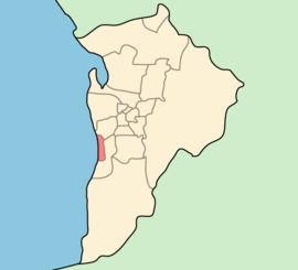
- City of Holdfast Bay
-
City of Holdfast Bay
South Australia
Population: 38,653(2009)[1] • Density: 2358/km² (6,107.2/sq mi) Area: 13.72 km² (5.3 sq mi) Mayor: Ken Rollond Council Seat: Brighton Region: Metropolitan Adelaide State District: Bright, Morphett Federal Division: Boothby, Hindmarsh 
LGAs around City of Holdfast Bay: City of West Torrens City of West Torrens City of Holdfast Bay City of Marion City of Marion City of Marion The City of Holdfast Bay is a Local Government Area in the south western coastal suburbs of Adelaide, South Australia.
Contents
Origins
The council was formed 1 January 1997, when the former councils of Glenelg and Brighton were amalgamated by the State government. As a result there are two council offices, one in the historic Glenelg Town Hall on Moseley Square, and the other on Jetty Road Brighton.
Mayors
The council has only had two mayors to date: Brian Nadilo and the current mayor Ken Rollond, who was re-elected.
Suburbs
- Brighton (5048)
- Glenelg (5045)
- Glenelg East (5045)
- Glenelg North (5045)
- Glenelg South (5045)
- Hove (5048)
- Kingston Park (5049)
- North Brighton (5048)
- Seacliff (5049)
- Seacliff Park (5049)
- Somerton Park (5044)
- South Brighton (5048)
Wards
The council is split into four ward divisions from which three councillors are elected to represent the area (excluding the mayor). They are the Glenelg Ward, Somerton Ward, Brighton Ward and Seacliff Ward.
Sister city
There is one Sister city to Holdfast Bay.[2]
References
- ^ Australian Bureau of Statistics (30 March 2010). "Regional Population Growth, Australia, 2008–09". http://www.abs.gov.au/ausstats/abs@.nsf/Latestproducts/3218.0Main%20Features72008-09?opendocument&tabname=Summary&prodno=3218.0&issue=2008-09&num=&view=. Retrieved 4 June 2010.
- ^ "Hayama Sister City". City of Holdfast Bay. http://www.holdfast.sa.gov.au/site/page.cfm?u=937. Retrieved 4 June 2010.
External links
Local Government Areas of South Australia Metropolitan Adelaide Adelaide · Adelaide Hills · Burnside · Campbelltown · Charles Sturt · Gawler · Holdfast Bay · Marion · Mitcham · Norwood Payneham & St Peters · Onkaparinga · Playford · Port Adelaide Enfield · Prospect · Salisbury · Tea Tree Gully · Unley · Walkerville · West TorrensEyre Peninsula Ceduna · Cleve · Elliston · Franklin Harbour · Kimba · Lower Eyre Peninsula · Port Augusta · Port Lincoln · Streaky Bay · Tumby Bay · Wudinna · WhyallaCentral Barossa · Barunga West · Clare and Gilbert Valleys · Copper Coast · Flinders Ranges · Goyder · Light · Mallala · Mount Remarkable · Northern Areas · Orroroo Carieton · Peterborough · Port Pirie · Wakefield · Yorke PeninsulaSouthern and Hills Murray Mallee Southeast Outback Coordinates: 35°1′S 138°31′E / 35.017°S 138.517°E
Categories:- Local Government Areas of South Australia
- Local Government Areas in Adelaide
- Australia government stubs
- Adelaide geography stubs
Wikimedia Foundation. 2010.
