- City of Mitcham
-
City of Mitcham
South Australia
Population: 65,315(2009)[1] • Density: 791/km² (2,048.7/sq mi) Area: 75.55 km² (29.2 sq mi) Mayor: Michael Picton[2] Council Seat: Torrens Park Region: Metropolitan Adelaide State District: Davenport, Elder, Heysen, Waite Federal Division: Boothby 
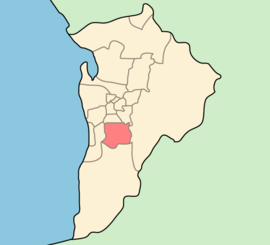
LGAs around City of Mitcham: City of Unley City of Burnside City of Marion City of Mitcham Adelaide Hills Council City of Onkaparinga The City of Mitcham is a Local Government Area situated in the foothills of eastern Adelaide, South Australia. Within its bounds is Flinders University, South Australia's third largest.
The City of Mitcham was founded in 1853 and was the first local government area formally founded in South Australia after the City of Adelaide.[3]
Contents
Suburbs
- Bedford Park - 5042
- Belair - 5052
- Bellevue Heights - 5050
- Blackwood – 5051
- Brown Hill Creek – 5062
- Clapham - 5062
- Clarence Gardens - 5039
- Colonel Light Gardens - 5041
- Coromandel Valley - 5051
- Craigburn Farm - 5051
- Cumberland Park - 5041
- Daw Park - 5041
- Eden Hills - 5050
- Glenalta - 5052
- Hawthorn - 5062
- Hawthorndene - 5051
- Kingswood - 5062
- Leawood Gardens - 5150
- Lower Mitcham - 5062
- Lynton - 5062
- Melrose Park - 5039
- Mitcham - 5062
- Netherby - 5062
- Panorama - 5041
- Pasadena - 5042
- Springfield - 5062
- St. Marys - 5042
- Torrens Park - 5062
- Upper Sturt - 5156
- Urrbrae - 5064
- Westbourne Park - 5041
Wards
The City of Mitcham is divided into 6 wards, each of which elect 2 or 3 representatives to the Council.[4] They cover suburbs roughly as follows.[5]
Ward Suburbs Overton Clarence Gardens, Cumberland Park, Melrose Park, Daw Park, (part of) Colonel Light Gardens Gault Westbourne Park, Hawthorn, (most of) Colonel Light Gardens, Lower Mitcham, (part of) Clapham Boorman Kingswood, Netherby, Urrbrae, Torrens Park, Mitcham, Springfield, Brownhill Creek, Leawood Gardens, Lynton Babbage St Marys, Pasadena, Panorama, (part of) Clapham, Bedford Park The Park (most of) Belair, Glenalta, (part of) Crafers West, (part of) Blackwood, Hawthorndene, (part of) Upper Sturt Craigburn Eden Hills, (part of) Belair, (most of) Blackwood, Bellevue Heights, Craigburn Farm, (part of) Coromandel Valley See also
References
- ^ Australian Bureau of Statistics (30 March 2010). "Regional Population Growth, Australia, 2008–09". http://www.abs.gov.au/ausstats/abs@.nsf/Latestproducts/3218.0Main%20Features72008-09?opendocument&tabname=Summary&prodno=3218.0&issue=2008-09&num=&view=. Retrieved 4 June 2010.
- ^ "Mayor Michael Picton". City of Mitcham. http://www.mitchamcouncil.sa.gov.au/site/page.cfm?u=1170&c=18. Retrieved 2011-01-04.
- ^ "About Council". City of Mitcham. http://www.mitchamcouncil.sa.gov.au/site/page.cfm?u=1069. Retrieved 2008-11-11.
- ^ "Elected Members". City of Mitcham. http://www.mitchamcouncil.sa.gov.au/site/page.cfm?u=1088. Retrieved 2011-05-28.
- ^ "Ward Map". City of Mitcham. http://www.mitchamcouncil.sa.gov.au/site/page.cfm?u=1169. Retrieved 2011-05-28.
External links
Local Government Areas of South Australia Metropolitan Adelaide Adelaide · Adelaide Hills · Burnside · Campbelltown · Charles Sturt · Gawler · Holdfast Bay · Marion · Mitcham · Norwood Payneham & St Peters · Onkaparinga · Playford · Port Adelaide Enfield · Prospect · Salisbury · Tea Tree Gully · Unley · Walkerville · West TorrensEyre Peninsula Ceduna · Cleve · Elliston · Franklin Harbour · Kimba · Lower Eyre Peninsula · Port Augusta · Port Lincoln · Streaky Bay · Tumby Bay · Wudinna · WhyallaCentral Barossa · Barunga West · Clare and Gilbert Valleys · Copper Coast · Flinders Ranges · Goyder · Light · Mallala · Mount Remarkable · Northern Areas · Orroroo Carieton · Peterborough · Port Pirie · Wakefield · Yorke PeninsulaSouthern and Hills Murray Mallee Southeast Outback Coordinates: 35°1′S 138°38′E / 35.017°S 138.633°E
Categories:- Local Government Areas in Adelaide
- Local Government Areas of South Australia
- Australia government stubs
- Adelaide geography stubs
Wikimedia Foundation. 2010.
