- Belair, South Australia
Infobox Australian Place | type = suburb
name = Belair
city = Adelaide
state = sa
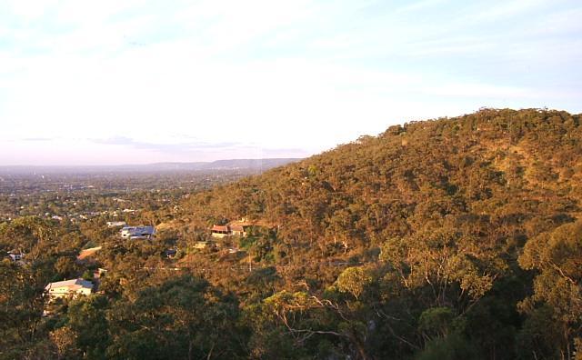
caption = Part of the view north from Windy Point
lga = City of Mitcham
postcode = 5052
est =
pop = 4,379 (2006 census) [Census 2006 AUS|id =SSC41106|name=Belair (State Suburb)|accessdate=2008-07-02| quick=on]
area =
propval =
stategov =
fedgov =
near-nw = Lynton
near-n = Torrens Park
near-ne = Brown Hill Creek
near-e =Belair National Park
near-se = Hawthorndene
near-s = Glenalta
near-sw = Blackwood
near-w = Pasadena
dist1 =
location1=Belair is a
suburb situated in the southern foothills ofAdelaide ,South Australia .Geography
A leafy suburb, Belair was established during the settlement of Adelaide as a source of
timber . Parts of Belair have views of the city of Adelaide, the Adelaide Plains and the coast.Belair National Park is one of the major attractions of the suburb, and Windy Point (formerly known as Observation Point) provides a 230 degree panorama making it one of the best lookouts over the city, the plains and the coast.Recreational facilities
Belair National Park is a very popular location for feeding the ducks, walking through the bush, enjoying the native flora and fauna, having barbecues and playing social games of tennis, football, soccer and 'backyard' cricket. There is an 18-hole public golf course adjacent to the National Park. It is also a very popular area for mountain bikers with many bike trails in the National Park, around the area, and steep tracks down the hills face to railway stations on the Belair line, which terminates adjacent to the National Park.History
The origin of the name 'Belair' appears uncertain. Gustav Ludewigs, who subdivided the area, may have named the suburb after Bel Air,
Accessibility
Belair is approximately a fifteen minute drive from the Adelaide CBD. Belair railway station is the terminus of the suburban Belair railway line.
Education
"Belair schools" consist of a co-located
junior school and an upperprimary school situated on Main Road, Belair. The schools have Eco-school status, [ [http://www.environment.sa.gov.au/reporting/education/pdfs/case_studies/belair_ecoschool.pdf "Belair Eco School"] , Department of Environment and Heritage, "accessed8 July 2008 "] and follow theInternational Baccalaureate syllabus. [http://www.internationalstudents.sa.edu.au/files/links/Belair_Primary_School.pdf "Belair Primary School"] , Department of Education and Children's Services, "accessed8 July 2008 "] In 1999 the schools twinned with Momoyama Elementary School inKyoto ,Japan . Every two years, during May, a group of students and staff travel to Kyoto. In the alternate year, Momoyama students and staff visit Belair during August. These visits have become an integral part of the schools'Japanese language and cultural programme.References
External links
* [http://www.belairschools.sa.edu.au/ Belair Schools] ;Links to copyright photographs
* [http://www.mitchamcouncil.sa.gov.au/webdata/resources/images/Windy_Point1.jpgView of the city from Windy Point.] (Copyright Mitcham Council)
Wikimedia Foundation. 2010.