- Stirling, South Australia
Infobox Australian Place | type = town
name = Stirling
state = sa
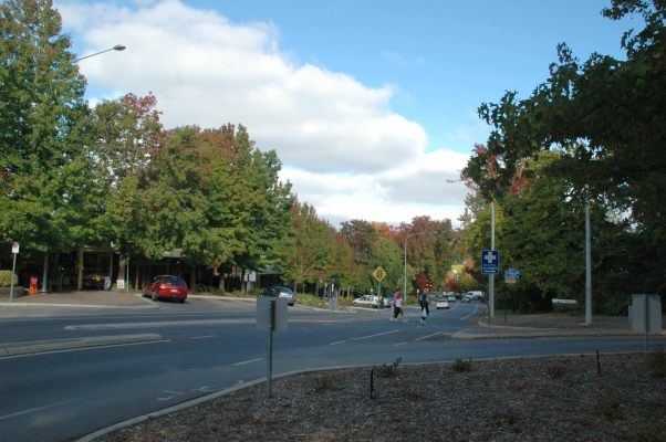
caption = View of Main Street in Stirling.
lga = Adelaide Hills Council
postcode = 5152
pop = 2,868 (2006)Census 2006 AUS
id=SSC42651
name=Stirling (State Suburb)
accessdate=2007-10-25
quick=on]
est = 1854
stategov = Heysen
fedgov = Mayo
near-nw = Crafers West
near-n = Crafers
near-ne = Piccadilly
near-w = Upper Sturt
near-e = Stirling East
near-sw = Heathfield
near-s = Aldgate
near-se = BridgewaterStirling (sometimes called Stirling East) is a town in the
Adelaide Hills District Council. Its population is about 2500, though the town has largely merged with neighbouring townships such as Crafers and Aldgate.History
Founded in 1854 , Stirling grew rapidly as a result of the expansion of
apple growing andmarket gardening to satisfy the demand of the expanding city ofAdelaide , whose centre is only 15 kilometres from Stirling. It was also developed as a residence for Englishmen who could not cope with Adelaide's hot summers. Today, farming has declined as more of the region has been urbanised, with many Stirling residents commuting to Adelaide daily.Owing to the wet and mild climate, many
deciduous trees have been imported fromEurope , and these are a major tourist attraction in the autumn. Other tourist sites include the nearbyBelair National Park andCleland Conservation Park .Climate
climate chart|Stirling
11|24|36
11|24|37
10|21|43
8|17|81
6|14|143
5|12|183
4|11|161
4|12|156
6|15|98
7|18|77
9|20|51
10|21|43
float=rightOwing to its location nearMount Lofty , Stirling is the wettest place in South Australia, receiving an average of 1200 millimetres (47 inches) of rain per year - more than twice the average of Adelaide [Commonwealth Bureau of Census and Statistics, South Australian Office; "South Australian Year Book"; 1978 edition ISBN 00856428] . Between May and August, the average monthly rainfall is as high as 155 millimetres (over 6 inches), and in June 1916, over 450 millimetres fell. Mean summer temperatures are about 5 °C (9 °F) lower than in Adelaide, which may explain why Stirling was recommended as a residence for English migrants, whilst winters are distinctly fresh, with average maxima of 11 °C (52 °F).Government
Stirling is located in the state electorate of Heysen and in the federal
Division of Mayo . The local council is theAdelaide Hills Council (formerly Stirling Council) in the Mt Lofty and Manoah wards.Fire Service
The Stirling community is protected from fire, road crash and Hazardous Materials by the
Stirling Country Fire Service Volunteers.In 2006, theAdelaide Hills Council stepped up efforts to relocate the station to Crafers, against the wants of the volunteersFact|date=May 2007. The council proposed the move in order to sell the land currently inhabited by the CFS station on Avenue road, to fund a new Library. However, in mid 2006 the council elected to sell the land the fire station was on toSAFECOM (The government organisation which owns all Fire Service assets). The new Library started construction anyway, in early 2007.References
Wikimedia Foundation. 2010.