Piccadilly, South Australia
- Piccadilly, South Australia
Infobox Australian Place | type = town
name = Piccadilly
state =
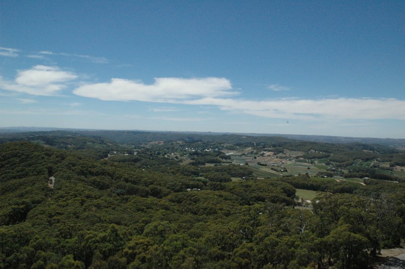
caption = Piccadilly from Mount Lofty
lga = Adelaide Hills Council
postcode = 5151
pop = 526
est =
stategov =
fedgov = Mayo
near-nw = Greenhill
near-n = Summertown
near-ne = Uraidla
near-w = Mount Osmond
near-e = Carey Gully
near-sw = Mount Osmond
near-s = Crafers
near-se = Mount George
Piccadilly is a small town in the Adelaide Hills of South Australia, Australia.
The Piccadilly Valley was for many decades a market gardening centre which produced food for the Adelaide and overseas market. A large part of the valley is now used for growing premium 'cool climate' grape varieties.
Piccadilly is home to the Woodhouse Scout Centre, which in addition to scout jamborees hosts school camps and various outdoor activities.
Wikimedia Foundation.
2010.
Look at other dictionaries:
Crafers, South Australia — Crafers South Australia Crafers main street … Wikipedia
Summertown, South Australia — Infobox Australian Place | type = town name = Summertown state = South Australia caption = lga = Adelaide Hills Council postcode = 5141 est = 1870s pop = 440 (2001 census) elevation= maxtemp = mintemp = rainfall = stategov = Heysen fedgov = Mayo… … Wikipedia
Oakbank, South Australia — Oakbank South Australia Oakbank Racecourse … Wikipedia
Mylor, South Australia — Mylor South Australia … Wikipedia
Montacute, South Australia — Montacute South Australia … Wikipedia
Cherryville, South Australia — Cherryville South Australia The town of Cherryville seen from Marble Hill … Wikipedia
Charleston, South Australia — Charleston South Australia Charleston Hotel and general store … Wikipedia
Stirling (South Australia) — Stirling Hauptstraße von Stirling Staat … Deutsch Wikipedia
Uraidla, South Australia — Infobox Australian Place | type = town name = Uraidla state = South Australia caption = Uraidla Township lga = Adelaide Hills Council postcode = 5142 est = 1880s pop = 442 (2001 census) elevation= maxtemp = mintemp = rainfall = stategov = Heysen… … Wikipedia
Stirling, South Australia — Infobox Australian Place | type = town name = Stirling state = sa caption = View of Main Street in Stirling. lga = Adelaide Hills Council postcode = 5152 pop = 2,868 (2006)Census 2006 AUS id=SSC42651 name=Stirling (State Suburb) accessdate=2007… … Wikipedia