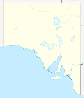
- Cherryville, South Australia
-
Cherryville
South Australia
The town of Cherryville seen from Marble HillPopulation: 238 (2006 Census)[1] Established: 1840 Postcode: 5134 Elevation: 493 m (1,617 ft) Location: 15 km (9 mi) from Adelaide LGA: Adelaide Hills Council State District: Heysen Federal Division: Mayo Cherryville is a small town in the Adelaide Hills, South Australia. It was named in around 1840 after the native cherry trees that grew in the area,[2] although some historians claim that it was not named until 1892, when horticultural cherry plantings became widespread in the area.[3] Prior to this, land holdings were typically of around 100 acres (40 ha) and used primarily for pastoralism or small-scale vegetable gardens. At the 2006 census, Cherryville had a population of 238.[1]
Cherryville Post Office opened on 2 January 1899 and closed in 1974.[4]
References
- ^ a b Australian Bureau of Statistics (25 October 2007). "Cherryville (State Suburb)". 2006 Census QuickStats. http://www.censusdata.abs.gov.au/ABSNavigation/prenav/LocationSearch?collection=Census&period=2006&areacode=SSC43321&producttype=QuickStats&breadcrumb=PL&action=401. Retrieved 27 July 2011.
- ^ Hines, Lucy Maymon (1937). Environs of Norton Summit. East Torrens Historical Society (1996).
- ^ Rick Bzowy Architects; Simon Weidenhofer, Robyn Taylor, Bill Smith (February 1994). East Torrens Heritage Survey. Department for Environment and Natural Resources. pp. 30.
- ^ Premier Postal History. "Post Office List". Premier Postal Auctions. https://www.premierpostal.com/cgi-bin/wsProd.sh/Viewpocdwrapper.p?SortBy=SA&country=. Retrieved 2011-05-26.
Towns and Localities of the Adelaide Hills Council Aldgate · Ashton · Balhannah · Basket Range · Birdwood · Bradbury · Bridgewater · Carey Gully · Castambul · Chain of Ponds · Charleston · Cherryville · Cleland · Crafers · Crafers West · Cromer · Cudlee Creek · Dorset Vale · Forest Range · Forreston · Greenhill · Gumeracha · Heathfield · Horsnell Gully · Houghton · Humbug Scrub · Inglewood · Ironbank · Kersbrook · Lenswood · Lobethal · Longwood · Lower Hermitage · Marble Hill · Millbrook · Montacute · Mount George · Mount Torrens · Mylor · Norton Summit · Oakbank · Paracombe · Piccadilly · Scott Creek · Stirling · Summertown · Teringie · Upper Hermitage · Upper Sturt · Uraidla · Verdun · Woodforde · WoodsideAdelaide Hills, South Australia Major Townships Birdwood · Clarendon · Echunga · Gumeracha · Hahndorf · Littlehampton · Lobethal · Macclesfield · Meadows · Mount Barker · Mylor · Nairne · Oakbank · Stirling · WoodsideAttractions See also Categories:- Towns in South Australia
- Adelaide Hills, South Australia
- Adelaide geography stubs
- Suburbs of Adelaide
Wikimedia Foundation. 2010.

