- Mount Barker, South Australia
-
Mount Barker
South Australia
The southern entrance to the Mount Barker Central mall.
 Mount Barker
Population: 10 258 (2006 Census) Established: 1839 Postcode: 5251 Elevation: 360 m (1,181 ft) Location: 33 km (21 mi) from Adelaide LGA: Mount Barker State District: Kavel, Heysen Federal Division: Mayo Mean max temp Mean min temp Annual rainfall 19.9 °C
68 °F4.5 °C
40 °F764.4 mm
30.1 inLocalities around Mount Barker: Hahndorf Littlehampton Nairne Echunga Mount Barker Callington Macclesfield Strathalbyn Langhorne Creek Mount Barker is an expanding city, home to 10 258 [1] residents that is 33 kilometres up the South Eastern Freeway, east of Adelaide, in South Australia. It is the seat of the District Council of Mount Barker, is the largest town in the Adelaide Hills, and is one of the fastest growing areas in the state. Mount Barker is close enough to Adelaide that many people commute there on a daily basis, although it is far enough away from the city that people call it "the country".
Mount Barker lies at the base of a local mountain of the same name, called the Mount Barker summit by locals. It is 50 kilometres from the Murray River. Mount Barker was traditionally a farming area, and many of the lots just outside the town area are farming lots, although some of them have been replaced with new subdivisions in recent times.
The Mount Barker Summit was first discovered by Captain Collet Barker in 1830, but he was killed by Aborigines in 1831, so Captain Charles Sturt named Mount Barker after him when he founded it in 1834.
Mount Barker is well serviced, with a recently upgraded Police station, a Country Fire Service station, the Adelaide Hills State Emergency Service centre, an Ambulance station, and five bus routes.
Mount Barker is in the federal division of Mayo, and the state electoral districts of Kavel and Heysen, with most of the town in Kavel, and only the south-eastern portion of the town in Heysen. Local Federal Member of Parliament, Jamie Briggs, succeded former Foreign Affairs Minister, Alexander Downer.
Mount Barker was the epicenter for an Earthquake on 16 April 2010 at 11.35pm local time, the quake registered 3.8 on the Richter scale.[2]
Contents
History
Mount Barker was first sighted by Captain Charles Sturt in 1830, although he thought he was looking at the previously discovered Mount Lofty. Captain Collet Barker fixed this error when he surveyed the area in 1831. Sturt named the mountain in honour of Captain Barker after he was killed later that year by Aborigines, at the Murray Mouth.[3] The mountain was officially recognised by King William IV in 1834, two years before the colonisation of South Australia in 1836.[3] The mountain was first climbed in December 1837 by the explorers Robert Cock, William Finlayson, A. Wyatt and G. Barton, when they passed through the area on their expedition from Adelaide to Lake Alexandrina.[4][5]
Mount Barker was surveyed in 1839 by Duncan McFarlane, who was hoping the area could be used for wheat and grain farming. The land was divided into lots of 80 acres (320,000 m2), although farmers didn't settle until 1844, when John Dunn built the first steam flour mill outside of Adelaide. The flour mill ran for 50 years and is now a tourist attraction. All of the towns major buildings were built soon afterwards, with a post office (now replaced) in 1860 and a police station (also replaced) that was built in 1878. In 1883, the railway line from Adelaide to Strathalbyn was laid,[3] but that line is now discontinued, with the line terminating short of Balhannah, and is used by the SteamRanger historic railway.
Mount Barker was originally home to the Peramangk Aboriginal people. The Ngarrindjeri people from the east also used the Summit for ceremonial and burial sites. The Mount Barker Summit is a significant Aboriginal area, and may be one of the most sacred sites near Adelaide.[6] In 1984 the Ngarrindjeri people tried to prevent the building of a police communications tower, and in 1987 they also tried to stop the Telecom tower, although both attempts were not successful.
Mount Barker has since developed into a large urban centre, which is developing very rapidly. The Mount Barker district council is the area that experienced the fourth largest growth between 1996 and 2006 in South Australia, with an increase of 3,800 new residents (3% growth per year). Mount Barker is ranked fifth for fastest growth in South Australia.[7] During the last 10 years, many new subdivisions have been developed, such as Martin-Dale and Waterford. During this period, there has also been an economic boom in Mount Barker and a number of additional malls and shopping centres, such as the recently completed Adelaide Hills Home-maker Centre, with a radio rentals, a Harvey Norman, the new offices for the District Council of Mount Barker. There have also recently been lodged plans for a new shopping centre, which will feature a major department store larger than 4,000 m 2.[8]
Several new developments in Mount Barker that were in the planning stage in 2007. The largest plan awaiting a decision from the council is a new 1000 home subdivision in the town's south.[9][10][11][12] There is an increasing problem with the infrastructure of the town, with the District Council of Mount Barker attempting to convince the State Government to fund a new freeway exit on the South Eastern Freeway, which goes from Adelaide to Murray Bridge, and is the only major road to service the area.
Geography
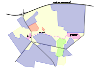 A map of Mount Barker. Blue:Residential, Red:CBD, Green:Industry
Mount Barker is located on the plains surrounding the Mount Barker Summit, about 2 km west of the mountain itself, at 35°04′S 138°51′E / 35.067°S 138.85°E. Mount Barker is south east of Mount Lofty and Adelaide. It is to the north of the The Coorong, and the west of Murray Bridge. Mount Barker is at an elevation of 360 m.
The city is just south of the freeway from Adelaide to Murray Bridge (and Melbourne). Its four major roads form a star that reaches out of the town. To the west of the town there is the industrial area, and the Laratinga Wetlands. North of the wetlands there are the subdivisions Martindale, Waterford and Dalmeny Park. The wetland is fed by the Mount Barker Creek that goes from Keith Stephenson Park to the wetlands, right next to the linear trail.
Mount Barker is about 4 km west of the local mountain, Mount Barker. The mountain is called the Mount Barker summit by locals.
Mount Barker in South Australia is often confused with Mount Barker in Western Australia, especially when dealing with national telephone centres.
Climate
Mount Barker Climate chart (explanation) J F M A M J J A S O N D 2627122627123125105920888177100145105135102145861666819740239342510Average max. and min. temperatures in °C Precipitation totals in mm Source: Bureau of Meteorology[13] Imperial conversion J F M A M J J A S O N D 18153180531.276512.369473.562443.957414.15540458413.462422.767451.673481.47751Average max. and min. temperatures in °F Precipitation totals in inches Mount Barker is generally cooler than Adelaide, with a mean maximum temperature of 19.9 degrees and a mean minimum temperature of 8 degrees. The average rainfall for the year is 765.2 mm.[13] Mount Barker is typically the driest during February, with an average of only 25.5 mm of rain, with July usually producing the most rain, with an average rainfall of 105.4 mm.
Mount Barker is typically between 2 and 3 degrees cooler than Adelaide, which has an average temperature of 22.2 degrees, and it gets more than 200 mm more rain (on average) than Adelaide.
Demographics
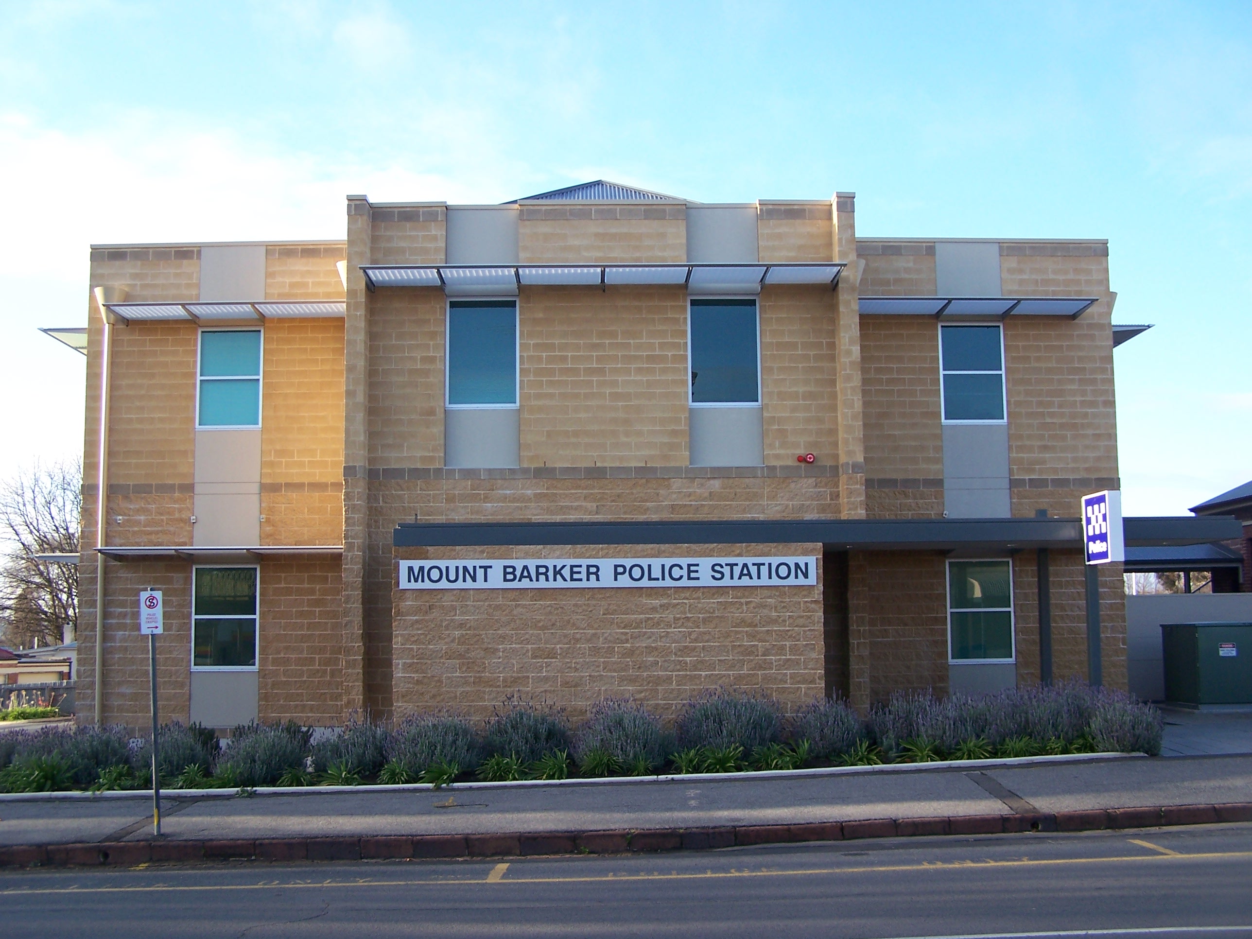
 The recently upgraded 24-Hour Mount Barker police station
Mount Barker has an above average number of females, with 52.7% of the population female, and only 47.3% male, compared with the national averages of 50.6% female and 49.4% male.[14] Mount Barker has a below average population age of 34 compared to the national average of 37. Mount Barker has more married people than the national average with 50% of people married compared to the national average of 49.6%.
Most people that live in the city were born in Australia, with 8,274 people who live in Mount Barker born in Australia. Other common places of birth include England (682), Germany (87), Netherlands (79), New Zealand (78) and Scotland (75).[14] Of the people living in Mount Barker, 9,426 of them only speak English at home (91.9%), 84 speak German, 67 Italian, 24 Dutch, 13 Afrikaans and 12 Indonesian.
Overall, Mount Barker is generally less multicultural than other areas of the country, with 80.7% of people from the city being Australian, compared to the national average of 70.9%. This lack of other cultures is also apparent in the spoken language, with 91.9% of people from Mount Barker only speaking English at home compared to the national average of 78.5%.[14]
Mount Barker has a growing economy with new shopping centres and other businesses, as well as a growing population.[7] There are plans for another shopping centre and for Mount Barker Central to be expanded.[citation needed] There are several new housing developments in the city that are in the planning stage at the moment. The largest plan that is still awaiting a decision from the council is a new 1000 home subdivision in the towns south.[9][10][11][12] The average income for residents of Mount Barker is $460 per week per person, down only $6 per week from the national average.
Culture
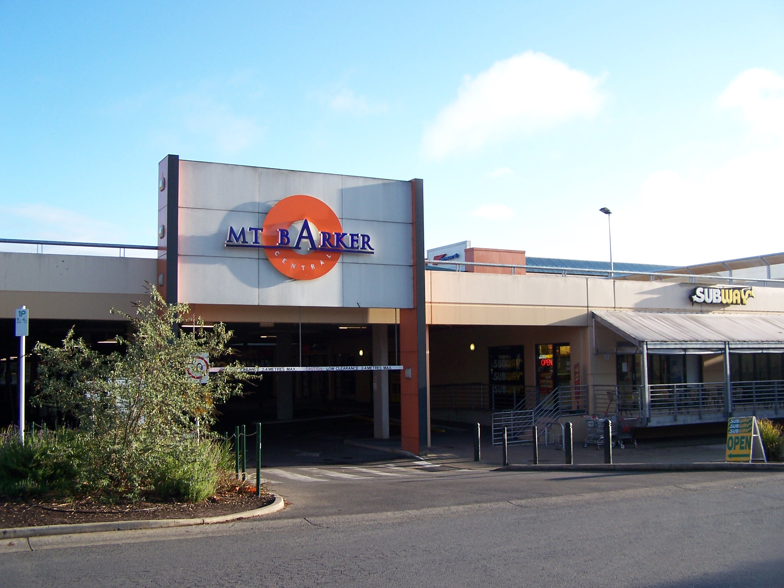
 The south entrance to Mount Barker Central, the largest shopping centre in Mount Barker
Mount Barker is the largest town in the Adelaide Hills, with more than 10,000 people. It is the home of a number of different businesses including five shopping centres, four supermarkets and many restaurants, cafés and fast food outlets. Mount Barker also has many recreational activities available such as walking trails and a cinema. Mount Barker has five shopping centres, Mount Barker Central, also known as The Bilo Mall (The original Bilo Mall was formerly the Mount Barker Tannery which closed down in the early eighties[15]) is the largest and oldest, containing a Coles (Previously BI-LO), a Kmart and more than 50 speciality shops.[16] Mount Barker Village is a smaller shopping centre based around the Foodland supermarket. It has fewer speciality shops although it does have a playground. Mount Barker Plaza which used to house another Coles supermarket (that was around before the one in Mount Barker Central was converted from a BI-LO) has recently been redeveloped, adding new stores such as Dick Smith, Gloria Jeans and The Reject Shop, which is located where Coles used to be in the mall. The developers have also increased car parking on property adjacent to satisfy the requirements of the new retail additions to the site. The Woolworths Complex is not really a shopping centre as such, but is just a Woolworths and a few small shops nearby.
The most recent shopping centre is the Adelaide Hills Homemaker Centre. It replaces some old industrial buildings (which was Jacobs Smallgoods and Abattoir)near the St Francis de Sales college that were bulldozed in 2003. This industrial site also was used as the meatworks in the movie The Honorable Wally Norman. This shopping centre has a Harvey Norman, a Radio Rentals, about ten speciality shops, and a multi-story office block what is to become the new home for the Mount Barker Council in the next few months.
Recreation
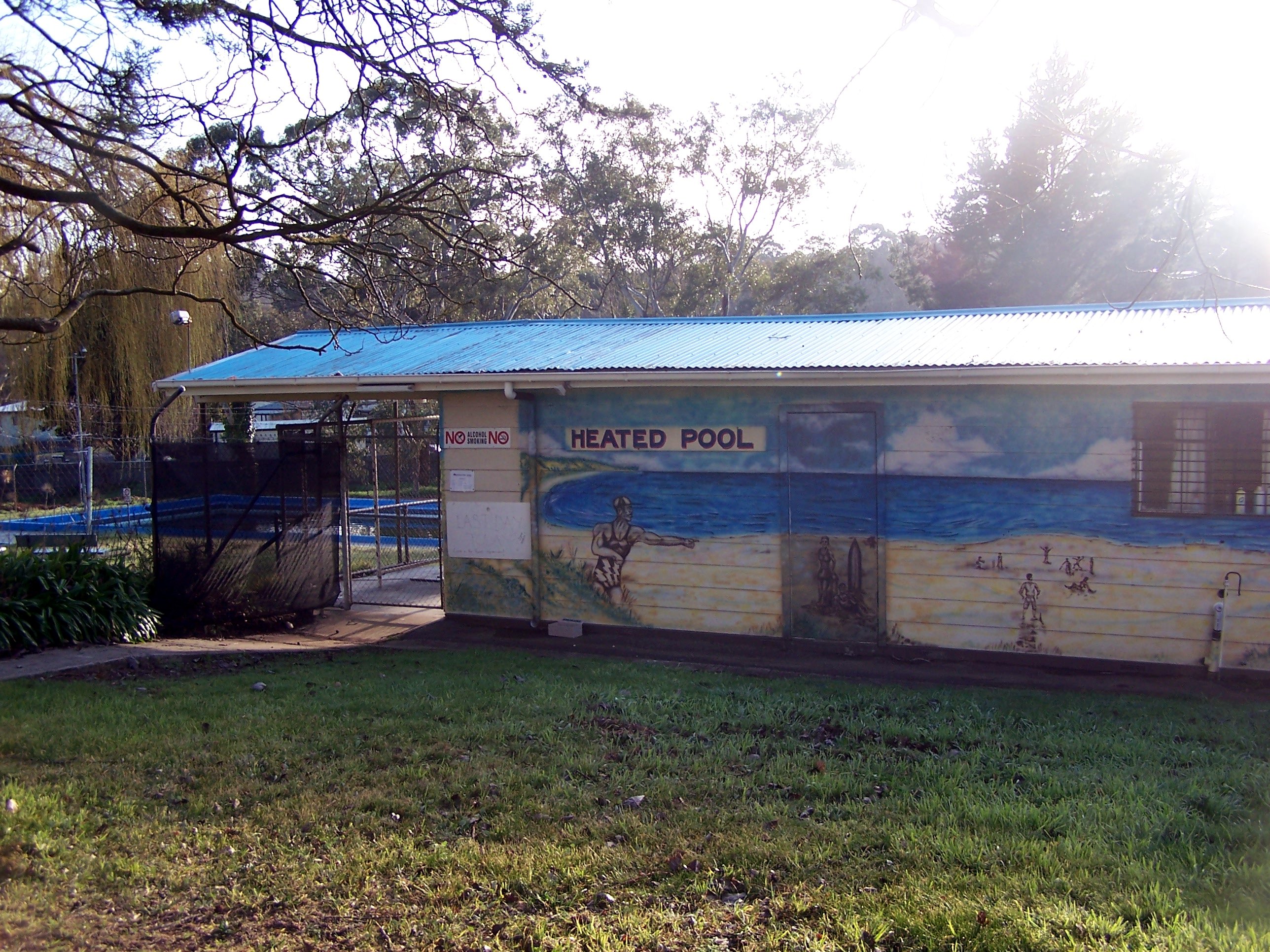
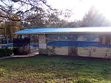 The Mount Barker Mountain Pool, next to the caravan park
Mount Barker has numerous activities that are available. There is the Linear Trail that starts at Keith Stephenson Park which has a lake, a playground and also the skate park. The Mount Barker lawn bowls club is just across the road from Keith Stephenson Park. The linear trail goes to the Laratinga Wetlands, and is a total length of about 3 km. There are also many walking trails and a few barbecues at the Laratinga Wetlands.
Just up the hill from Keith Stephenson Park is the Mount Barker Wallis Cinema. The cinema has seven screens, all with full Dolby Digital surround. The cinema is partially underground, with only about three rows of seats raised above ground level, and the rest is below. The cinema is right next to the Auchendorroch House restaurant.[17]
Mount Barker has two ovals, the Mount Barker oval, right next to The Recreation Centre, where the Mount Barker Show is held, as well as local HFL footy matches. The other oval is Dunn Park, which is located near Cornerstone College and the caravan park, although it is not used much any more. The various schools in the area also have their own ovals. Mount Barker also has a single public swimming pool, located near the caravan park, that is open from September to May.
Mount Barker has a single 18-hole, 5,614m golf course that is near the residential area on Bald Hills Road. The golf course is a par 70.[18] Mount Barker is also home to the SteamRanger historic railway which operates The Southern Encounter steam trains through Strathalbyn and Goolwa to Victor Harbor.
Mount Barker has a single local newspaper, The Courier that is published weekly on Wednesdays. It won SA's Best Regional Newspaper in 2006, and is "The newspaper of the Adelaide Hills since 1880".[19] There is also the Adelaide Hills transmission of the local radio station, Power FM, which transmits on 100.3 FM.
Infrastructure
The main route to Adelaide is via the Freeway. Many people use this road to get to work in the city every day. The local government has been lobbying to the state and federal governments to fund another freeway exit, because the current one is almost at capacity.[20]
Public Services
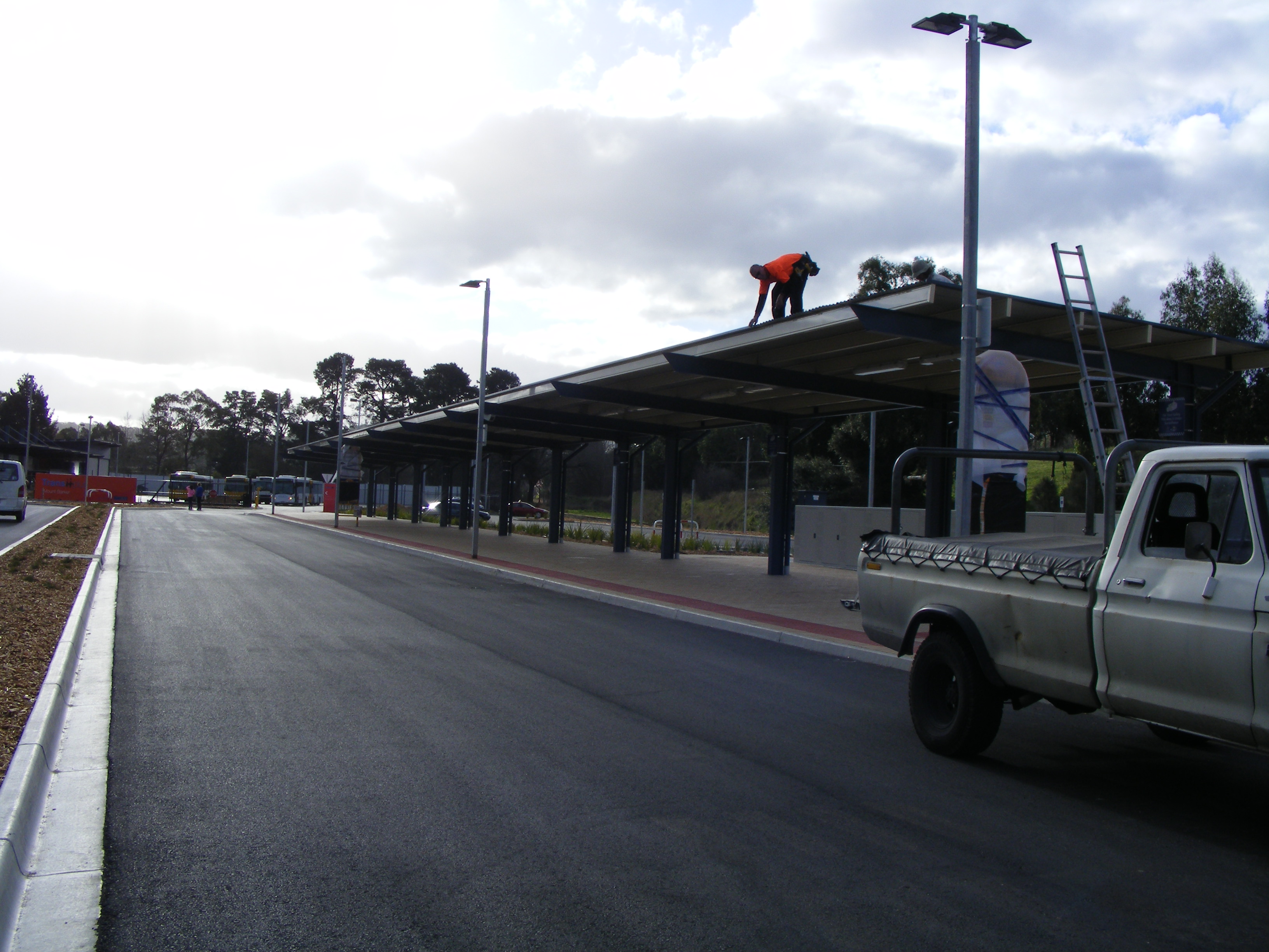
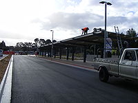 The Park 'n' Ride Facility in Mount Barker being completed.
Mount Barker has many services. The Mount Barker Police station was recently upgraded, and is now open 24 hours a day, as was the Country Fire Service station, which is one of the busiest in the state. Mount Barker has a library adjacent to the Mount Barker TAFE campus. There is also a post office which shares the same building as the doctors centre, adjacent to the Mount Barker Central mall.
Mount Barker has an Ambulance Station and a hospital on Wellington Road, as well as the Adelaide Hills State Emergency Service unit which is one of the busiest in the state.[21]
Adelaide Metro provides daily bus services from Mount Barker to Adelaide and back either via the surrounding hills districts such as Hahndorf and Stirling, or an express route via the South Eastern Freeway. There are also buses to surrounding hills districts such as Lobethal, Nairne and Strathalbyn,[22] as well as two loop buses. The local council also provides a to-your-door service for the elderly.
All of the Mount Barker buses (and the Strathalbyn buses) connect at the Mount Barker Park 'n' Ride. The facility was opened on 6 July 2008. It features 183 Car Parks, security lighting, bike storage and a large sheltered waiting area.[23]
Education
Mount Barker has three primary schools, the Mount Barker South Primary School, Mount Barker Primary School, and St Marks Primary School, which is a Lutheran school. Both St Francis and Waldorf have a primary school as well as a high school, which share the same campus.
Mount Barker has a single public high school, Mount Barker High School, as well as three private high schools: Cornerstone College, which is run by the Lutheran Church of Australia, St Francis de Sales College which is Catholic and Mount Barker Waldorf School which employs Waldorf Education. All of these schools are co-educational. Overall about 1500 - 2000 school students, from Mount Barker, as well as many of the surrounding towns, such as Nairne, Littlehampton and Strathalbyn, are serviced by these high schools.
References
- ^ 2006 Census QuickStats: Mount Barker (State Suburb)
- ^ Geoscience Australia (16 April 2010). "Recent Earthquake : Near Mt Barker, SA". http://www.ga.gov.au/bin/earthquake.pl?title=Near+Mt+Barker%2C+SA&magnitude=3.8&depth=0&xy=138.840,-35.150&date=16,04,2010&time=13,57,26&bg1=eqrisk_lm&zoom=100&station=STKA. Retrieved 17 April 2010.
- ^ a b c District Council of Mount Barker "History"
- ^ South Australian Gazette and Colonial Register. Adelaide, Saturday 20 Jan 1838
- ^ Recollections of Old Colonists” (RGSA vol 6), “Reminiscences by Pastor Finlayson” pp 48-49
- ^ District Council of Mount Barker "Aboriginal History of the area"
- ^ a b ABS. "POPULATION CHANGE - STATES AND TERRITORIES". Regional Population Growth, Australia, 1996 to 2006 (South Australia). http://www.abs.gov.au/AUSSTATS/abs@.nsf/Latestproducts/3218.0Main%20Features41996%20to%202006?opendocument&prodno=3218.0&issue=1996%20to%202006#Untitled%20Section_2. Retrieved 2007-08-21.
- ^ Lisa Symonds (21 November 2007). "New Shopping Centre". The Courier.
- ^ a b Planning SA - Development 580/D027/07
- ^ a b Planning SA - Development 580/D059/07
- ^ a b Planning SA - Development 580/D088/06
- ^ a b Planning SA - Development 580/C089/06
- ^ a b "Climate Averages for Mount Barker". Australian Bureau of Meteorology. http://www.bom.gov.au/climate/averages/tables/cw_023733.shtml. Retrieved 2007-11-05.
- ^ a b c Australian Bureau of Statistics (25 October 2007). "Mount Barker (State Suburb) - SA". 2006 Census QuickStats. http://www.censusdata.abs.gov.au/ABSNavigation/prenav/LocationSearch?collection=Census&period=2006&areacode=SSC44261&producttype=QuickStats&breadcrumb=PL&action=401. Retrieved 2008-02-28.
- ^ "Early Businesses in Mt Barker SA". The town of Mount Barker in South Australia. ancestry.com. 6 May 2008. http://freepages.genealogy.rootsweb.ancestry.com/~jksgenie/mtbarker/mtbbusiness.htm. Retrieved 2009-06-06.
- ^ Business Mount Barker "Mount Barker Central Shopping Centre"
- ^ "Wallis :: Mt Barker". Wallis Cinemas. http://www.wallis.com.au/index_new.php?id=6. Retrieved 2008-08-25.
- ^ Mount Barker District Golf Club Online
- ^ "The Courier". http://www.courier.net.au/.
- ^ "Second exit". The Courier. 31 January 2008. http://thecouriernews.blogspot.com/2008/01/second-exit.html. Retrieved 2008-08-25.
- ^ SES Rescue "Annual Reports", page 68 (part 4 page 7)
- ^ "Adelaide Metro". http://www.adelaidemetro.com.au.
- ^ "Adelaide Metro". http://www.adelaidemetro.com.au/routes/servicechanges_hills.html#parknride.
External links
Coordinates: 35°04′S 138°51′E / 35.067°S 138.85°E
Adelaide Hills, South Australia Major Townships Attractions See also 10 Most Populated South Australian Cities* 
Adelaide
pop. ~ 1,290,000Mount Gambier
~ 23,000Whyalla
pop. ~ 21,000Gawler
pop. ~ 20,000Murray Bridge
pop. ~ 14,000Port Augusta
pop. ~ 13,000Port Pirie
pop. ~ 13,000Port Lincoln
pop. ~ 13,000Victor Harbor
pop. ~ 10,000Mount Barker
pop. ~ 10,000
- "2006 Census". Australian Bureau of Statistics. 25 October 2007. http://www.censusdata.abs.gov.au.
Categories:- Towns in South Australia
- Adelaide Hills, South Australia


Wikimedia Foundation. 2010.