- Berri Barmera Council
-
Berri Barmera Council
South Australia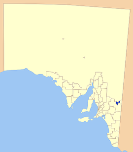
Location of the Berri Barmera Council in SAPopulation: 11,240(2009)[1] Established: 1996 Area: 508 km² (196.1 sq mi) Mayor: Peter Hunt LGAs around Berri Barmera Council: Outback Areas Outback Areas Outback Areas Loxton Waikerie Berri Barmera Council Renmark Paringa Loxton Waikerie Loxton Waikerie Loxton Waikerie Berri Barmera Council is a local government area in the Riverland region of South Australia.
The towns covered by the council area are Barmera, Berri, Cobdogla, Glossop, Loveday, Monash, Overland Corner and Winkie.
The District Council of Berri was declared in 1922, 11 years after the town was proclaimed. Its first major project was to provide reliable electricity to the entire area. It bought the Berri Electric Supply Company in 1936 to facilitate this, and later sold it to the Electricity Trust of South Australia, a state government agency.
The Cobdogla District Council was gazetted on 17 June 1924, and its name changed to District Council of Barmera in 1937. Barmera had been a soldier settlement community after World War I.
Berri and Barmera District Councils merged in 1996 as part of a rationalisation of local government areas.
References
- ^ Australian Bureau of Statistics (30 March 2010). "Regional Population Growth, Australia, 2008–09". http://www.abs.gov.au/ausstats/abs@.nsf/Latestproducts/3218.0Main%20Features72008-09?opendocument&tabname=Summary&prodno=3218.0&issue=2008-09&num=&view=. Retrieved 3 June 2010.
External links
Local Government Areas of South Australia Metropolitan Adelaide Adelaide · Adelaide Hills · Burnside · Campbelltown · Charles Sturt · Gawler · Holdfast Bay · Marion · Mitcham · Norwood Payneham & St Peters · Onkaparinga · Playford · Port Adelaide Enfield · Prospect · Salisbury · Tea Tree Gully · Unley · Walkerville · West TorrensEyre Peninsula Ceduna · Cleve · Elliston · Franklin Harbour · Kimba · Lower Eyre Peninsula · Port Augusta · Port Lincoln · Streaky Bay · Tumby Bay · Wudinna · WhyallaCentral Barossa · Barunga West · Clare and Gilbert Valleys · Copper Coast · Flinders Ranges · Goyder · Light · Mallala · Mount Remarkable · Northern Areas · Orroroo Carieton · Peterborough · Port Pirie · Wakefield · Yorke PeninsulaSouthern and Hills Murray Mallee Berri Barmera · The Coorong · Gerard · Karoonda East Murray · Loxton Waikerie · Mid Murray · Murray Bridge · Renmark Paringa · Southern MalleeSoutheast Outback Coordinates: 34°17′00″S 140°36′00″E / 34.2833333333°S 140.6°E
Categories:- Populated places established in 1996
- 1996 establishments in Australia
- Local Government Areas of South Australia
- Riverland

Wikimedia Foundation. 2010.