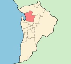
- City of Salisbury
-
City of Salisbury
South Australia
Population: 130,022(2009)[1] • Density: 700/km² (1,813.0/sq mi) Coordinates: 34°46′02″S 138°35′09″E / 34.7673°S 138.5857°ECoordinates: 34°46′02″S 138°35′09″E / 34.7673°S 138.5857°E Area: 158.1 km² (61.0 sq mi) Mayor: Gillian Aldridge Council Seat: Salisbury Region: Metropolitan Adelaide State District: Ramsay, Little Para, Wright, Florey, Playford, Taylor Federal Division: Makin, Port Adelaide, Wakefield 
LGAs around City of Salisbury: City of Playford City of Salisbury City of Tea Tree Gully City of Port Adelaide Enfield The City of Salisbury is a local government area (LGA) located on the northern fringes of Adelaide, South Australia. It has an estimated population of 130,022 people and encompasses an area of 158km². The council's main offices are situated in the Salisbury central business district.
Contents
Suburbs
- Bolivar - 5110
- Brahma Lodge - 5109
- Burton – 5110
- Cavan - 5094
- Direk - 5110
- Dry Creek - 5094
- Edinburgh - 5111
- Elizabeth Vale - 5112
- Globe Derby Park - 5110
- Green Fields – 5107
- Gulfview Heights - 5096
- Ingle Farm - 5098
- Mawson Lakes – 5095
- Para Hills - 5096
- Para Hills West - 5096
- Para Vista– 5093
- Parafield - 5106
- Parafield Gardens - 5107
- Paralowie - 5108
- Pooraka - 5095
- Salisbury - 5108
- Salisbury Downs - 5108
- Salisbury East - 5109
- Salisbury Heights - 5109
- Salisbury North - 5108
- Salisbury Park - 5109
- Salisbury Plain - 5109
- Salisbury South - 5106
- St Kilda - 5110
- Valley View - 5093
- Walkley Heights - 5098
- Waterloo Corner - 5110
See also
References
- ^ Australian Bureau of Statistics (30 March 2010). "Regional Population Growth, Australia, 2008–09". http://www.abs.gov.au/ausstats/abs@.nsf/Latestproducts/3218.0Main%20Features72008-09?opendocument&tabname=Summary&prodno=3218.0&issue=2008-09&num=&view=. Retrieved 4 June 2010.
External links
- City of Salisbury website
- City of Salisbury Official Page
- City of Salisbury on Twitter
- City of Salisbury community profile
- City of Salisbury Asset Management Information
Local Government Areas of South Australia Metropolitan Adelaide Adelaide · Adelaide Hills · Burnside · Campbelltown · Charles Sturt · Gawler · Holdfast Bay · Marion · Mitcham · Norwood Payneham & St Peters · Onkaparinga · Playford · Port Adelaide Enfield · Prospect · Salisbury · Tea Tree Gully · Unley · Walkerville · West TorrensEyre Peninsula Ceduna · Cleve · Elliston · Franklin Harbour · Kimba · Lower Eyre Peninsula · Port Augusta · Port Lincoln · Streaky Bay · Tumby Bay · Wudinna · WhyallaCentral Barossa · Barunga West · Clare and Gilbert Valleys · Copper Coast · Flinders Ranges · Goyder · Light · Mallala · Mount Remarkable · Northern Areas · Orroroo Carieton · Peterborough · Port Pirie · Wakefield · Yorke PeninsulaSouthern and Hills Murray Mallee Southeast Outback Categories:- Australia government stubs
- Adelaide geography stubs
- Local Government Areas in Adelaide
- Local Government Areas of South Australia
Wikimedia Foundation. 2010.
