- Wakefield Regional Council
-
Wakefield Regional Council
South Australia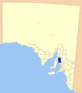
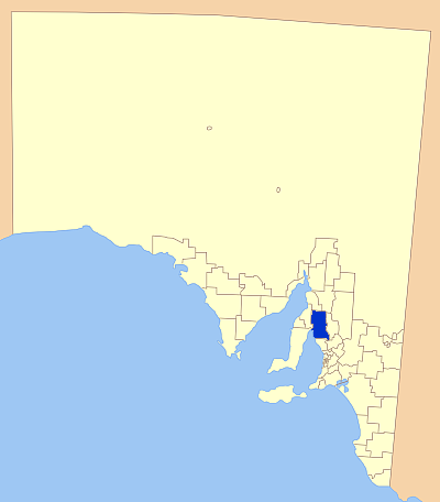
Location of Wakefield Regional CouncilPopulation: 6,756(2009)[1] Area: 3469.4 km² (1,339.5 sq mi) Mayor: James Maitland Council Seat: Balaklava Region: Mid North State District: Frome, Goyder Federal Division: Wakefield, Grey 
LGAs around Wakefield Regional Council: Barunga West Port Pirie Northern Areas Gulf St Vincent Wakefield Regional Council Clare and Gilbert Valleys Gulf St Vincent District Council of Mallala Light 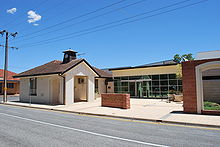 Offices in Balaklava
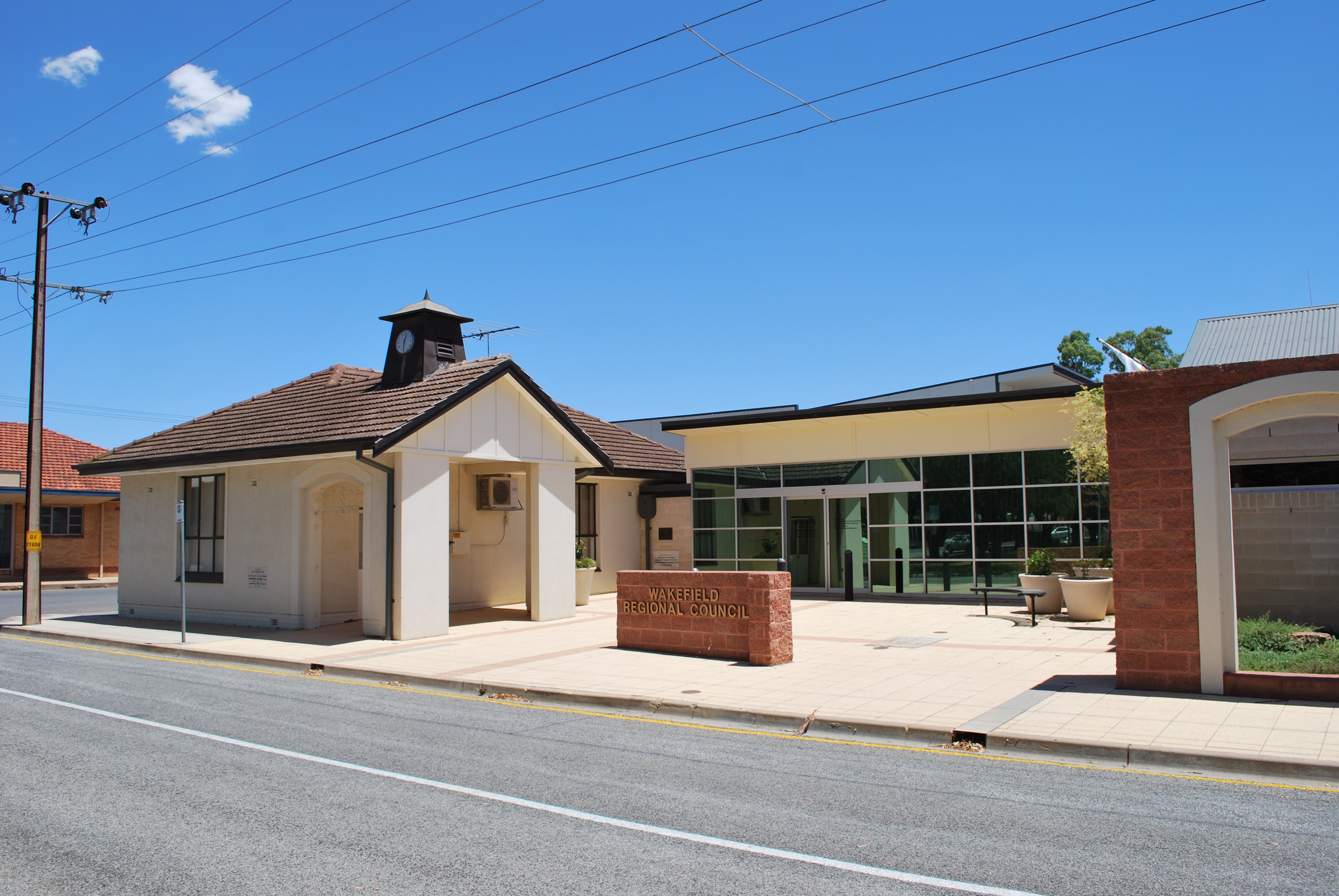
Wakefield Regional Council is a local government administrative body in South Australia.
Contents
Towns and communities
The Wakefield Regional Council includes the following townships located in the area:[2]
- Alma
- Avon
- Balaklava
- Barabba Hill
- Barunga
- Barunga Gap
- Beaufort
- Blyth
- Boucaut
- Bowillia
- Bowmans
- Brinkworth
- Bumbunga
- Burnsfield
- Cameron
- Condowie
- Condowie Plains
- Corcondo
- Dalkey
- Erith
- Everard
- Everard Central
- Goyder
- Halbury
- Hamley Bridge
- Hart
- Hope Gap
- Hoskins Corner
- Hoyleton
- Inkerman
- Kallora
- Kybunga
- Lakeview
- Lochiel
- Lorne
- Maro Creek
- Marola
- Mount Templeton
- Mundoora
- Nantawarra
- Owen
- Pinery
- Port Wakefield
- Proof Range
- Rochester
- Saints
- Salter Springs
- Snowtown
- Stockyard Creek
- Stow
- Watchman
- Whitwarta
- Wokurna
History
The body came into being on 1 July 1997, as a result of the amalgamation of the former District Councils of:
The amalgamation occurred when much of the boundary reform of the local government was coming from the State Government as a result of various provisions contained in the "Local Government Act 1934". As a result, the number of local councils in South Australia was reduced from 118 to 68 by the deadline of 30 June 1999. The extent of this reform was in-line with the Australian Federal Government's overall broader micro-economic reform plans.
The area falling under Wakefield Regional Council (WRC) has been much affected by local government boundary changes that have taken place since the early 1980s. Before 1983 the area consisted of five local government district councils which have now all been subsumed into the WRC.
The Council's development plans are set out in the Green Paper.
Geography
On the west side of Wakefield council area is the coastal fringe along the north east of Gulf St Vincent and the Hummocks and Barunga ranges. The area spans wide fertile plains to the north Mount Lofty Ranges on its eastern border. Immediately to the east of the Hummocks and Barunga ranges are a series are low-lying salt lakes, of which Lake Bumbunga is the largest.[3]
Transport
The regional area is well served by a developed transport and communication networks. The main roads, which include the Stuart Highway, are all sealed and there are well maintained minor gravel roads. There is no rail service for passengers in the council area, but it is traversed by the national Sydney-Perth line as well as by the state rail network.
Demographics
The population of Wakefield Regional Council is 6,756 (2009 estimate).[4]
The council recorded a net decrease in its population of 4.2% between 1991-2001, about 27 people per annum. In 2001, the median age of the population was 39, an increase of 5 years since 1991, indicating a trend towards an aging population.
The council's geographical area covers 3,469.4 square kilometres (1,339.5 sq mi) in which 2,695 kilometres (1,675 mi) of road existed at 30 June 2002. As at 1 July 2005, the total assessed value within the council area was $1,354,733,680 (capital value).
References
- ^ Australian Bureau of Statistics (30 March 2010). "Regional Population Growth, Australia, 2008–09". http://www.abs.gov.au/ausstats/abs@.nsf/Latestproducts/3218.0Main%20Features72008-09?opendocument&tabname=Summary&prodno=3218.0&issue=2008-09&num=&view=. Retrieved 4 June 2010.
- ^ "Wakefield Regional Council". http://www.lga.sa.gov.au/site/page.cfm?c=4197.
- ^ , Wakefield Regional Council, p. 4, http://www.wakefieldrc.sa.gov.au/webdata/resources/employmentOpportunity/200810EHOInformationKit.PDF, retrieved 14 July 2011
- ^ "National Regional Profile: Wakefield (DC) (Local Government Area)". National Regional Profiles. Australian Bureau of Statistics. 22 November 2010. http://www.abs.gov.au/ausstats/abs@nrp.nsf/Latestproducts/LGA48130Population/People12005-2009?opendocument&tabname=Summary&prodno=LGA48130&issue=2005-2009. Retrieved 26 September 2011.
External links
Local Government Areas of South Australia Metropolitan Adelaide Adelaide · Adelaide Hills · Burnside · Campbelltown · Charles Sturt · Gawler · Holdfast Bay · Marion · Mitcham · Norwood Payneham & St Peters · Onkaparinga · Playford · Port Adelaide Enfield · Prospect · Salisbury · Tea Tree Gully · Unley · Walkerville · West TorrensEyre Peninsula Ceduna · Cleve · Elliston · Franklin Harbour · Kimba · Lower Eyre Peninsula · Port Augusta · Port Lincoln · Streaky Bay · Tumby Bay · Wudinna · WhyallaCentral Barossa · Barunga West · Clare and Gilbert Valleys · Copper Coast · Flinders Ranges · Goyder · Light · Mallala · Mount Remarkable · Northern Areas · Orroroo Carieton · Peterborough · Port Pirie · Wakefield · Yorke PeninsulaSouthern and Hills Murray Mallee Southeast Outback Coordinates: 34°08′51″S 138°24′56″E / 34.1475°S 138.415555556°E
Categories:

Wikimedia Foundation. 2010.