- Mundoora, South Australia
-
Mundoora
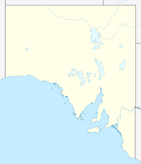
South AustraliaPopulation: 248 (2006 Census)[1] Postcode: 5555 LGA: Barunga West State District: Frome Federal Division: Grey Localities around Mundoora: Crystal Brook Port Broughton Mundoora Redhill Alford Bute Snowtown Location of Mundoora in South AustraliaMundoora is a settlement in South Australia.[2] In 1876, Mundoora was connected to Port Broughton by a horse drawn railway. This has since fallen into disuse.[citation needed] At the 2006 census, Mundoora had a population of 248.[1]
References
- ^ a b Australian Bureau of Statistics (25 October 2007). "Mundoora (State Suburb)". 2006 Census QuickStats. http://www.censusdata.abs.gov.au/ABSNavigation/prenav/LocationSearch?collection=Census&period=2006&areacode=SSC44331&producttype=QuickStats&breadcrumb=PL&action=401. Retrieved 11 October 2011.
- ^ "2905.0 - Statistical Geography: Volume 2 -- Census Geographic Areas, Australia, 2006". Australian Bureau of Statistics. http://www.abs.gov.au/AUSSTATS/abs@.nsf/Latestproducts/2905.0Appendix82006?opendocument&tabname=Notes&prodno=2905.0&issue=2006&num=&view=. Retrieved 8 December 2009.
Coordinates: 33°35′42″S 138°04′59″E / 33.595°S 138.083°E
Towns and localities of the District Council of Barunga West Alford · Barunga North · Bews · Brucefield · Bute · Clements Gap · Fishermans Bay · Kulpara · Melton · Mona · Mundoora · Ninnes · Nurrondi
Paskeville · Port Broughton · South Hummocks · Thomas Plains · Tickera · Wards Hills · Walliamulka · Wiltunga · WokurnaCategories:- Towns in South Australia
- South Australia geography stubs
Wikimedia Foundation. 2010.

