- Outback (region)
-
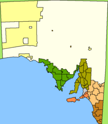

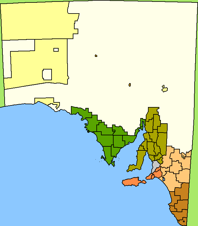
The Outback Region, as defined by the Local Government Association of South Australia[1], is one of seven regions of South Australia.
Contents
Geography
It is by far the largest region, with very nearly 80 percent of the land area of South Australia, but less than one percent of its population, making it simultaneously by far the least populated and the least densely populated of all seven regions. The region encompasses all areas north and west of the more densely populated southeasten part of the state, all the way to its northern border with the Northern Territory (26th parallel south) and to its western border with Western Australia (129th meridian east). It also borders with Queensland in the northeast, and with New South Wales in the east (141st meridian east).
The South Australian Outback Region has a population of 12,496 (as of census of 2006, on an area of 834,679.8, which makes for a population density of 0.015 per km². The largest town is the mining town Roxby Downs (pop. 4055). In total, there are some 60 settlements and communities, including aboriginal communities.
Four of the five aboriginal councils of South Australia fall within the geographical bounds of the Outback Region. They are listed with the Local Government Areas below. Only Gerard (Aboriginal Council) falls within Murray Mallee region, which is southeast of the Outback Region.
Largest towns
The largest towns of the Outback Region, with their 2006 census population figures:
Town Type Population
(Census 2006)founded Local Government Area Roxby Downs mining town 4055 1988 Roxby Downs Coober Pedy opal mining town 1916 1915 Coober Pedy Leigh Creek coal mining town 548 1888 Outback Areas Community Development Trust Andamooka opal mining town 528 1920s Outback Areas Community Development Trust Indulkana aboriginal community 339 Anangu Pitjantjatjara Yankunytjatjara Pukatja (Ernabella) aboriginal community 332 1938 Anangu Pitjantjatjara Yankunytjatjara Amata aboriginal community 319 1961 Anangu Pitjantjatjara Yankunytjatjara Mimili aboriginal community 303 1972 Anangu Pitjantjatjara Yankunytjatjara Woomera military facility 295 1947 Outback Areas Community Development Trust Oodnadatta cattle station 277 1890 Outback Areas Community Development Trust These ten largest towns encompass more than 70 percent of the Outback Region population.
Local Government Areas
On the local government level, the Outback Region is composed of seven units, with a wide range in area from 76 to 624,339 km²:
Local Government Area Type Major Town Land Area
(km²)Pop.
2006Density
km-2Towns Est. Roxby Downs Municipal Council Roxby Downs 110 4292 39,018 2 1982 Coober Pedy District Council Coober Pedy 77,8 1996 25,656 1 1987 Anangu Pitjantjatjara Yankunytjatjara Aboriginal Council Umuwa 102650 2204 0,021 18 1981 Maralinga Tjarutja 1) Aboriginal Council Oak Valley 102863,6 105 0,001 1 1984 Yalata Aboriginal Council Yalata 4563 100 0,022 1 1994 Nepabunna Aboriginal Council Nepabunna, South Australia 76,4 49 0,641 1 1998 Outback Areas Community Development Trust Unincorporated Area Leigh Creek 624339.0 3750 0,006 36 1978 Outback LGA Region Roxby Downs 834679,8 12496 0,015 60 1) including Mamungari Conservation Park and Emu Field, excluding Maralinga References
Categories:- Regions of South Australia
Wikimedia Foundation. 2010.