- Penong, South Australia
Infobox Australian Place | type = town
name = Penong
state = sa
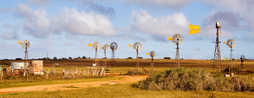
caption = Windmills around Penong
Photographed by [http://www.flickr.com/people/ccdoh1/ Cain Doherty]
lga =Outback Areas Community Development Trust
postcode = 5690
pop = 215
pop_footnotes=Census 2006 AUS|id=SSC44571 |name=Penong (State Suburb)|accessdate=2007-11-11|quick=on]
est = 1915
stategov = Flinders
fedgov = Grey
dist1 = 854
location1= Adelaide
dist2 = 73
location2= Ceduna
dist3 = 543
location3= Port AugustaPenong is a small
South Australia n town, located on theNullarbor Plain . Its location on theEyre Highway makes it a popular rest-stop for travellers.The area surrounding Penong was settled by Europeans in the 19th century, the town being established in 1915 with the arrival of the railway. It is characterised by many
windmill s, which pump water from the Anjutabie water basin.Penong is located close to
Lake McDonnell , which has rich reserves ofsalt andgypsum . The town is 20km north of Cactus Beach, a popularsurfing beach.References
* [http://www.nullarbornet.com.au/towns/penong.html Penong - Nullarbor Travel Guide Australia]
* [http://www.smh.com.au/news/South-Australia/Penong/2005/02/17/1108500204561.html Penong - South Australia - Australia - Travel - smh.com.au]
Wikimedia Foundation. 2010.