- Shire of Kaniva
Infobox Australian Place | type = lga
name = Shire of Kaniva
state = vic
region =Wimmera
area = 3082.11
est = 1891
seat = Kaniva
pop = 1,680 (1992) [cite book|title=Victorian Year Book|author=Australian Bureau of Statistics, Victoria Office|year=1994|page=49-52|id=ISSN 0067-1223]
logosize =
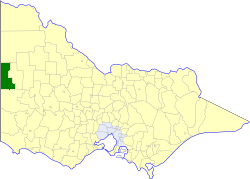
caption = Location in Victoria
county = Lowan, Weeah
near-nw = "Tatiara (SA)"
near-n = Walpeup
near-ne = Walpeup
near-w = "Tatiara (SA)"
near-e = Lowan
near-sw = "Naracoorte (SA)"
near-s = Kowree
near-se = Kowree
_noautocat = yesThe Shire of Kaniva was a Local Government Area located in the
Wimmera region of western Victoria,Australia , near theSouth Australia n town of Bordertown. The shire covered an area of convert|3082.11|km2|sqmi|1, and existed from 1891 until 1995.History
Kaniva was originally part of the
Shire of Wimmera when it incorporated in 1862, then became part of theShire of Lowan when it split away from Wimmera. The Shire of Lawloit was established in its own right out of the West Riding of Lowan on 29 May 1891. It was renamed Kaniva on 22 May 1939.cite book|title=Victorian Municipal Directory|year=1992|publisher=Arnall & Jackson|location=Brunswick|pages=710-711 Accessed atState Library of Victoria , La Trobe Reading Room.]On 20 January 1995, the Shire was abolished, and merged with most of Kowree and parts of Arapiles and Glenelg into the
Shire of West Wimmera . [cite book|url=http://www.ausstats.abs.gov.au/ausstats/free.nsf/0/76E601D6DB55E88ACA25722500049195/$File/12570_1994-95.pdf|title=Victorian local government amalgamations 1994-1995: Changes to the Australian Standard Geographical Classification|author=Australian Bureau of Statistics |date=1 August 1995|publisher=Commonwealth of Australia|page=12|isbn=0-642-23117-6|accessdate=2008-01-05]Wards
Kaniva was divided into three ridings, each of which elected three councillors:
* East Riding
* North Riding
* West RidingTowns and Localities
* Kaniva
* Dinyarrak
* Lawloit
* Leeor
* Lillimur
* Miram
* Sandsmere
* Serviceton
* Telopea Downs
* Yanipy
* Yarrock
* YearingaPopulation
* Estimates in 1958, 1983 and 1988 Victorian Year Books.
References
Wikimedia Foundation. 2010.