- Shire of Kowree
Infobox Australian Place | type = lga
name = Shire of Kowree
state = vic
region =
area = 5379.41
est = 1862
seat = Edenhope
pop = 3,710 (1992) [cite book|title=Victorian Year Book|author=Australian Bureau of Statistics, Victoria Office|year=1994|page=49-52|id=ISSN 0067-1223]
logosize =
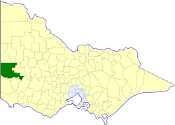
caption = Location in Victoria
county = Lowan
near-nw = "Tatiara (SA)"
near-n = Kaniva
near-ne = Lowan
near-w = "Naracoorte (SA)"
near-e = Arapiles
near-sw = "Naracoorte (SA)"
near-s = Glenelg Wannon
near-se = Dundas
_noautocat = yesThe Shire of Kowree was a Local Government Area located in western Victoria,
Australia . The shire covered an area of convert|5379.41|km2|sqmi|1, and existed from 1862 until 1995.History
Kowree was first incorporated as a district on 24 June 1862, and became a shire on 26 January 1872. It added the South Riding of the
Shire of Lowan to its North Riding on 29 May 1894.cite book|title=Victorian Municipal Directory|year=1992|publisher=Arnall & Jackson|location=Brunswick|pages=730-731 Accessed atState Library of Victoria , La Trobe Reading Room.]On 20 January 1995, the Shire was abolished, and merged with
Shire of Kaniva and parts of Arapiles and Glenelg into theShire of West Wimmera . The Black Range and Toolondo Reservoir districts joined theRural City of Horsham , while a small unpopulated section joined theShire of Southern Grampians . [cite book|url=http://www.ausstats.abs.gov.au/ausstats/free.nsf/0/76E601D6DB55E88ACA25722500049195/$File/12570_1994-95.pdf|title=Victorian local government amalgamations 1994-1995: Changes to the Australian Standard Geographical Classification|author=Australian Bureau of Statistics |date=1 August 1995|publisher=Commonwealth of Australia|page=7, 11, 12|isbn=0-642-23117-6|accessdate=2008-01-05]Wards
Kowree was divided into four ridings , each of which elected three councillors:
* Central Riding
* East Riding
* North Riding
* West RidingTowns and Localities
* Edenhope
* Apsley
* Bringalbert
* Douglas
* Goroke
* Gymbowen
* Harrow
* Minimay
* Rocklands
* Toolondo
* WombelanoPopulation
* Estimates in 1958, 1983 and 1988 Victorian Year Books.
References
Wikimedia Foundation. 2010.