- Shire of Lowan
Infobox Australian Place | type = lga
name = Shire of Lowan
state = vic
region =Wimmera
area = 2861
est = 1875
seat = Nhill
pop = 2,940 (1992) [cite book|title=Victorian Year Book|author=Australian Bureau of Statistics, Victoria Office|year=1994|page=49-52|id=ISSN 0067-1223]
logosize =
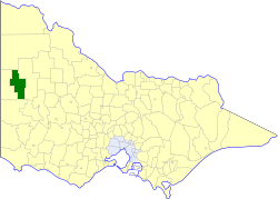
caption = Location in Victoria
county = Lowan, Weeah
near-nw = Walpeup
near-n = Walpeup
near-ne = Dimboola
near-w = Kaniva
near-e = Dimboola
near-sw = Kowree
near-s = Kowree
near-se = Arapiles
_noautocat = yesThe Shire of Lowan was a Local Government Area located in the
Wimmera region of western Victoria,Australia . The shire covered an area of convert|2861|km2|sqmi|1, and existed from 1875 until 1995.History
Lowan was originally part of the
Shire of Wimmera which incorporated in 1862. On 31 December 1875, Lowan became a shire in its own right. Several parts of it split away in its first 20 years—Dimboola on 2 April 1885, the West Riding as Kaniva (Lawloit) on 29 May 1891 and the South Riding as Kowree on 29 May 1894. Like many western shires, it lost a remote section to its north whenShire of Walpeup was created on 1 November 1911.cite book|title=Victorian Municipal Directory|year=1992|publisher=Arnall & Jackson|location=Brunswick|pages=744-745 Accessed atState Library of Victoria , La Trobe Reading Room.]On 20 January 1995, the Shire was abolished, and merged with the
Shire of Dimboola into theShire of Hindmarsh . [cite book|url=http://www.ausstats.abs.gov.au/ausstats/free.nsf/0/76E601D6DB55E88ACA25722500049195/$File/12570_1994-95.pdf|title=Victorian local government amalgamations 1994-1995: Changes to the Australian Standard Geographical Classification|author=Australian Bureau of Statistics |date=1 August 1995|publisher=Commonwealth of Australia|page=7|isbn=0-642-23117-6|accessdate=2008-01-05]Wards
Lowan was divided into four ridings on 31 May 1901, each of which elected three councillors:
* East Riding
* West Riding
* South Riding
* Southwest RidingTowns and Localities
* Nhill
* Yannac
* Baker
* Balrootan North
* Boyeo
* Broughton
* Kinimakatka
* Netherby
* Propodollah
* Tarraginnie
* Waggon Flat
* WiniamPopulation
* Estimates in 1958, 1983 and 1988 Victorian Year Books.
References
Wikimedia Foundation. 2010.