- Cowangie, Victoria
-
Cowangie
Victoria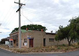
The post office at Cowangie, now closed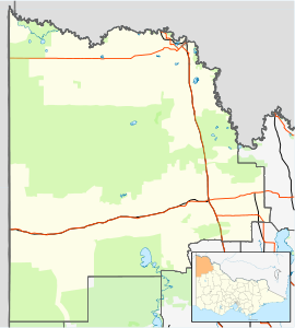
 Cowangie
Postcode: 3506 Coordinates: 35°13′19″S 141°23′45″E / 35.22194°S 141.39583°ECoordinates: 35°13′19″S 141°23′45″E / 35.22194°S 141.39583°E Elevation: 94 m (308 ft) Location: LGA: Rural City of Mildura State District: Mildura Federal Division: Mallee Cowangie (pronounced /kaʊˈændʒi/) is a locality situated on the section of the Mallee Highway between Ouyen and the South Australian border in the Sunraysia region of Victoria, Australia. The place by road, is situated about 12 kilometres southeast from Tutye and 12 kilometres northwest from Danyo.
The Post Office opened on 15 July 1912 when a regular mail service was provided by the opening of the railway from Ouyen to Murrayville a month earlier. Known as Kow Plains until 1913, the office closed in 1994.[2]
The area of the locality contains a number of smaller areas namely Pallarang which had a post office open from 1915 until 1917, Daalko with an office open from 1928 until 1930, Bunurouk, Bunurouk West with an office in 1915 and 1916, Cowangie North and Koonoa.[2]
Former Formula One and V8 Supercar driver Larry Perkins was born in Cowangie.[3]
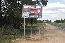 Sign proclaiming Cowangie to be the "Hometown of Larry Perkins"
References
- ^ Travelmate
- ^ a b Premier Postal History, Post Office List, https://www.premierpostal.com/cgi-bin/wsProd.sh/Viewpocdwrapper.p?SortBy=VIC&country=, retrieved 2008-04-11
- ^ Cowangie in the mallee (Victoria) Retrieved from www.murrayriver.com.au on 30 January 2011
Towns in the Rural City of Mildura Big Desert • Birdwoodton • Boinka • Cabarita • Cardross • Carina • Carwarp • Colignan • Cowangie • Cullulleraine • Hattah • Iraak • Irymple • Koorlong • Kulwin • Lindsay Point • Linga • Merbein • Merbein South • Merbein West • Meringur • Merrinee • Mildura • Mittyack • Murrayville • Nangiloc • Neds Corner • Nichols Point • Ouyen • Panitya • Patchewollock • Red Cliffs • Tempy • Torrita • Tutye • Underbool • Walpeup • Wargan • Werrimull • Yelta •

This article about a location in the Mallee is a stub. You can help Wikipedia by expanding it.


