- Murrayville, Victoria
-
Murrayville
Victoria
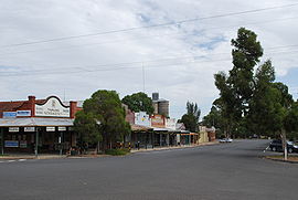
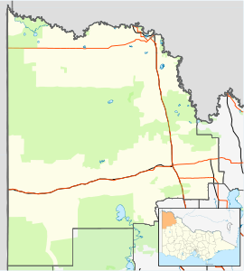
Reed St, in MurrayvillePopulation: 444(2006)[1] Postcode: 3512 Coordinates: 35°15′44″S 141°11′0″E / 35.26222°S 141.183333°ECoordinates: 35°15′44″S 141°11′0″E / 35.26222°S 141.183333°E Elevation: 94 m (308 ft) Location: LGA: Rural City of Mildura Region: Sunraysia State District: Mildura Federal Division: Mallee Murrayville is a town on the section of the Mallee Highway between Ouyen and the South Australian border. It is about 24 kilometres (15 mi) east of the South Australian border and 536 kilometres (333 mi) north west of the state capital Melbourne, but 268 kilometres (167 mi) east of Adelaide. At the 2006 census, Murrayville had a population of 444.
The Post Office opened on November 1, 1910.[3]
The area of the locality contains a number of smaller areas namely Duddo which had a post office open from 1913 until 1918, Duddo Wells with a post office from 1914 until 1950, Danyo with a post office from 1912 (when the railway arrived) until 1975, and Goongee.[3]
The town's main industry is cereal crops, sheep and cattle, other industries are potato farming and other small crops. Irrigation is only supplied to the potato farms by an underground basin of high quality water.
The town runs a dramatic society that has been running for 46 years straight.[citation needed]
Golfers play at the course of the Murrayville Golf Club.[4]
During Easter, 2010 Murrayville celebrated their Centenary. Visitors from all over Australia attended with 1300 dinner meals delivered on the Saturday night and 900 for the Sunday evening meal. Included in the attractions was a collection of antique farm machinery, a display of old cars, an animal nursery, a bucking bull and a dual carriage small motorised train.
References
- ^ Australian Bureau of Statistics (25 October 2007). "Murrayville (State Suburb)". 2006 Census QuickStats. http://www.censusdata.abs.gov.au/ABSNavigation/prenav/LocationSearch?collection=Census&period=2006&areacode=SSC26257&producttype=QuickStats&breadcrumb=PL&action=401. Retrieved 2007-10-01.
- ^ Travelmate
- ^ a b Premier Postal History, Post Office List, https://www.premierpostal.com/cgi-bin/wsProd.sh/Viewpocdwrapper.p?SortBy=VIC&country=, retrieved 2008-04-11
- ^ Golf Select, Murrayville, http://www.golfselect.com.au/armchair/courseView.aspx?course_id=1044, retrieved 2009-05-11
Towns in the Rural City of Mildura Big Desert • Birdwoodton • Boinka • Cabarita • Cardross • Carina • Carwarp • Colignan • Cowangie • Cullulleraine • Hattah • Iraak • Irymple • Koorlong • Kulwin • Lindsay Point • Linga • Merbein • Merbein South • Merbein West • Meringur • Merrinee • Mildura • Mittyack • Murrayville • Nangiloc • Neds Corner • Nichols Point • Ouyen • Panitya • Patchewollock • Red Cliffs • Tempy • Torrita • Tutye • Underbool • Walpeup • Wargan • Werrimull • Yelta •

This article about a location in the Mallee is a stub. You can help Wikipedia by expanding it.


