- Shire of Mildura
Infobox Australian Place | type = lga
name = Shire of Mildura
state = vic
region =
area = 10145
est = 1890
seat = Irymple
pop = 21230 (1992) [cite book|title=Victorian Year Book|author=Australian Bureau of Statistics, Victoria Office|year=1994|page=49-52|id=ISSN 0067-1223]
logosize =
caption = Location in Victoria
county = Karkarooc, Millewa
near-nw = "Paringa (SA)"
near-n = "Wentworth (NSW)"
near-ne = "Wentworth (NSW)"
near-w = "Loxton (SA)"
near-e = "Wentworth (NSW)"
near-sw = "Loxton (SA)"
near-s = Walpeup
near-se = Swan Hill
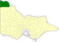
_noautocat = yesThe Shire of Mildura was a Local Government Area located at the northwestern corner pf Victoria,
Australia , on theMurray River and theSouth Australia n border. The shire covered an area of convert|10145|km2|sqmi|1, and existed from 1890 until 1994. From 1920 onwards, Mildura itself was managed by a separate entity, ultimately known as theCity of Mildura . After a large-scale statewide amalgamation program by the Victorian Government in 1994–1995, they were reunited under theRural City of Mildura .History
Mildura was originally part of the Swan Hill District, which initially covered most of northwestern Victoria. Swan Hill was incorporated on 8 July 1862, and became a shire on 14 August 1871. On 10 January 1890 the Shire of Mildura was incorporated from part of the Lower Murray Riding.cite book|title=Victorian Municipal Directory|year=1992|publisher=Arnall & Jackson|location=Brunswick|pages=761-762 Accessed at
State Library of Victoria , La Trobe Reading Room.]A new shire, Walpeup, was formed in western Victoria on 1 October 1911, taking in some southern areas of Mildura and sections of five other shires. A small part of the Shire in and near Mildura severed on 18 May 1920 and incorporated as a borough, which became the
City of Mildura on 21 March 1934. Parts of the Sandilong and Lake Ridings were annexed to the City on 1 October 1971.On 20 January 1995, the Shire was abolished, and merged with the
City of Mildura andShire of Walpeup into theRural City of Mildura . [cite book|url=http://www.ausstats.abs.gov.au/ausstats/free.nsf/0/76E601D6DB55E88ACA25722500049195/$File/12570_1994-95.pdf|title=Victorian local government amalgamations 1994-1995: Changes to the Australian Standard Geographical Classification|author=Australian Bureau of Statistics |date=1 August 1995|publisher=Commonwealth of Australia|page=9|isbn=0-642-23117-6|accessdate=2008-01-05]Wards
Mildura was divided into three ridings, each of which elected three councillors:
* Koorlong Riding
* Lake Riding
* Sandilong RidingTowns and Localities
Population
* Estimate in the 1958 Victorian Year Book.
References
Wikimedia Foundation. 2010.