Wentworth Shire Council

Wentworth Shire Council

Infobox Australian Place | type = lga
name = Wentworth Shire
state = nsw


caption =
pop = 7,236
density = 0.28
area = 26269
est =
seat = Wentworth (26 - 28 Adelaide Street)
mayor = Margaret Thomson
region = Far West

url = http://www.wentworth.nsw.gov.au/
stategov = Murray-Darling
fedgov = Farrer
near-nw = OACDT (SA)
near-n = Unincorporated Far West
near-ne = Central Darling
near-e = Balranald
near-w = OACDT (SA)
near-sw = Renmark Paringa (SA)
near-s = Mildura (Vic)
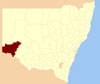
near-se = Mildura (Vic)

Wentworth Shire is a Local Government Area in the far south west of New South Wales, Australia, just over the river from Mildura, on the Victorian side. Its major roads are the Sturt and the Silver City Highways. The Shire includes the towns of Wentworth, Gol Gol, Dareton and Pooncarie.

Solar Tower Buronga

Buronga, in Wentworth Shire, is the proposed site of the world's first full scale solar updraft tower. The status of the project is uncertain.

External links

* [http://www.wentworth.nsw.gov.au/ Wentworth Shire Council home page]


Wikimedia Foundation. 2010.

Игры ⚽ Нужно решить контрольную?

Look at other dictionaries:

  • Wentworth Shire — Shire of Wentworth Lage des Wentworth Shire in New South Wales Gliederung …   Deutsch Wikipedia

  • Central Darling Shire Council — Infobox Australian Place | type = lga name = Central Darling Shire Council state = nsw caption = Location in New South Wales pop = 2,418 density = 0.05 area = 53511 est = seat = Wilcannia (21 Reid Street) mayor = Raymond Longfellow region = Far… …   Wikipedia

  • Balranald Shire Council — Infobox Australian Place | type = lga name = Balranald Shire state = nsw caption = location in NSW pop = 2,755 density = 0.13 area = 21699 est = seat = Balranald (70 Market Street) mayor = Alan Purtill region = Murray url =… …   Wikipedia

  • Wentworth, New South Wales — Infobox Australian Place | type = town name = Wentworth state = nsw caption = Darling Street, Wentworth lga = Wentworth Shire postcode = 2648 est = pop = 1303 (2006)Census 2006 AUS | id = UCL182600 | name = Wentworth (Urban Centre/Locality) |… …   Wikipedia

  • Wentworth (Australie) — Pour les articles homonymes, voir Wentworth. 34° 06′ 19″ S 141° 54′ 58″ E / …   Wikipédia en Français

  • Wakool Shire — Shire of Wakool New South Wales Location in New South Wales Population: 4,427(2009) …   Wikipedia

  • Wentworth — I. /ˈwɛntwɜθ/ (say wentwerth) noun 1. D Arcy, 1762?–1827, Australian pioneer surgeon and magistrate, born in Ireland. 2. William Charles, 1790–1872, son of D Arcy Wentworth, Australian explorer and politician; active in gaining self government… …  

  • Muswellbrook Shire — New South Wales Location in New South Wales Population …   Wikipedia

  • Conargo Shire — New South Wales Location in New South Wales Population: 1,700(2009) …   Wikipedia

  • Cowra Shire — New South Wales Location in NSW Population: 12,945(2009) …   Wikipedia

Share the article and excerpts

Direct link
Do a right-click on the link above
and select “Copy Link”