- Shire of Wycheproof
Infobox Australian Place | type = lga
name = Shire of Wycheproof
state = vic
region =
area = 4110.3
est = 1894
seat = Wycheproof
pop = 3130 (1992) [cite book|title=Victorian Year Book|author=Australian Bureau of Statistics, Victoria Office|year=1994|page=51|id=ISSN 0067-1223]
logosize =
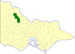
caption = Location in Victoria
county = Borung, Tatchera, Karkarooc, Kara Kara
near-nw = Walpeup
near-n = Swan Hill
near-ne = Swan Hill
near-w = Karkarooc
near-e = Kerang
near-sw = Birchip
near-s = Donald
near-se = Charlton
_noautocat = yesThe Shire of Wycheproof was a Local Government Area located about convert|130|km|mi|0 northwest of Bendigo in northwestern Victoria,
Australia . The shire covered an area of convert|4110.3|km2|sqmi|1, and existed from 1894 until 1995.History
Wycheproof was originally part of the St Arnaud district which was incorporated in 1861 and became a Shire in 1864. On 27 April 1894, the North Riding of the Shire was severed and proclaimed as the Shire of Wycheproof. Over the years several boundary changes occurred:cite book|title=Victorian Municipal Directory|year=1992|publisher=Arnall & Jackson|location=Brunswick|pages=900-901 Accessed at
State Library of Victoria , La Trobe Reading Room.]* 31 May 1897 - Part of the Shire of Castle Donnington was annexed as the Tyrrell Riding.
* 28 April 1898 - Part of theShire of Donald was annexed to the South Riding.
* 31 May 1906 - Wycheproof lost part of its Tyrrell Riding to theShire of Karkarooc .
* 21 December 1936 - Part of theShire of Swan Hill annexed as part of the Tyrrell Riding
* 10 May 1949 - Wycheproof lost part of its Central Riding to theShire of Birchip .On 20 January 1995, the Shire was abolished, and merged with the Shires of Birchip, Charlton, Donald and part of Kara Kara into the
Shire of Buloke . [cite book|url=http://www.ausstats.abs.gov.au/ausstats/free.nsf/0/76E601D6DB55E88ACA25722500049195/$File/12570_1994-95.pdf|title=Victorian local government amalgamations 1994-1995: Changes to the Australian Standard Geographical Classification|author=Australian Bureau of Statistics |date=1 August 1995|publisher=Commonwealth of Australia|page=5|isbn=0-642-23117-6|accessdate=2008-01-05]Wards
Wycheproof was divided into four ridings, each of which elected three councillors, except for Bunguluke which elected two councillors.
* Bunguluke Riding
* Myall Riding
* Thalia Riding
* Tyrrell RidingTowns and Localities
Population
* Estimate in the 1958 Victorian Year Book.
References
Wikimedia Foundation. 2010.