- Shire of Cohuna
Infobox Australian Place | type = lga
name = Shire of Cohuna
state = vic
region =
area = 494.69
est = 1922
seat = Cohuna
pop = 4630 (1992) [cite book|title=Victorian Year Book|author=Australian Bureau of Statistics, Victoria Office|year=1994|page=52|id=ISSN 0067-1223]
logosize =
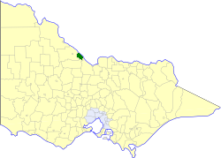
caption = Location in Victoria
county = Gunbower
near-nw = Kerang
near-n = "Wakool (NSW)"
near-ne = "Wakool (NSW)"
near-w = Kerang
near-e = "Murray (NSW)"
near-sw = Gordon
near-s = Gordon
near-se = Rochester
_noautocat = yesThe Shire of Cohuna was a Local Government Area located on the
Murray River about convert|265|km|mi|0 north-northwest ofMelbourne , the state capital of Victoria,Australia . The shire covered an area of convert|494.69|km2|sqmi|1, and existed from 1922 until 1994.History
Cohuna was originally part of the Swan Hill District, which initially covered most of northwestern Victoria. Swan Hill was incorporated on 8 July 1862, and became a shire on 14 August 1871. It was renamed
Shire of Kerang on 31 December 1898.On 8 March 1922, parts of the North East and South East Ridings severed and incorporated as the Shire of Cohuna.cite book|title=Victorian Municipal Directory|year=1992|publisher=Arnall & Jackson|location=Brunswick|pages=631-632, 718-720 Accessed at
State Library of Victoria , La Trobe Reading Room.]On 20 January 1995, the Shire was abolished, and merged with the Borough and
Shire of Kerang into theShire of Gannawarra . [cite book|url=http://www.ausstats.abs.gov.au/ausstats/free.nsf/0/76E601D6DB55E88ACA25722500049195/$File/12570_1994-95.pdf|title=Victorian local government amalgamations 1994-1995: Changes to the Australian Standard Geographical Classification|author=Australian Bureau of Statistics |date=1 August 1995|publisher=Commonwealth of Australia|page=|isbn=0-642-23117-6|accessdate=2008-01-05]Wards
Cohuna was divided into three wards, each of which elected three councillors:
* Central Ward
* East Ward
* West WardTowns and Localities
* Cohuna
* Gannawarra
* Gunbower
* Leitchville
* Mead
* McMillansPopulation
* Estimate in the 1958 Victorian Year Book.
References
Wikimedia Foundation. 2010.