Shire of Loddon

Shire of Loddon

Infobox Australian Place | type = lga
name = Shire of Loddon
state = vic


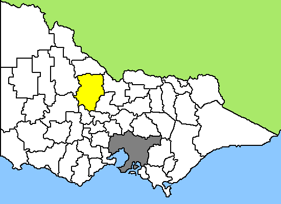
caption = Location in Victoria
pop = 7,836 (2006 Census)
area = 6694
est =
seat = Wedderburn
mayor = Christine Brooke
region =

url = http://www.loddon.vic.gov.au/
stategov = Swan Hill
fedgov = Murray, Bendigo
near-nw = Gannawarra
near-n = Gannawarra
near-ne = Campaspe
near-w = Buloke
near-e = Greater Bendigo
near-sw = Northern Grampians
near-s = Central Goldfields
near-se = Mount Alexander
The Shire of Loddon is a Local Government Area in Victoria, Australia. It is located in the north-western part of the state. It includes the towns of Boort, Pyramid Hill and Wedderburn. It has an area of 6,701 square kilometres. In 2006 it had a population of 7,836. It was formed in 1995 from the merger of the Shire of East Loddon, Shire of Gordon, Shire of Korong, and parts of the City of Greater Bendigo, Shire of Bet Bet, Shire of Maldon and Shire of Tullaroop.

Loddon is located 175 km north west of Melbourne and covers an area of approximately 6700 square kilometres making it the eighth largest municipality in area in Victoria.

External links

* [http://www.loddon.vic.gov.au/ Loddon Shire Council official website]


Wikimedia Foundation. 2010.

Игры ⚽ Поможем сделать НИР

Look at other dictionaries:

  • Shire of Loddon — Loddon Shire Lage des Loddon Shire in Victoria Basisdaten Bundesstaat: Victoria Hauptort: Wedderburn Fläche: 6.700 …   Deutsch Wikipedia

  • Shire of East Loddon — Infobox Australian Place | type = lga name = Shire of East Loddon state = vic region = area = 1200.18 est = 1864 seat = Serpentine pop = 1320 (1992) [cite book|title=Victorian Year Book|author=Australian Bureau of Statistics, Victoria Office|year …   Wikipedia

  • Shire of Gordon — Infobox Australian Place | type = lga name = Shire of Gordon state = vic region = area = 2028 est = 1885 seat = Boort pop = 2720 (1992) [cite book|title=Victorian Year Book|author=Australian Bureau of Statistics, Victoria… …   Wikipedia

  • Shire of Korong — Infobox Australian Place | type = lga name = Shire of Korong state = vic region = area = 238.5 est = 1862 seat = Wedderburn pop = 3480 (1992) [cite book|title=Victorian Year Book|author=Australian Bureau of Statistics, Victoria… …   Wikipedia

  • Shire of Tullaroop — Infobox Australian Place | type = lga name = Shire of Tullaroop state = vic region = area = 637.63 est = 1861 seat = Maryborough pop = 2780 (1992) [cite book|title=Victorian Year Book|author=Australian Bureau of Statistics, Victoria… …   Wikipedia

  • Shire of Bet Bet — Infobox Australian Place | type = lga name = Shire of Bet Bet state = vic region = area = 928.2 est = 1861 seat = Dunolly pop = 2120 (1992) [cite book|title=Victorian Year Book|author=Australian Bureau of Statistics, Victoria… …   Wikipedia

  • Loddon Shire — Lage des Loddon Shire in Victoria Gliederung …   Deutsch Wikipedia

  • Shire of Mount Alexander — Victoria Location in Victoria …   Wikipedia

  • Shire of Cardinia — Lage von Cardinia Shire in Melbourne Basisdaten Bundesstaat: Victoria Hauptort: Pakenham Fläche: 1.280 …   Deutsch Wikipedia

  • Shire of East Gippsland — Lage des East Gippsland Shire in Victoria Basisdaten Bundesstaat: Victoria Hauptort: Bairnsdale Fläche …   Deutsch Wikipedia

Share the article and excerpts

Direct link
Do a right-click on the link above
and select “Copy Link”