- Shire of East Loddon
Infobox Australian Place | type = lga
name = Shire of East Loddon
state = vic
region =
area = 1200.18
est = 1864
seat = Serpentine
pop = 1320 (1992) [cite book|title=Victorian Year Book|author=Australian Bureau of Statistics, Victoria Office|year=1994|page=49-52|id=ISSN 0067-1223]
logosize =
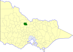
caption = Location in Victoria
county = Bendigo
near-nw = Gordon
near-n = Gordon
near-ne = Rochester
near-w = Korong
near-e = Rochester
near-sw = Korong
near-s = Marong
near-se = Huntly
_noautocat = yesThe Shire of East Loddon was a Local Government Area located about convert|50|km|mi|0 northwest of Bendigo in northwestern Victoria,
Australia . The shire covered an area of convert|1200.18|km2|sqmi|1, and existed from 1864 until 1995.History
East Loddon was first incorporated as a district on 28 December 1864, and became a shire on 28 July 1871.cite book|title=Victorian Municipal Directory|year=1992|publisher=Arnall & Jackson|location=Brunswick|pages=664-666 Accessed at
State Library of Victoria , La Trobe Reading Room.]On 20 January 1995, the Shire was abolished, and merged with the Shires of Gordon and Korong, the Loddon River district of the
Rural City of Marong and surrounding districts into theShire of Loddon . [cite book|url=http://www.ausstats.abs.gov.au/ausstats/free.nsf/0/76E601D6DB55E88ACA25722500049195/$File/12570_1994-95.pdf|title=Victorian local government amalgamations 1994-1995: Changes to the Australian Standard Geographical Classification|author=Australian Bureau of Statistics |date=1 August 1995|publisher=Commonwealth of Australia|page=8|isbn=0-642-23117-6|accessdate=2008-01-05]Wards
East Loddon was divided into three ridings on 14 May 1913, each of which elected three councillors:
* North Riding
* South Riding
* East RidingTowns and Localities
* Serpentine
* Bear's Lagoon
* Calivil
* Dingee
* Jarklin
* Kamarooka
* Mitiamo
* Pompapiel
* Prairie
* Tandarra
* YallookPopulation
* Estimate in the 1958 Victorian Year Book.
References
Wikimedia Foundation. 2010.