- Mount Baw Baw
-
Mount Baw Baw 
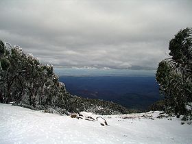
The view south across Gippsland from Mount Baw BawElevation 1,567 m (5,141 ft) AHD Location Location Victoria, Australia Range Baw Baw Plateau Coordinates 37°50′S 146°16′E / 37.833°S 146.267°ECoordinates: 37°50′S 146°16′E / 37.833°S 146.267°E Climbing Easiest route Hike/ski Mount Baw Baw is a mountain in Victoria, Australia. Mount Baw Baw Alpine Resort is an Unincorporated area of Victoria surrounded by the Shire of Baw Baw.
Contents
Location
Mount Baw Baw is about 120 km east of Melbourne and 50 km north of the Latrobe Valley. The mountain itself is one of several peaks on the Baw Baw Plateau, a long plateau tending north-east. Other peaks on the plateau include Mount Whitelaw, Mount St. Phillack (the highest), Mount Mueller, Mount Tyers, Mount Kernot and Mount Saint Gwinear. The plateau itself is isolated from most of Victoria's high country by the Thomson and Aberfeldy Rivers and tributaries of the La Trobe River, including the Tanjil and Tyers Rivers to the south.
The Baw Baw massif consists of a late Devonian granodiorite pluton. There is relatively little relief on the plateau itself, the highest point (Mount St. Phillack) reaching 1,567 metres. The lower slopes of the plateau are covered in montane eucalypt forest and tall forest, and creek valleys have cool temperate rainforest of myrtle beech, Nothofagus cunninghamii. Above 1,200 metres snow gum woodland occur, grading into subalpine grasslands and shrublands above 1,300 metres. Much of this subalpine zone is included in the 133 km² Baw Baw National Park. The Baw Baw Village ski resort is technically outside the National Park.
The climate of the plateau itself is subalpine, with an average annual precipitation of 1,900 mm. Snow covers the plateau from June to September.
It is thought that Baron Ferdinand von Mueller made the first recorded European ascent of Baw Baw in 1860, naming Christmas Creek on one of his major collecting expeditions. It was on this trip that he collected the Baw Baw Berry, Wittsteinia vacciniacea.
Mount Baw Baw is home to the critically endangered Baw Baw frog.
Ski resort
There is a small ski resort of the same name on this mountain. There are about 30 hectares of mainly beginner - intermediate ski runs. There are six ski runs and two chair lifts that service the mountain, with the highest going almost to the top of Mount Baw Baw. The resort village is at the bottom of the lifts, offering ski in - ski out access. The downhill runs are accompanied by a greater distance of cross country trails offering access to other parts of the Baw Baw plateau. Like most lower lying Australian ski resorts, the snow cover can often be variable from year to year. A reliable snow cover is regularly available for the ski season locally from about July to the end of September. A list of every ski tow to operate at Baw Baw can be found at wikiski.
Cycling
The access road to the resort, the Mount Baw Baw tourist road, features what is usually regarded as the toughest climb accessible by road bicycles in Australia. The final climb of 6.2 kilometres rises 718 metres at an average grade of 11.5%, maxing out at 20.3%. The climb is not as long as, but considerably steeper than any of the Hors Categorie climbs featured in the Tour de France. The Mount Baw Baw Classic [1], which began in 2001, is an annual cycling race held by the Warragul Cycling Club [2], which ends at the Mount Baw Baw village.
Downhill Mountain Biking
There is a purpose built downhill track located on the south western side of the mountain, facing towards the sea. The course has hosted the Victorian Downhill Championships as well as a number of state rounds.
The track is around 3 and a half minutes duration, comprising a good mix of cambered dirt, rocks, fire road and technical sections.
The Mount Baw Baw tourist road provides excellent shuttle service capability, and the venue is very mountain bike friendly.
See also
- Skiing in Australia
References
Australian skifields NSW Perisher (Perisher Valley, Blue Cow, Guthega, Smiggin Holes) - Charlotte Pass - Thredbo - Selwyn Snowfields - CabramurraVictoria Mount Buller - Mount Baw Baw - Falls Creek - Mount Hotham - Dinner Plain - Lake Mountain (XC) - Mount Saint Gwinear (XC) - Mount Stirling (XC)Tasmania Former skifields Local Government Areas of Victoria Greater Melbourne Inner MelbourneMetropolitanBanyule · Bayside · Boroondara · Darebin · Glen Eira · Hobsons Bay · Kingston · Maribyrnong · Maroondah · Monash · Moonee Valley · Moreland · WhitehorseOuter MetropolitanBrimbank · Cardinia · Casey · Frankston · Greater Dandenong · Hume · Knox · Manningham · Melton · Mornington Peninsula · Nillumbik · Whittlesea · Wyndham · Yarra RangesSouthwest Central Highlands and Goldfields Goulburn Valley Northeast Gippsland Bass Coast · Baw Baw · East Gippsland · Elizabeth Island · French Island · Gabo Island · Latrobe · Mount Baw Baw Alpine Resort · South Gippsland · Wellington · Yallourn Works AreaWestern District Wimmera The Mallee Categories:- Mountains of Victoria (Australia)
- Ski areas and resorts in Victoria (Australia)
- Double-named places in Australia
Wikimedia Foundation. 2010.
