- Mount Buller, Victoria
-
For the mountain, see Mount Buller (Victoria).
Mount Buller Village
Victoria
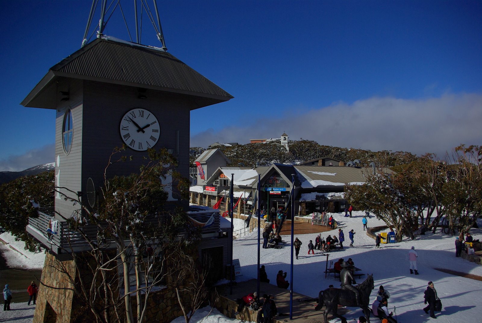
Bourke St, the main series of lifts leading from the village towards the summit of Mount Buller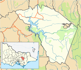
 Mount Buller Village
Population: 251[1] Postcode: 3723 Elevation: 1,804 m (5,919 ft) Location: LGA: State District: Benalla Federal Division: Indi Mean max temp Mean min temp Annual rainfall 9.3 °C
49 °F2.8 °C
37 °F1,470.8 mm
57.9 inMount Buller is a town in Victoria, Australia 208 kilometres (129 mi) east of Melbourne on the slopes of Mount Buller (elevation 1804 metres AHD).[2] Primarily a resort town, Mount Buller is popular with snowsports enthusiasts in winter due to its close location to Melbourne. At the 2006 census, Mount Buller had a population of 251.[1]
The Mount Buller Alpine Resort is an unincorporated area of Victoria; the larger surrounding locality of Mount Buller is part of the Shire of Mansfield.
Contents
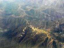
Mount Buller Village
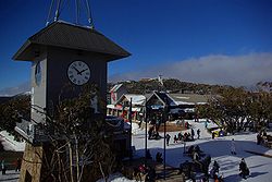 A view over the main part of the village.
The town has around 7000 beds available in accommodation facilities, the most of any Victorian ski resort.[citation needed]
La Trobe University had a minor campus at Mount Buller. The campus facilities included a public cinema, gym and indoor sporting facilities. La Trobe has vacated the mountain, however the Resort Management Board is now using the building, better known as the Mount Buller Community Centre, as its home. All facilities are still operational, with the cinema, gym and sports hall open all year round.
Mount Buller is also the home of the National Alpine Museum.
Mount Buller Ski Resort
Mount Buller Ski Area 
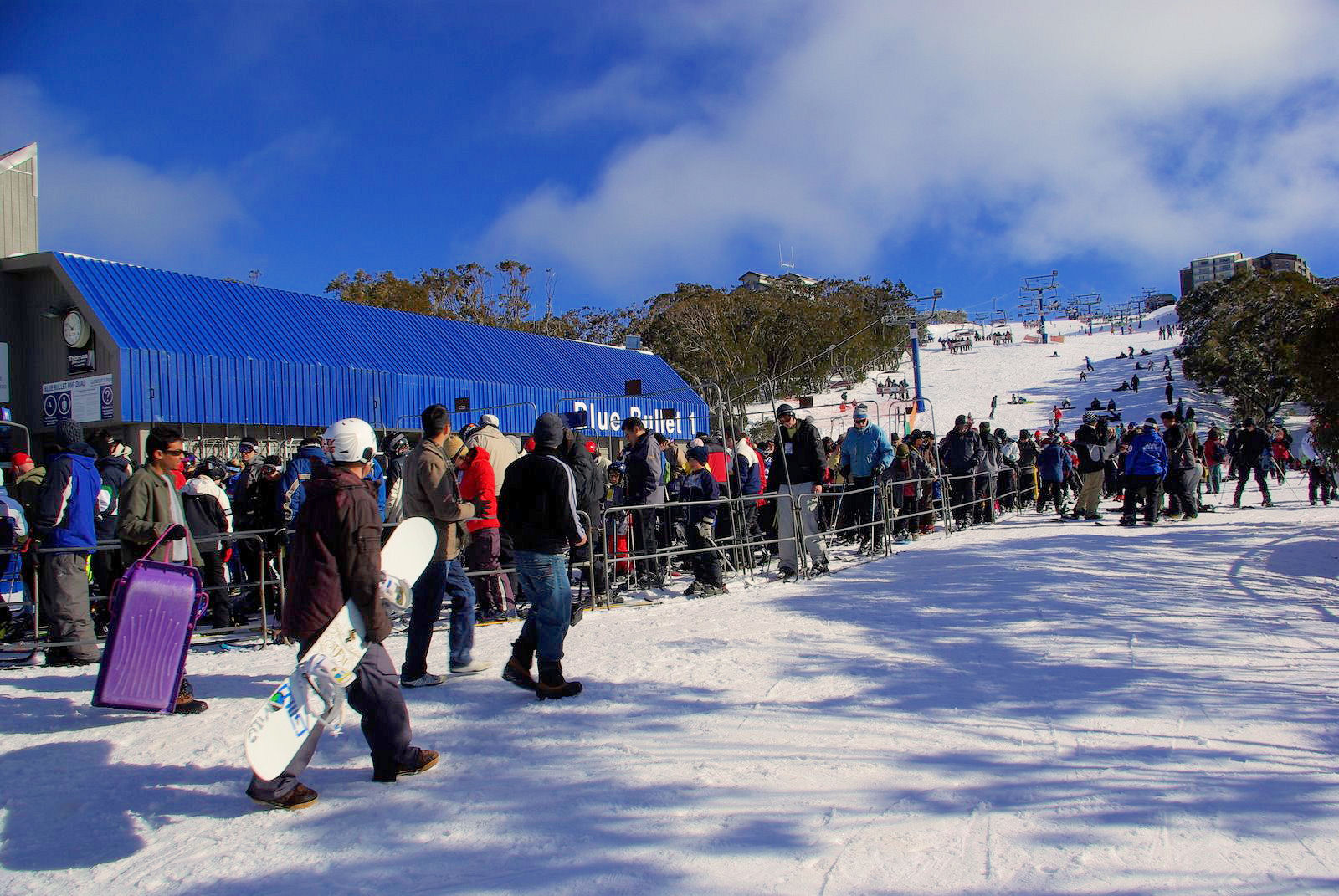
Location Mount Buller, Victoria Nearest city Benalla, Victoria Vertical 400 m Top elevation 1780 m Base elevation 1375 m Skiable area 300+ ha Runs 25 Longest run 2.5 km Lift system Detachable Chair x3, Fixed-Grip Chair x10, T-Bar x5, Rope Tow x4, Magic Carpet x2 Lift capacity 40,000 skiers/hr Terrain parks 3 Snowfall Yes Snowmaking Yes Night skiing Yes (Tuesday and Saturday Nights only) Web site www.MtBuller.com.au The ski area around the town has a network of 25 lifts, capable of moving more than 40,000 people per hour - the highest capacity in Victoria. The highest lifted point is 1780 m at Grimus Chairlift and the base altitude is 1375 m at the Chalet Creek loading station on the Horse Hill chairlift / gondola. The lifts are owned by Groset, a part of the Grollo group of companies.[3]
History
A Mount Buller Post Office opened on 17 February 1958.[4]
Before 1984 Mount Buller was serviced by two lift companies that involved the skier needing to purchase two lift tickets to ski the whole mountain. In 1985, the two lift companies merged, allowing skiers to ski the whole mountain with one ticket. Today, Mount Buller is serviced by 24 lifts covering a wide range of terrain. In 1993, with an increasing number of visitors, the ski resort built a new quad chairlift called Wombat Lift on the skiers right of Little Buller spur to relieve the traffic on Federation triple chairlift. 2005 saw the addition of the Emirates quad chairlift to the lift network. A new six-seater chairlift — the Holden Express — was installed over the 2007/08 summer and is operational for 2008. This addition saw the decommissioning of one of the oldest chairs of the mountain — the Abom (previously known as Helicopter), along with Blue Bullet 2. A list of every ski tow to ever operate at Mount Buller can be found at wikiski.
Facilities
There are around 80 km of groomed trails spread over more than 300 hectares of terrain. 25% is beginner terrain, 45% intermediate and 30% advanced. There are also 9 km of cross-country trails accessible from the village. These trails also connect Mount Buller with Mount Stirling. Australia's first resort-wide wireless internet service is available in the village, operated by Whispar.
24 Lifts at Mount Buller include: Blue Bullet 1, Holden Express, Skyline, Emirates, Bull Run, Federation, Southside, Summit, Grimus, Boggy Creek, Tirol, Spurs, Burnt Hut, Wombat, Howqua, Koflers, Chamois, Bluff View, Burke Street Carpet, Horse Hill Access, Baldy Rope Tow
Events
Mount Buller usually hosts two International Ski Federation Aerial Skiing World Cup events every year in September. However, these events were cancelled in 2007 due to lack of sponsorship. Every year Mount Buller also hosts the Victorian Snowsports Championships, which has with over 3000 competitors.
The Mount Buller summit and faces are also popular with ice climbers especially in winter.
Snowmaking
Snowmaking began on Mount Buller in the 1970s with a pilot system on Enzian Ski Run, which was later moved to Bourke Street. The main snowmaking infrastructure was installed in 1994 at the Snowflake Factory on the top of Baldy. This included the water storage reservoir, air compressors, pump station and distribution pipelines for water and compressed air. The snowmaking system infrastructure and distribution pipelines were designed and built to accommodate future increases in capacity as coverage areas are increased.
The Mount Buller snowmaking systems use a combination system of fan and air/water guns. The system is based around a central high level water storage reservoir, pump station and central air compressor station. Large distribution pipelines deliver the water and compressed air to the various ski runs. Water and compressed air delivery hydrants are located down the edge of the runs where the snow guns are coupled using flexible snowmaking hoses. The system currently has 223 snow gun connection hydrants around the mountain, of these, 81 are connected to snowmaking guns - 57 fan guns and 58 air/water guns.
The coverage of snowmaking at Mount Buller includes:
- Bourke Street
- Baldy
- Skyline
- Magic Forest
- Chamois
- Snowtubing Park
- Spurs Beginner Area
- Burnt Hut
- Koflers
- Summit
- Scott Talbut Downhill
- Howqua
- Howqua Extension
- Family Run
- Little Buller Spur
- Whiskey Creek Trail
- Wombat
- Shakey Knees
- Access trails
Total ski able area of snowmaking: Over 74 hectares
Geography
Climate
Mount Buller experiences an alpine climate with an influence of the oceanic climate.[citation needed]
Climate data for Mount Buller Month Jan Feb Mar Apr May Jun Jul Aug Sep Oct Nov Dec Year Average high °C (°F) 17.1
(62.8)17.0
(62.6)14.3
(57.7)9.9
(49.8)6.4
(43.5)3.3
(37.9)1.5
(34.7)2.2
(36.0)4.9
(40.8)8.4
(47.1)12.0
(53.6)14.5
(58.1)9.3 Average low °C (°F) 8.6
(47.5)8.8
(47.8)6.6
(43.9)3.6
(38.5)1.2
(34.2)−1.2
(29.8)−2.6
(27.3)−2.3
(27.9)−0.7
(30.7)1.3
(34.3)4.4
(39.9)6.1
(43.0)2.8 Precipitation mm (inches) 67.6
(2.661)62.4
(2.457)68.5
(2.697)101.4
(3.992)130.7
(5.146)146.6
(5.772)163.5
(6.437)142.5
(5.61)144.7
(5.697)146.0
(5.748)122.7
(4.831)87.3
(3.437)1,393.0
(54.843)Source: [5] Miscellaneous
The area between Mount Buller and Mount Stirling is the primary catchment for the Delatite River.
During the summer the resort has a number of Mountain Biking tracks.
See also
- Skiing in Australia
External links
References
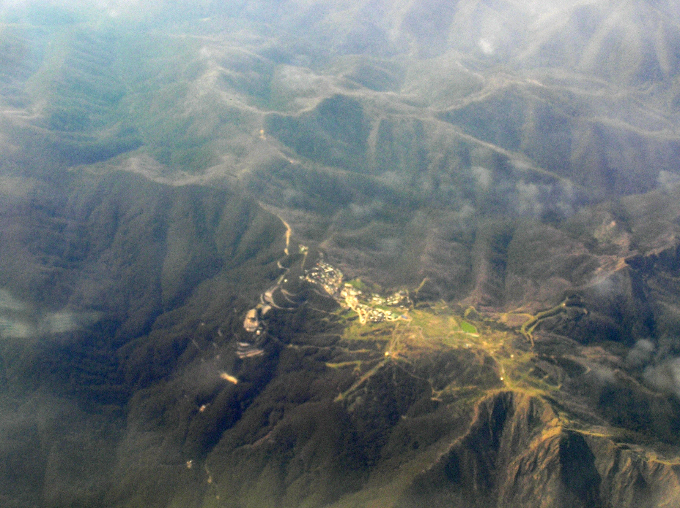
 Aerial photo
- ^ a b Australian Bureau of Statistics (25 October 2007). "Mount Buller Alpine Resort (Statistical Local Area)". 2006 Census QuickStats. http://www.censusdata.abs.gov.au/ABSNavigation/prenav/LocationSearch?collection=Census&period=2006&areacode=240158249&producttype=QuickStats&breadcrumb=PL&action=401. Retrieved 2007-08-05.
- ^ Place names search, Geoscience Australia
- ^ The Grollo Group - Property Tourism investment
- ^ Premier Postal History. "Post Office List". https://www.premierpostal.com/cgi-bin/wsProd.sh/Viewpocdwrapper.p?SortBy=VIC&country=. Retrieved 2008-04-11.
- ^ "Climate statistics for Mount Buller". Australian Bureau of Meteorology. http://www.bom.gov.au/climate/averages/tables/cw_083024.shtml. Retrieved 20 August 2009.
Coordinates: 37°08′S 146°25′E / 37.133°S 146.417°E
Australian skifields NSW Perisher (Perisher Valley, Blue Cow, Guthega, Smiggin Holes) - Charlotte Pass - Thredbo - Selwyn Snowfields - CabramurraVictoria Mount Buller - Mount Baw Baw - Falls Creek - Mount Hotham - Dinner Plain - Lake Mountain (XC) - Mount Saint Gwinear (XC) - Mount Stirling (XC)Tasmania Former skifields Mount Buffalo - Kiandra - Mount Franklin - Kunama HutCategories:- Towns in Victoria (Australia)
- Ski areas and resorts in Victoria (Australia)

Wikimedia Foundation. 2010.