- Clonbinane, Victoria
-
Clonbinane
Victoria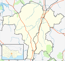
 Clonbinane
Population: 685 (2006)[1] Postcode: 3658 Elevation: 315 m (1,033 ft) Location: 55 km (34 mi) from Melbourne LGA: Shire of Mitchell State District: Seymour Federal Division: McEwen Mean max temp Mean min temp Annual rainfall 25 °C
77 °F15 °C
59 °F1,400 mm
55.1 inLocalities around Clonbinane: Waterford Park Waterford Park Reedy Creek Wandong Clonbinane Hazeldene Heathcote Junction Whittlesea Kinglake West During the development of the Australian colonies, the Clonbinane area was part of the Colony of New South Wales between 1788 and 1851 when, on 1 July 1851, Victoria was separated from New South Wales. An early mention of the name Clonbinane appeared in Melbourne's Argus Newspaper of 29 September 1848 in relation to Claims to Leases of Crown Land. At that time a 25,600 Acre Run Clonbinane was cited as a claim by Michael Heffernan. The property was bound 5 miles along Reedy Creek to the North, Mt Whitehead 1 and 1/2 miles to the West, up to the ranges East and 3 miles off Kirk and Harlin to the South with a potential for 600 head of cattle. [2]
The name Clonbinane, suggests a marriage of two surnames, Clon and Binane. The Binane part may have found its origins in Welsh, Irish or Scottish clans surnames, deriving from the Latin "Benedictus". It is suggested that the Binane part of the name came from the galectisation of Benedictus and that the Clon part may have its Origins in early Scottish History. It is not clear how the name came about as a mention in the Crown Land Leases of 1848.
Clonbinane is a sparse pastoral community now in the Australian state of Victoria. It is located 55 kilometres (34 mi) north of the state capital city, Melbourne. Geographically, it lies East of the Hume Freeway but lacks a distinctive township precinct. According to Crown Land records of 1856, the pastoral region was part of the Western Port District.
The region was affected by the Black Saturday bushfires on 7 February, 2009 with the fires converging from Kilmore East over the area's farmlets.[3]
Clonbinane Post Office opened on 23 January 1892 and closed on 1 July 1895, reopening again 5 October 1897 and closing 30 April 1956.[4] According to the Victorian Postal Guide of March 1895, mail coming from Melbourne had to be posted by 0530 Hours to reach Clonbinane Post Office by 1330 Hrs on the same day, allowing for sorting and logistics. At Clonbinane, mail had to lodged by 0900 hours to reach Melbourne's GPO by 1525 Hrs. The time-frames would suggest mail was routinely carried by train during the period, probably between Melbourne and Wandong. Clonbinane shares a postcode with neighbouring towns Broadford, Flowerdale, Hazeldene, Reedy Creek, Strath Creek, Sugarloaf Creek, Sunday Creek, Tyaak and Waterford Park. Waterford Park is regarded as the housing estate of Clonbinane.[5] In 2006, the total population of this postcode was 5047.[6] According to National Archives of Australia, it was determined in 1964 that, at the time of its existence in 1902, the Clonbinane Post Office was domiciled at the Clonbinane Park homestead. [The prominence of this site would suggest this is the true location of Clonbinane which concurs with government mapping. [7]]Clonbinane Park is a heritage listed site built for M. K. McKenzie around 1885 located about 250m off the Clonbinane Road at Lat 37,19' 42.65S, Lon 145,05'27.05E. Crown land licence records from 1856 suggested two large pastoral properties (runs) of around 25,600 Acres were operated by the McKenzie and McDonald families at Clonbinane and Reedy Creek. According to the Melbourne Argus Newspaper of January 27th, 1866, John McRae McKenzie was reported as being of Clonbinane and Tallarook Stations when on 25 January 1866 he married Emily Anne Cairnes, eldest daughter of Henry Cairnes of Dublin, Ireland.[8] John McDonald was reported in the records to have been assessed for 4600 sheep, 20 cattle and 8 horses. Clonbinane Park was in 1922 a property of 1924 Acres with a 1210 grating area with excellent potential for cattle grazing and wool production. Clonbinane Station appears to have been a much larger property with a sales notice in the Argus Newspaper of 4th July 1878 citing 80,000 Acres. [9]
Following its life as a Post Office, and some years later in 2000, Clonbinane Park was developed as a Bed and Breakfast accommodation. The business was not successful. The old homestead was later damaged by the Black Saturday bushfires. As at 01 August 2011 it was inaccessible.
The area is host to the Australian Equine Bahavioural Centre which is located Lat 37,20.843 S, Lon 145,06.250 E just before the entrance to the Anderson's Gardens bush park on the Clonbinane Road at the entrance to the Mt Disappointment National Park. As at 01 Aug 2011, the bush parks are still inaccessible or difficult to access due to forrest safety concerns after the fires.
Rainfall typically results in balanced wet and dry days per annum. Highest rainfall rates occur in February and late October through November. The average per day is around 2.9mm and the high range is 55mm to 70mm. Total rainfall per annum is around 1000 to 1400 mm.
Temperatures typically peak in February and are at their lowest in June-July which can result in morning frost. The daily spread is about 10 degrees. On Black Saturday,[3] temperatures in and around Melbourne reached near 47 deg C.
July 2007 saw the area again get prominence when a Rockwell Commander 500S, registered VH-YJB aircraft en-route Essendon (Vic) Shepparton broke up in flight at Lat 37°, 21.65' S, Lon 145°, 05.55' E approximately 1.5 Km SSW of the Equine Centre crashing in a heavily timbered mountain range. The aircraft was carrying the aircraft's owner and a pilot on an aircraft recovery mission when it encountered severe turbulance; both sustained fatal injuries.
Gold mining commenced in the Clonbinane area around 1870 and lasted until around 1880. There was a cyanide processing plant on the Wandong-Kilmore Rd which served the local gold mines. When the gold appeared to run out, the area was extensively logged and supported saw milling. More recently, test drillings have indicated 2.0 - 10 g/tonne potential yield on the Golden Dyke, Rising Sun and Apollo prospects at Beadell Resources Reedy Creek Project.
References
- ^ Australian Bureau of Statistics (25 October 2007). "Clonbinane (State Suburb)". 2006 Census QuickStats. http://www.censusdata.abs.gov.au/ABSNavigation/prenav/LocationSearch?collection=Census&period=2006&areacode=SSC25351&producttype=QuickStats&breadcrumb=PL&action=401. Retrieved 2009-02-11.
- ^ "CLAIMS TO LEASES OF CROWN LAND.". The Argus (Melbourne, Vic. : 1848 - 1956) (Melbourne, Vic.: National Library of Australia): p. 1. 29 September 1848. http://nla.gov.au/nla.news-article4771772. Retrieved 10 September 2011.
- ^ a b "Death toll may reach more than 40: police". The Age. 7 February 2009. http://www.theage.com.au/national/death-toll-may-reach-more-than-40-police-20090207-80ao.html. Retrieved 2009-02-07.
- ^ Premier Postal History. "Post Office List". https://www.premierpostal.com/cgi-bin/wsProd.sh/Viewpocdwrapper.p?SortBy=VIC&country=. Retrieved 2011-09-05.
- ^ "A dry humour that survives anything". http://www.theage.com.au/national/a-dry-humour-that-survives-anything-20090220-8dra.html. Retrieved 2011-09-11.
- ^ "Information about Clonbinane". http://myboot.com.au/3658/Clonbinane/suburb.aspx. Retrieved 2009-02-11.
- ^ "Locality of Clonbinane". http://www.ga.gov.au/bin/gazd01?rec=239968. Retrieved 2011-09-10.
- ^ "Family Notices.". The Argus (Melbourne, Vic. : 1848 - 1956) (Melbourne, Vic.: National Library of Australia): p. 4. 27 January 1866. http://nla.gov.au/nla.news-article5763317. Retrieved 10 September 2011.
- ^ "Advertising.". The Argus (Melbourne, Vic. : 1848 - 1956) (Melbourne, Vic.: National Library of Australia): p. 3. 4 July 1878. http://nla.gov.au/nla.news-article5938682. Retrieved 10 September 2011.
Coordinates: 37°20′S 145°05′E / 37.333°S 145.083°E
Towns in the Shire of Mitchell Categories:- Towns in Victoria (Australia)
- Victoria (Australia) geography stubs

Wikimedia Foundation. 2010.